Emergency Management Assessments

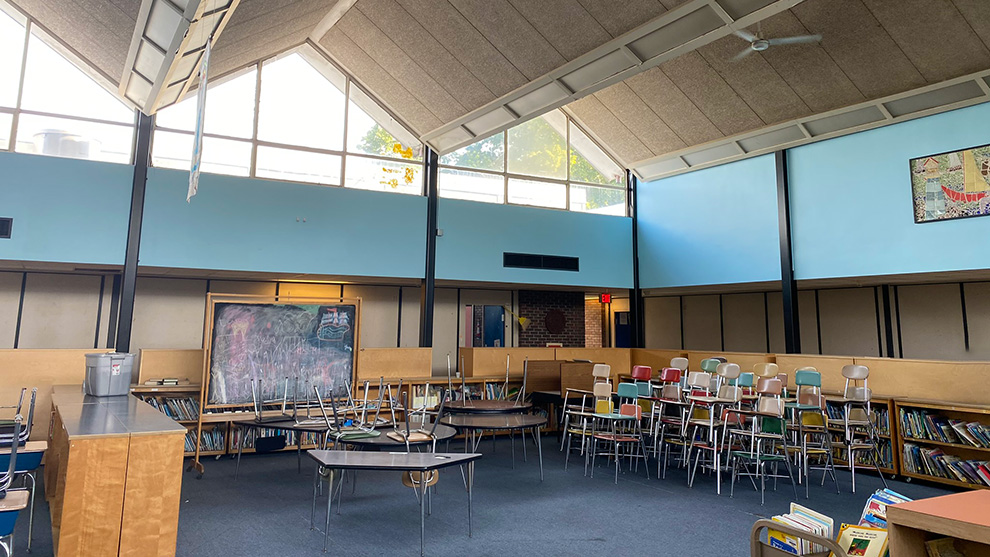
Over the course of a year, Fuss & O’Neill supported the City of Quincy’s Office of Emergency Management by providing studies and assessments of the City’s existing and proposed emergency shelters. Studies and assessments were performed to address capacity and capability to support the community during and after major storm events. Studies determined improvements needed to meet Red Cross Shelter Criteria and capacity calculations were performed for both permanent and temporary housing.

Salvation Army Assessment

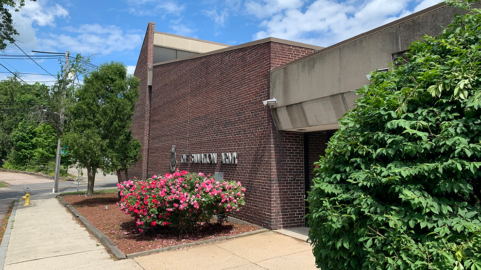
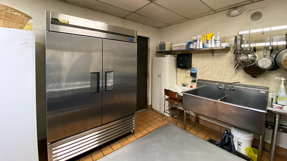
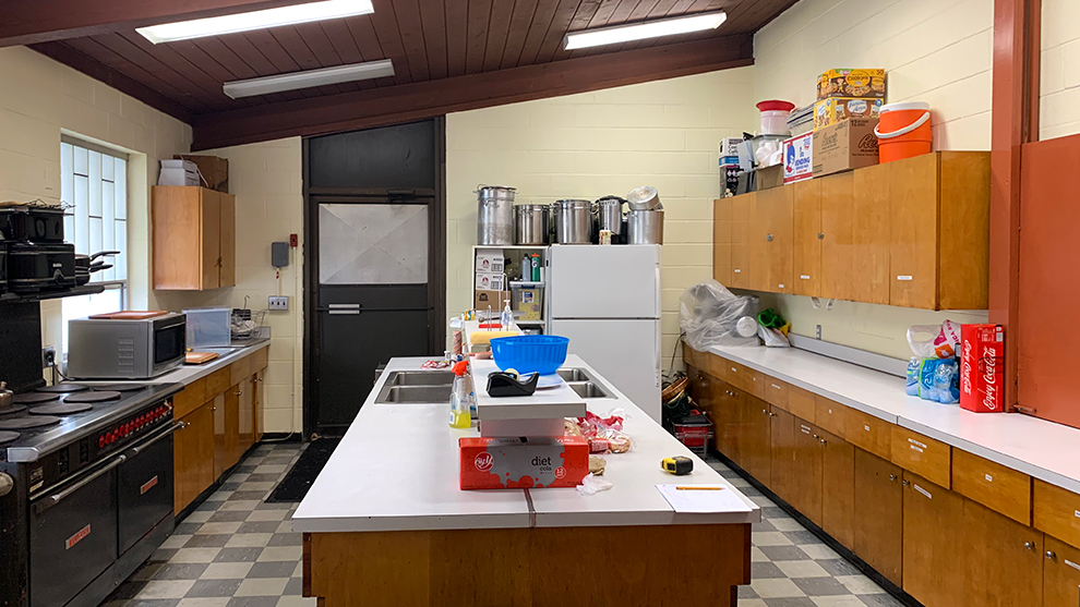
Fuss & O’Neill assessed the gymnasium at the Salvation Army to determine its capacity for use as an emergency shelter. Additionally, our team evaluated the kitchen and the existing electrical services to determine if the kitchen could be provided with backup power during an emergency where they would provide food services and if the existing 150kW portable generator could support the building during an emergency sheltering operation. Fuss & O’Neill designed a floor plan, provided a conceptual design for standby power, and outlined opinions of cost.

Thomas Aquinas Hall Evaluation

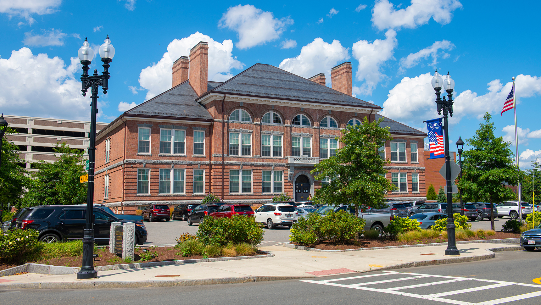
Our team performed a feasibility study at the Thomas Aquinas Hall to determine its suitability to function as a new emergency shelter for the Hough’s Neck area, which is frequently cut off from the City during major storm events. We identified sheltering area compliance and building modifications required for individuals with Functional Needs Support Services as defined by FEMA and in accordance with ADA requirements.

Public Elementary Schools Review

Fuss & O’Neill assessed existing conditions at three elementary schools (Atherton Hough Elementary School, Snug Harbor Community School, and Squantum Elementary School) for the purpose of emergency sheltering. Gymnasiums/assembly areas, restroom and shower facilities, and building electrical and mechanical systems were evaluated. The electrical systems were assessed for their existing power distribution and the power loads associated with the areas to be utilized during emergency sheltering, as well as the capacity of any existing generators. Fuss & O’Neill provided recommendations and options on interconnecting the City’s150 kW portable generator to the existing electrical infrastructure to support the identified essential power loads for sheltering.

We assessed an additional four public schools (Quincy High School, North Quincy High School, Central Middle School, and The Kennedy Center) to determine if these sites could be utilized as emergency shelters. Site visits were conducted, capacity was determined, and floor plans were designed.


Outcome

After considering accessibility, capacity, safety, and available amenities that could operate for 72 hours following a natural or human-made disaster, the City of Quincy designated four sites to be used as emergency shelters. The evaluations performed by Fuss & O’Neill staff facilitated effective assessment to help the City help its citizens.

Boston Neighborhood Safety and Mobility Projects

The City of Boston, as a commitment to improving multimodal safety and accessibility, developed “Go Boston 2030” and reaffirmed its commitment to Vision Zero. Go Boson 2030 is a large transportation plan that develops a vision and action plan to ensure that residents have excellent and equitable transportation systems that support both the economy and public health in a changing climate. Vision Zero focuses on safety and takes a people-first approach to transportation and community building. Through Vision Zero, the City commits resources to proven strategies to eliminate fata and serious crashes by 2030.

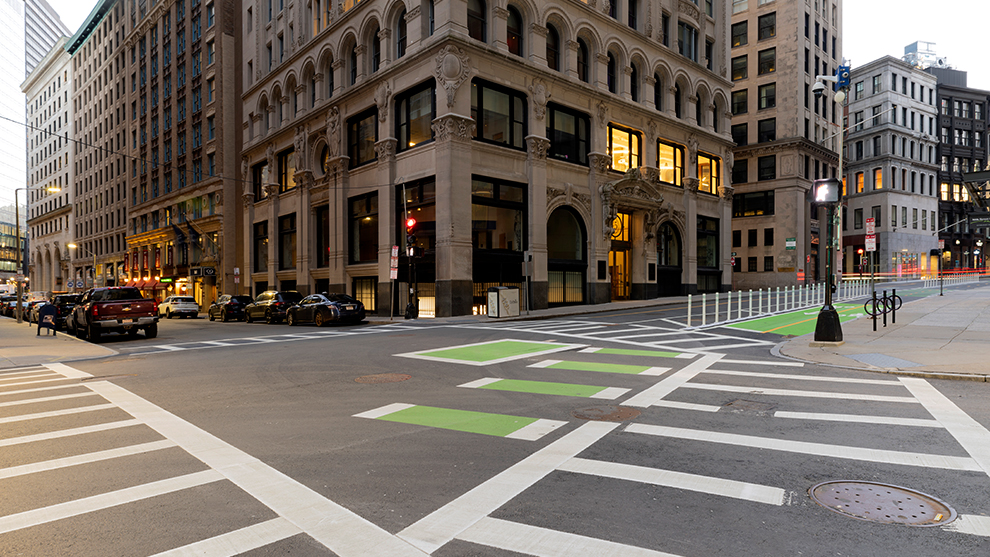
To support both programs, Fuss & O’Neill provides the City of Boston with traffic and transportation engineering services through a Neighborhood Safety and Mobility contract. As part of this contract, 10 traffic calming zones were identified for planning and design each year of the three-year program. Additionally, at least 25 raised crosswalks each year have been identified for design. Fuss & O’Neill has provided design and engineering support for each of these program elements. Furthermore, our team has supported public engagement and communications by providing graphics and project updates, as well as participating in public events.

Western Avenue Bike Lane

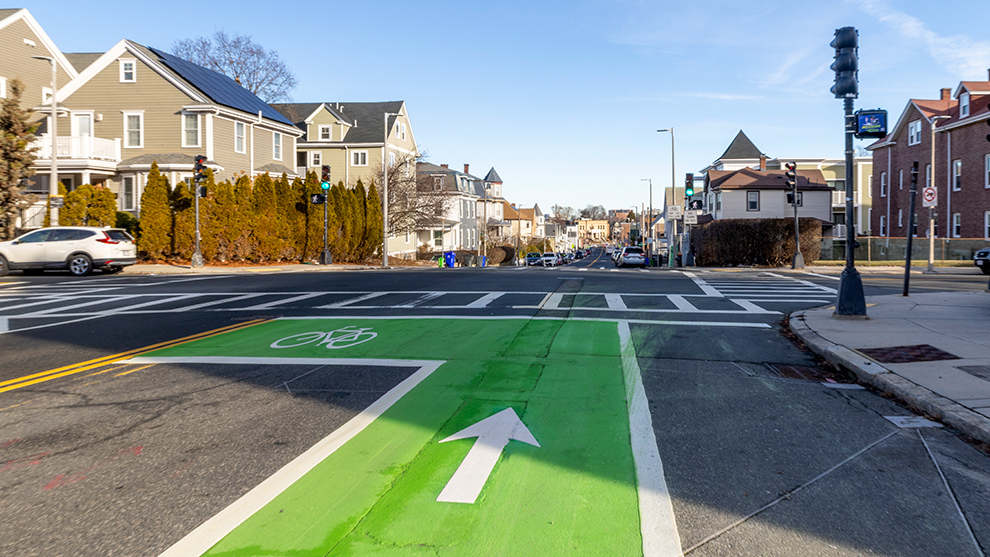
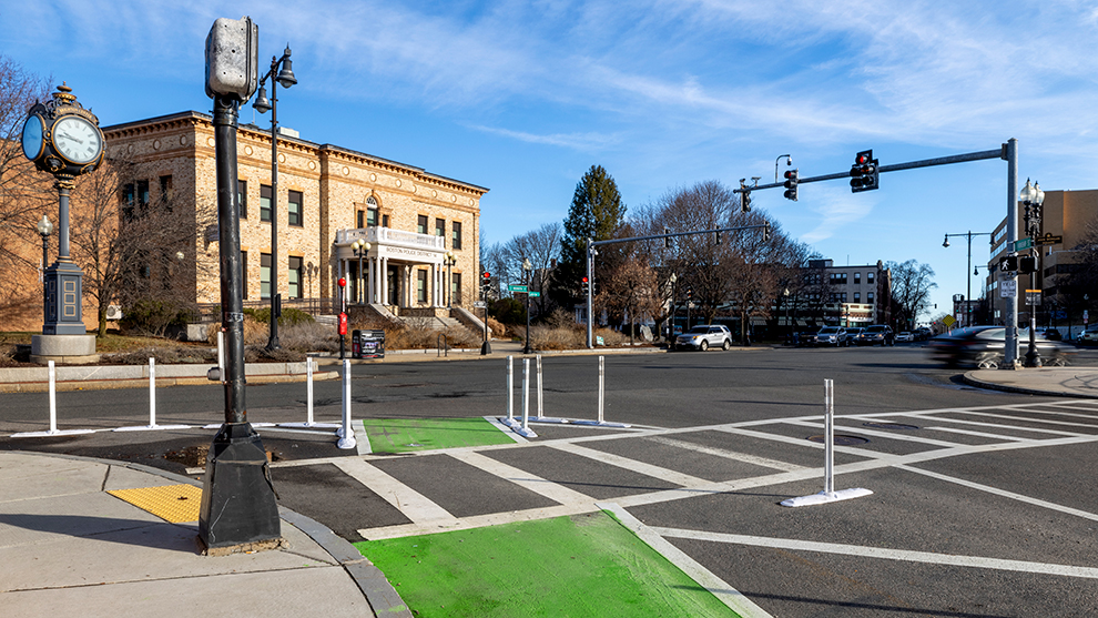
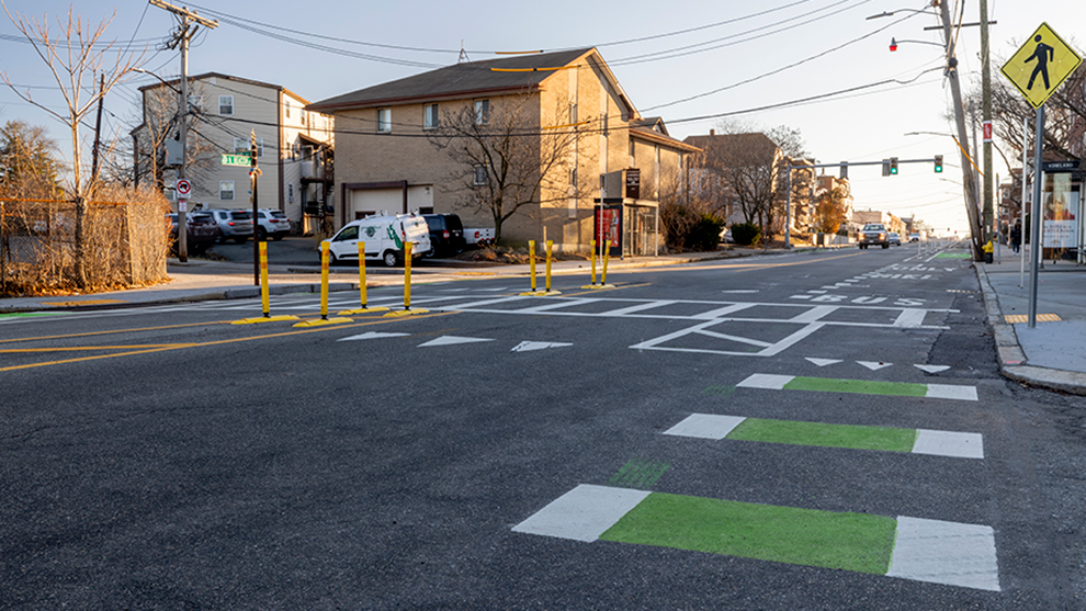
Fuss & O’Neill designed a separated bicycle lane and provided intersection safety improvements on Western Avenue and at North Harvard Street and Western Avenue, respectively. Western Avenue is a two-lane avenue bisecting the Harvard campus, making it a critical connection for pedestrians and cyclists.

Winship Street Improvements

Fuss & O’Neill designed a parking-protected bike line on Winship Street between Chestnut Hill Avenue and Union Street. Additionally, in this residential neighborhood, the two vehicle lanes were narrowed to 11 feet wide, a crosswalk now connects Winship Street to Peaceable Street, 11 pedestrian curb ramps were reconstructed, and two intersections had signal improvements implemented to improve accessibility. This street is an important connection for bicyclists traveling from Cambridge Street/Washington Street to destinations on Chestnut Hill Avenue and beyond.

Poplar Street Improvements

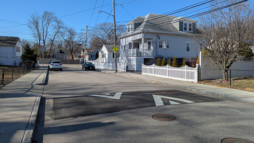
Fuss & O’Neill’s traffic engineers designed traffic calming measures, including installation of speed humps, in this residential neighborhood that connects to Roslindale Square. Our transportation engineers designed a contraflow bicycle lane between Washington Street and Sycamore Street and designed improvements at 5 intersections, including accessible curb ramps, street-level crosswalks, and curb extensions.

Milk Street Bike Lane

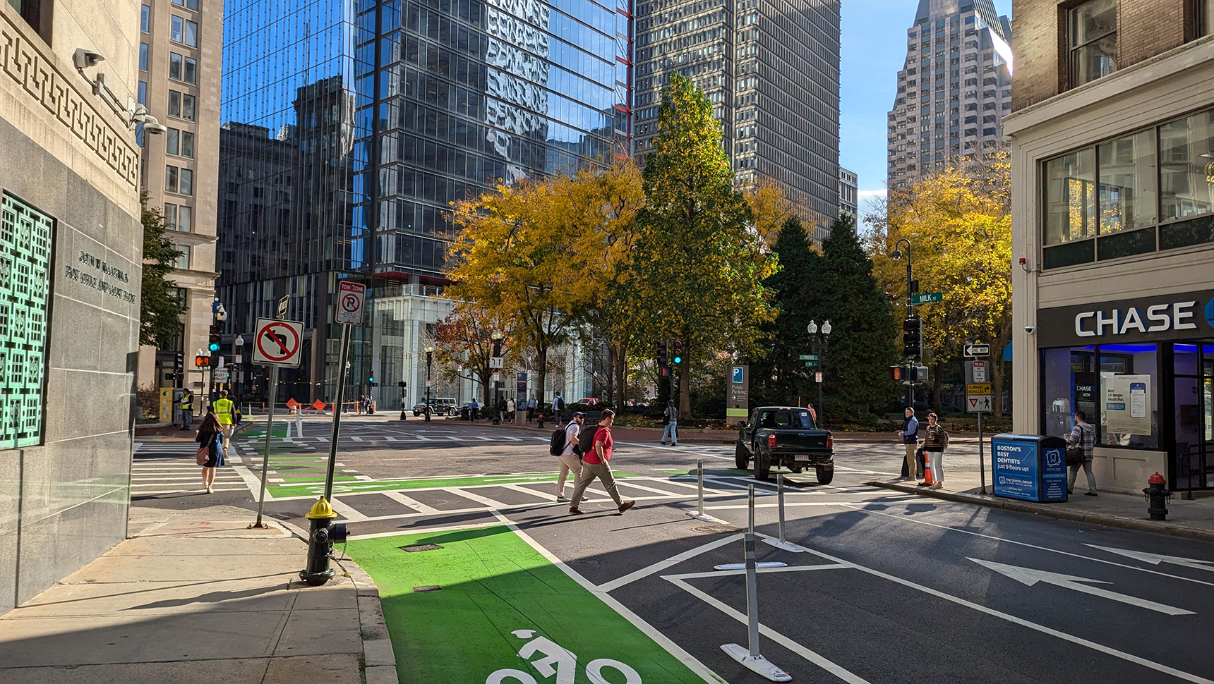
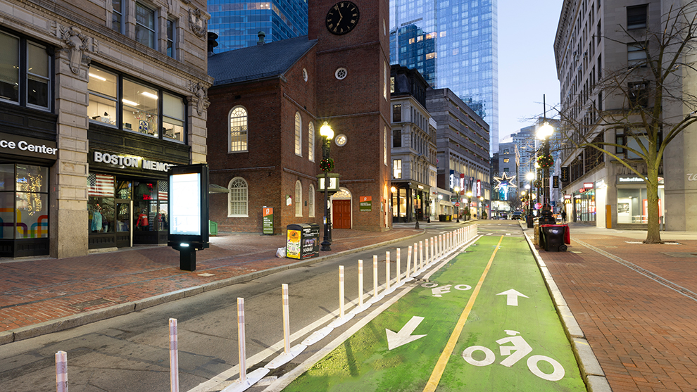
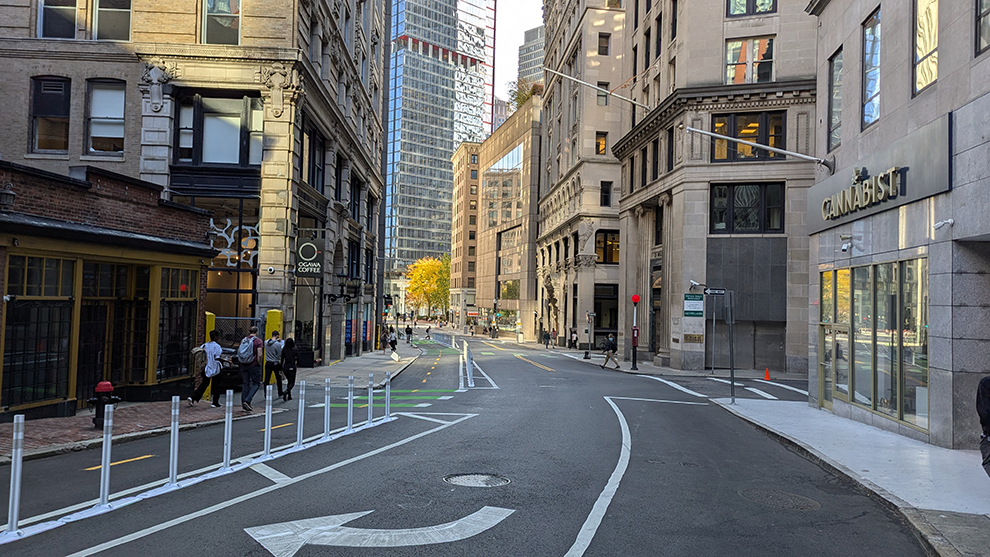
Fuss & O’Neill designed a separated bicycle lane along the entirety of Milk Street that connects School Street to the Rose Kennedy Greenway in this historic and tourist destination area. In addition to the bicycle lane, shorter crosswalks and signal timing were implemented and the pickup/dropoff zones were changed, while still ensuring that space remained for seasonal on-street dining patios.

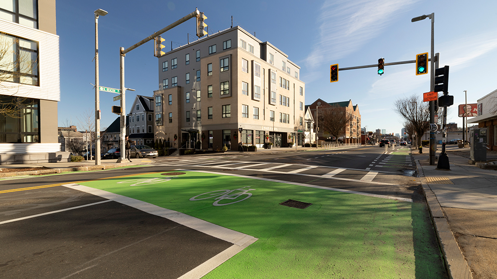
North Beacon Street Improvements

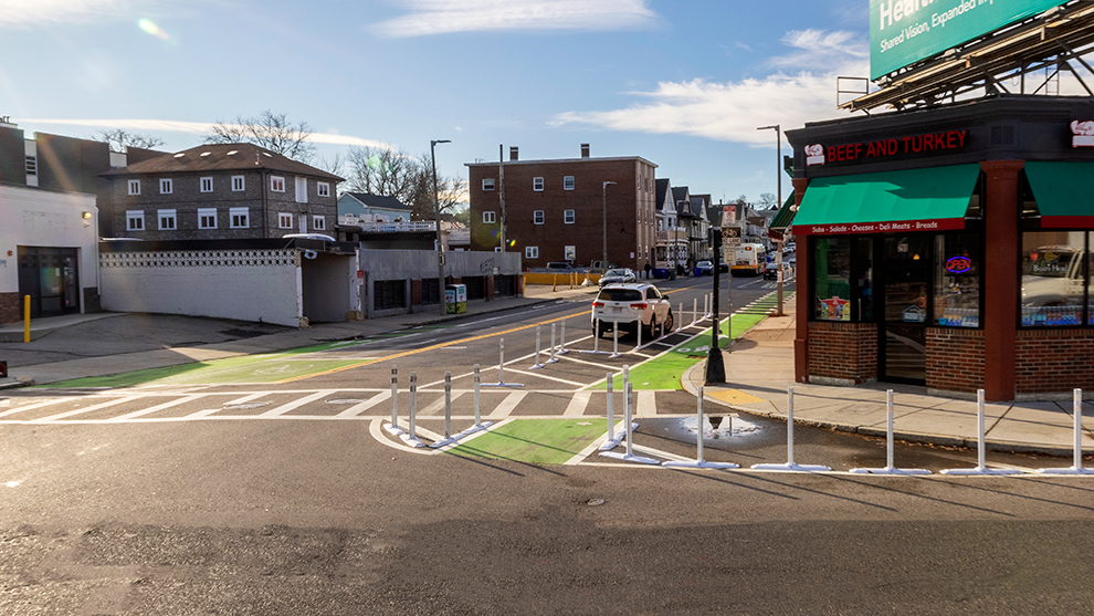
Fuss & O’Neill’s transportation engineers designed roadway and traffic improvements to support the redevelopment of North Beacon Street, which includes affordable housing and life science campuses. Design improvements include new curb ramps at crosswalks for accessibility, including an additional crosswalk and ramp to the west of Vineland Street. The implementation of shortened pedestrian crossings reduces exposure to vehicle traffic. A separated bike lane (separated from the general travel lane by a 3-foot painted buffer with flex posts every 20 feet) was designed for both directions from Everett Street to Vineland Street. Traffic signals were re-timed to keep traffic moving safely.

Neighborhood Safety Surge Initiative

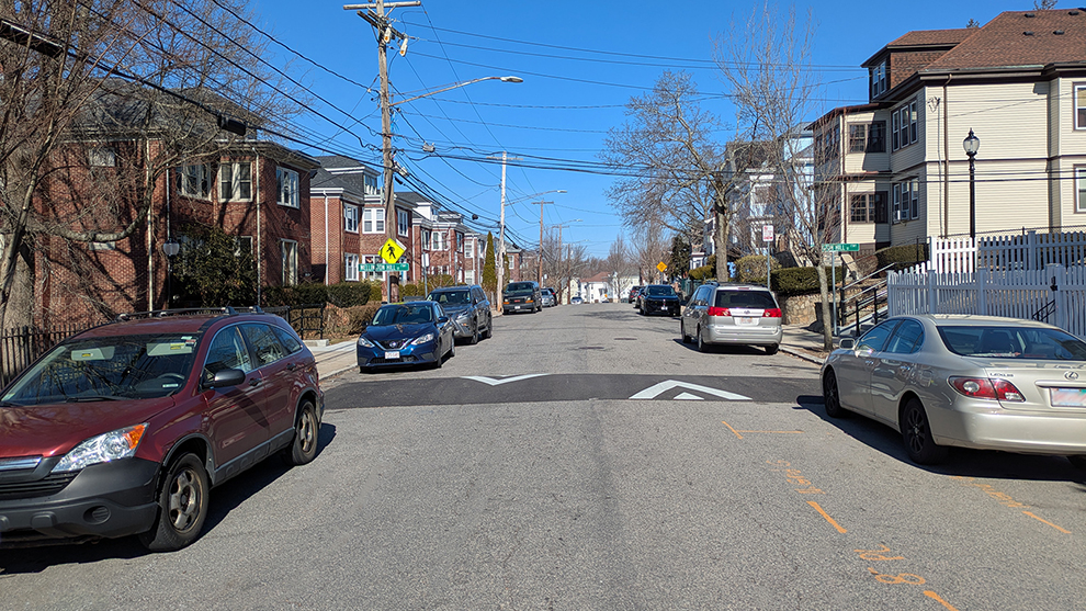
Boston’s Neighborhood Safety Surge Initiative is focused on bringing traffic safety improvements to neighborhood streets throughout the City. Fuss & O’Neill has supported this effort through the design of speed humps on hundreds of streets across 50 neighborhood zones. The design process for each neighborhood zone includes a field visit to verify utility locations, as well as preparation of installation guides and files to assist in developing a GIS database of every speed hump in the city. Fuss & O’Neill has been involved in the preparation of plans for the implementation of cast-in-place concrete at six locations in the City.

Blue Hill Avenue Multi-modal Corridor Project

Separate from our on-call contract, but still relevant to multimodal connectivity, Fuss & O’Neill is part of a project team that is working for the MBTA and with the City of Boston to re-imagine the Blue Hill Avenue corridor to include bus priority lanes and improved infrastructure for cyclists and pedestrians.

As part of this process, Fuss & O’Neill conducted a parking study of the 3-mile corridor and 12 intersecting side streets to understand parking availability and curbside use in the project area.

Fuss & O’Neill collected parking data via video recording, which helped to capture data over the course of a 12-hour day in a large study area. Video footage was reviewed to determine parking occupancy and vehicle turnover on each block in the study area. Additionally, license plate data were recorded and shared with the Metropolitan Area Planning Council to broadly understand vehicle origin, based on where vehicles are registered. On-street parking along the project corridor is a primary point of community interest; therefore, the parking study was key to understanding existing conditions, which informed the corridor redesign.

Fuss & O’Neill has also begun work to redesign all of the traffic signals along the entire 3-mile stretch, which includes 30 existing signals and as many as 10 new signals.

Outcome

Multimodal improvements strengthen connections among walking, biking, transit, and other travel options, making Boston safer, accessible, and easier to navigate. By designing streets that prioritize people and connectivity, Boston is preserving its neighborhood walkability. As the City continues to evolve, these thoughtful multimodal investments help ensure that Boston maintains its title of “America’s Walking City”.

South River Fish Passage and Veterans Memorial Park Improvement Project

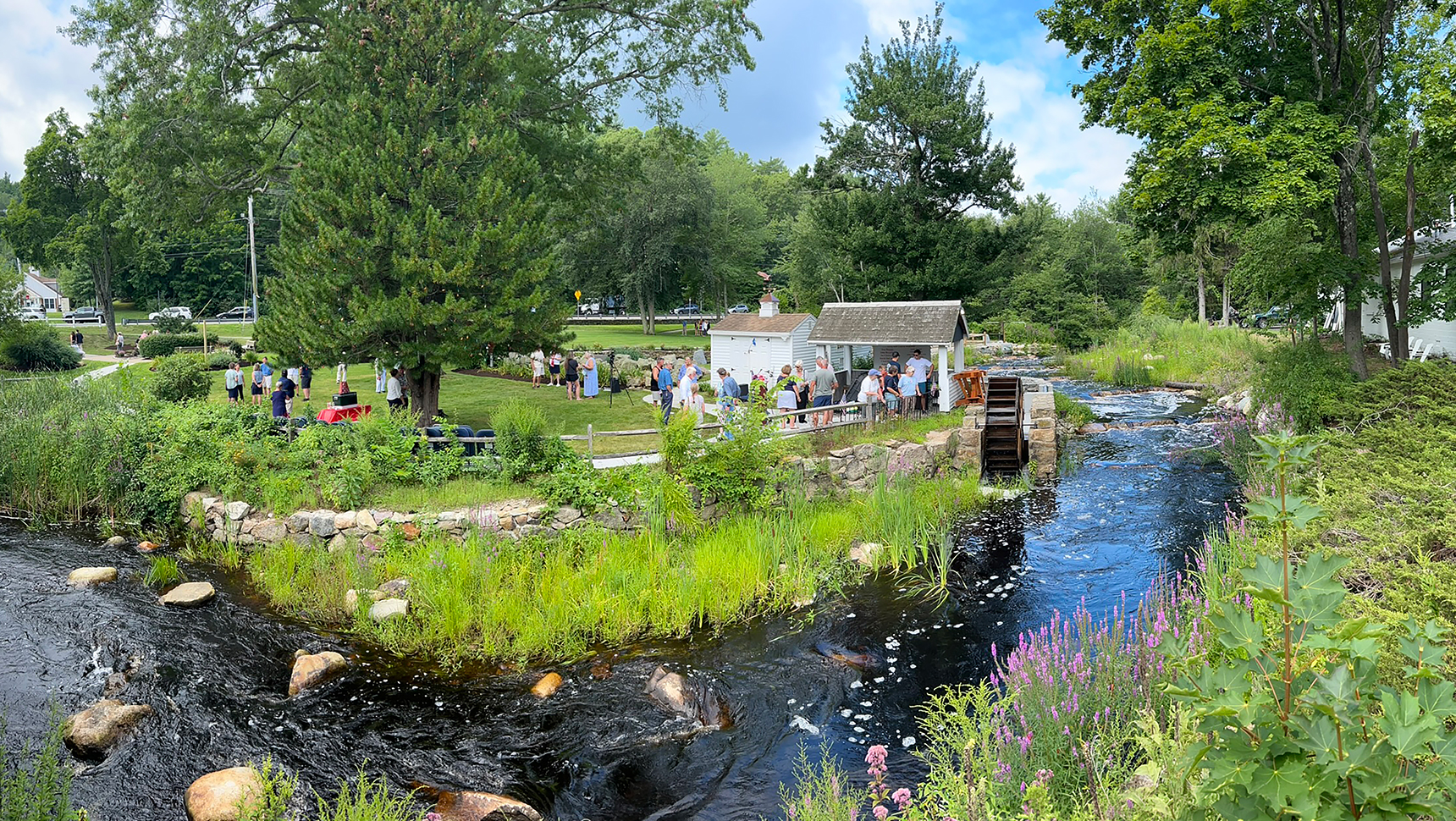
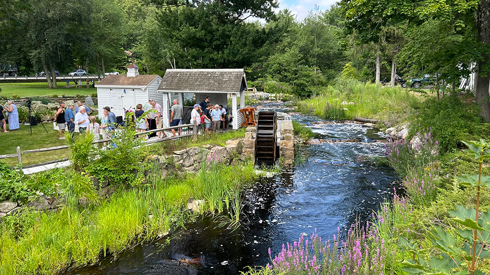
Veterans Memorial Park in Marshfield, MA is a representation of the Town’s appreciation for all veterans’ service. The park is maintained by local veterans who volunteer their time. The park is home to an iconic waterwheel that is referred to as “the heart of Marshfield”, which runs on the South River. The South River, just downstream of its confluence with Furnace Brook, had a dam and fish ladder that impeded passage of migratory fish to upstream spawning areas. The existing fish ladder required near-daily management and manipulation to provide passage, in particular, to herring migration. Fuss & O’Neill evaluated options for removing the dam while maintaining park aesthetics.
Conceptual Design

Our water resources engineers performed a feasibility and alternatives assessment that evaluated approaches to remove the dam and the underperforming fish ladder, while protecting and preserving the park’s symbolic heart-shaped memorial lagoon and water wheel.

Fuss & O’Neill developed a concept plan that focused on enhancing the park and restoring the river’s ecological functions by removing the dam.

To accommodate a compressed schedule, the feasibility study included a rapid desktop evaluation of conceptual alternatives, which was used to identify a preferred approach. The evaluation used a comparative criteria assessment of alternatives in which results were presented to, and discussed with, the Town’s DPW and Veterans’ Services staff and park caretaker at a workshop. Our team developed photorealistic renderings of alternatives to help stakeholders understand proposed configurations and to visualize aesthetic compatibility. The workshop was critical in achieving consensus among project stakeholders and, more critically, in initiating successful discussions the property owner bordering the river opposite the park whose support for the project was critical. The selected approach was then further developed through field investigations, hydraulic modeling, and additional design analyses in subsequent project phases.

Design Solutions

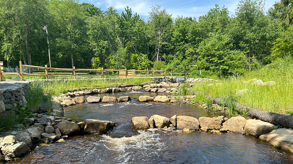
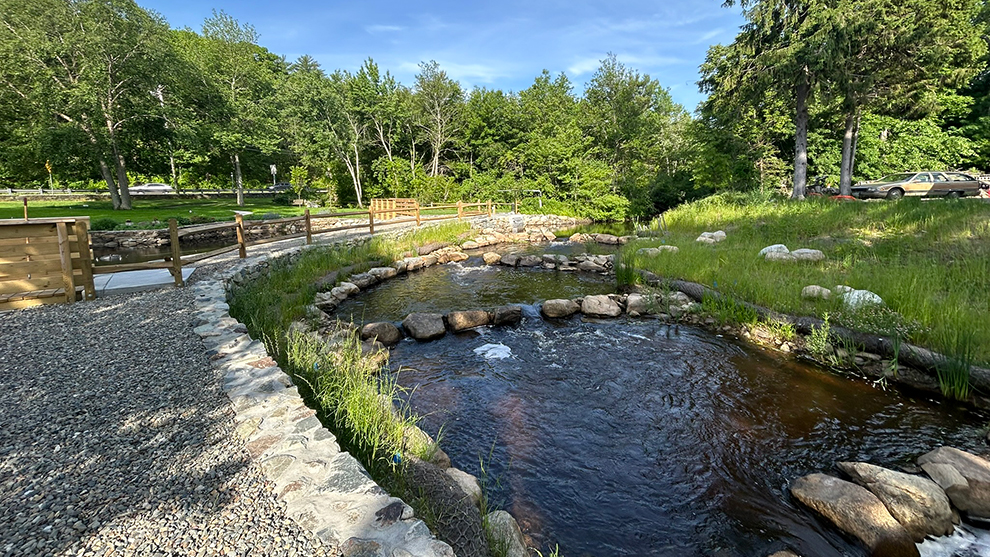
Fuss & O’Neill led the design of a nature-like fishway that maintains the aesthetic and cultural importance of the park’s memorial lagoon and iconic waterwheel. The design included additional and reconstructed footpaths within the park and pedestrian bridges over channels bordering the river. Additionally, our team assisted with permitting and regulatory compliance and supported the project’s completion by providing bidding and construction administration assistance.

Project Outcomes

The dam and fish ladder have been removed and replaced with nature-like fishway that restores natural river flows along the park for the first time in 400 years. A local woodcrafter and seven woodworking volunteers constructed the park’s iconic water wheel for the third time in 40 years, through the support of local businesses. Fuss & O’Neill is proud to support the Town of Marshfield’s veterans and wider community in revitalizing this park in its 78th year since its founding as a memorial and community showpiece. A dedication ceremony for the park’s new waterwheel was held in honor of Purple Heart Day and was attended by veterans, their families, and many members of the community.

Adams Street Historic Streetscape

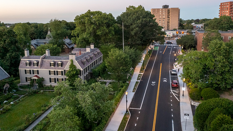
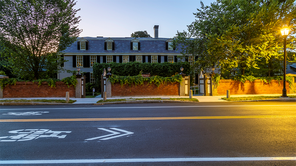
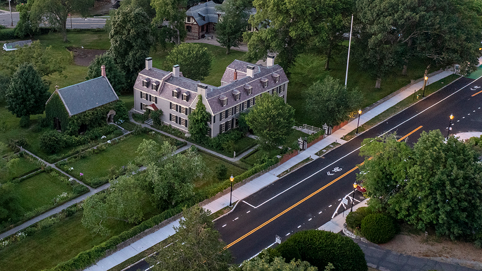
The City of Quincy is rife with history. Adams Street, which begins in Downtown Quincy and extends approximately seven miles into the center of Dorchester, is a historic district that is home to the Adams National Historic Park and John Adams’ home.

As both a historic tourist destination and a popular walking and biking route for locals, the half-mile between the Burgin Parkway and Whitwell Street needed context-sensitive transportation improvements for both vehicular and multimodal users that celebrated and preserved history while addressing modern needs.

Roadway Design

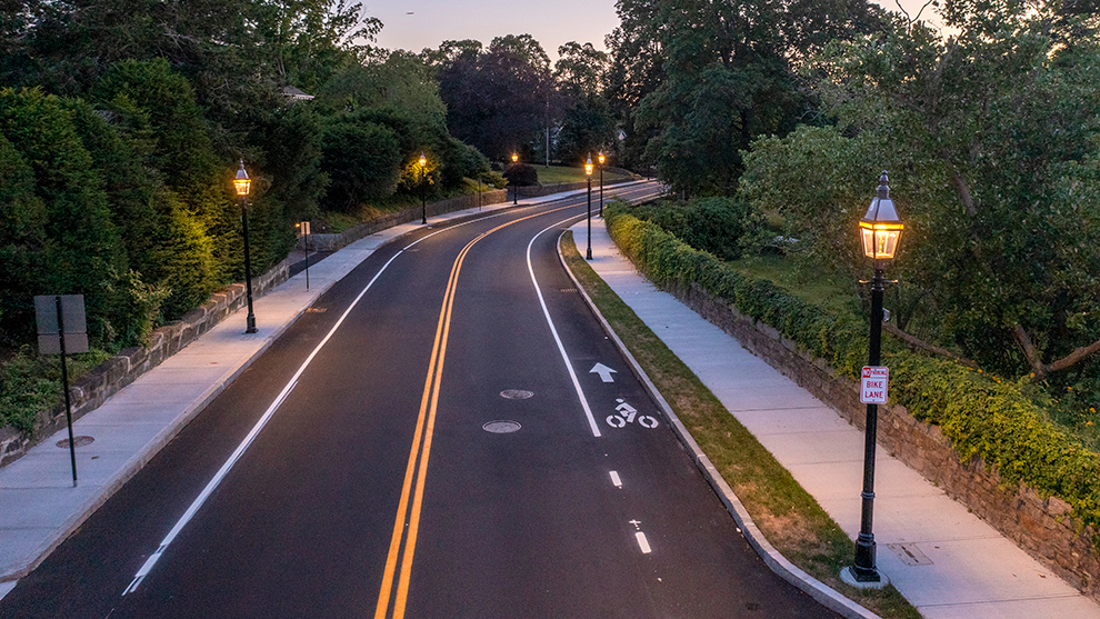
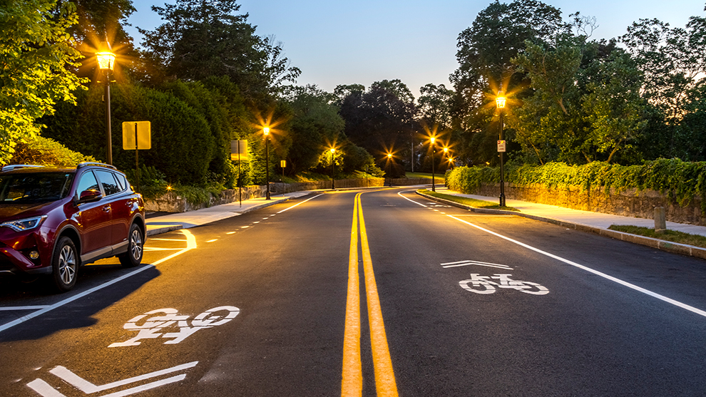
Fuss & O’Neill redesigned the streetscape to achieve the goals of the project without impacting any private rights-of-way. We designed the road and sidewalks to be in compliance with current ADA and PROWAG standards. Where safely feasible, we designed bicycle infrastructure, adding five-foot-wide bicycle lanes on the roadway shoulders that connect the Burgin Parkway to the Milton town line. The addition of bicycle lanes helps the City further its goal of providing equity for multimodal roadway use and helps alleviate congestion in this heavily trafficked area.

Unique Utility Infrastructure

During the project, the Fuss & O’Neill team uncovered some of the oldest utility infrastructure in Quincy. We worked with structural engineers and the City’s geotechnical engineer to design modern solutions. This portion of Adams Street was a critical path in the City’s hard-wired fire alarm reporting system, even though there were only two master boxes being affected by the project. The system relied on an old wooden telecommunications duct bank, which had collapsed. Fuss & O’Neill facilitated the integration of a new duct bank system in an already overcrowded roadway utilizing space under the sidewalk that was previously occupied by the street lighting system. As a forward-thinking solution, the duct bank systems and associated manholes were sized for future fiberoptics, which required careful coordination with the City and the contractor to ensure that the existing system remained active.

Historic and Site-specific Preservation

The street lighting design for this project presented several unique challenges and the prominent location at a significant historic building required a creative solution. Fuss & O’Neill worked with the City and a lighting representative to develop a period-style light fixture and pole that included a faux gas mantel to mimic historic fixtures as well as a primary LED light source to illuminate the roadway and sidewalks. Additionally, parking for the Adams National Historic Park and its trolley system was maintained.

Outcome

This project was completed under an expedited schedule to facilitate a parade celebrating the City’s 400th anniversary. The finished project is a unique blend of historic preservation and modern design. The importance of these improvements is underscored by the fact that Quincy is home to several Environmental Justice Block groups, including four Block groups immediately adjacent to the project area off Whitwell Street. Continuing to provide improved infrastructure for these neighborhoods helps achieve an additional City goal.

Herring River Salt Marsh Restoration

The Herring River Estuary was a great saltwater tidal marsh flowing into and out of Cape Cod Bay. In 1909, the Herring River was diked in the hopes of providing relief to vacationers from mosquitos breeding in the salt marsh (tourism being critical to the region’s economy).

Significantly reducing the tides and exchanging water within the estuary upset the health of this sensitive ecosystem. Some of these changes resulted in reduced oxygen levels and increased acidity in the water, causing significant harm to the habitat of fish and crustaceans. Freshwater plants and species invaded the ecosystem, replacing native marine plants that formerly thrived over large areas. Almost all aquatic life in the estuary suffered the effects of diminished water quality. The numbers of migrating fish were significantly diminished and the wetlands remain, to this day, affected by restricted tidal flows.

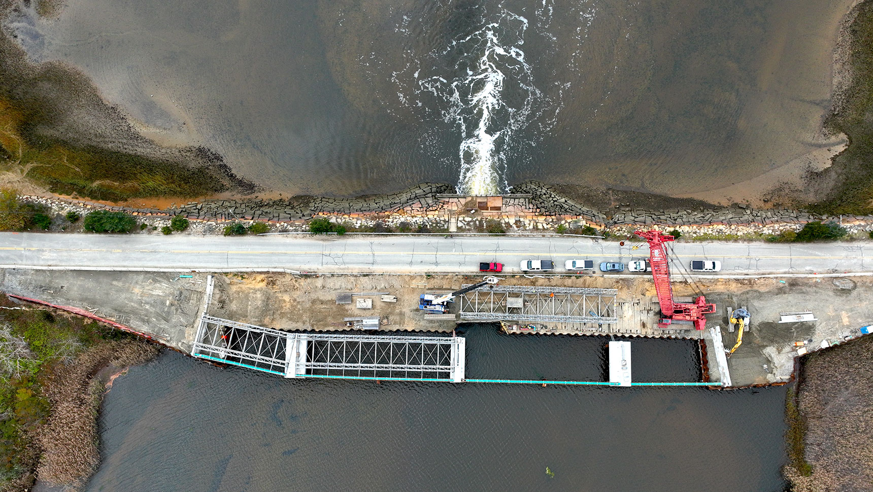
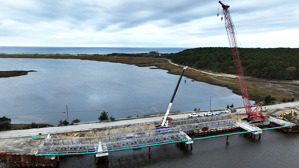
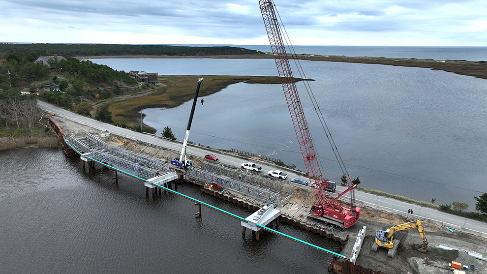
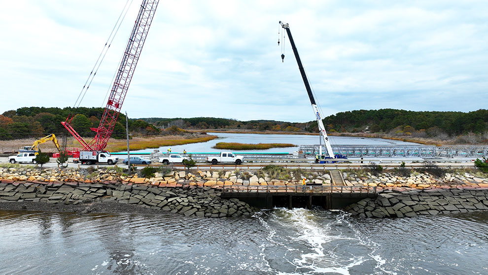
side view of construction on herring river bridge

Unique Solution

The Herring River Restoration Committee (led by MA DER, NOAA, NPS, and USFWS) and Conservation Law Foundation selected Fuss & O’Neill to lead the design of a new bridge structure and two secondary dike structures across Mill Creek. The purpose of this project is to replace an existing causeway with a bridge structure to allow gradual restoration of tidal flows to restore 1,100 acres of former salt marsh.

This is the largest salt marsh restoration project ever undertaken in the Northeast.

Side view of herring river with construction workers

Stakeholder Communication

Workshops were conducted with project partners and the public to present and discuss alternative bridge configurations and public access improvements. This workshop approach helped the design team to review alternatives and to obtain critical feedback, from which concepts were developed.

The concepts allowed for accurate assessments to identify which configuration would best meet the project’s unique functional requirements while minimizing impacts to adjacent natural resources, regulatory barriers, construction costs, and long-term operating and maintenance costs.

Carefully prepared reports, alternatives assessments, and cost/impact evaluations documented efforts through all phases of the feasibility studies. These reports were prepared in a manner to facilitate inclusion into later permitting and regulatory compliance filings.

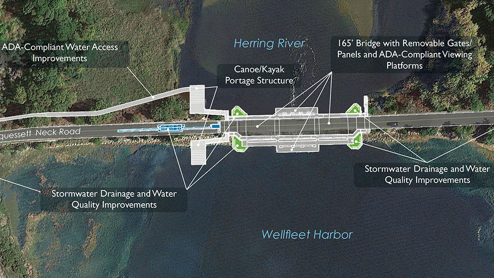
View of herring river plan

Design and Restoration

The existing raised roadway across the Herring River salt marsh has limited waterway openings that cut off the fragile ecosystem upstream from the Cape Cod Bay from the water that it needs to thrive. To correct this, this entire roadway embankment will be replaced with a combination bridge and water control structure with a 160-foot-span at the mouth of a coastal river in a manner that will allow National Park Service scientists to control flows into the marsh system.

This one-of-a-kind design includes removable flood panels that can be inserted through the bridge as well as slide gates in some of those panels to provide more finite controls.

These operable gates allow for controlled flow. Over a long period of time, this will re-establish the aquatic and vegetation environments that existed at this site prior to the roadway’s construction. Additionally, this bridge structure will provide future flood protection for homes and infrastructure around the restored marsh area.

The new bridge structure over the Herring River will also provide ADA-compliant public boat and fishing access improvements for the public. The design incorporates parking, viewing/fishing piers, re-use of stormwater with built-in planters, and water access for small recreational watercraft.

Fuss & O’Neill’s structural, hydraulic, environmental, and climate change professionals carefully balancing their multidisciplinary expertise to ensure that the site is well positioned to be restored to its natural condition.

Bruce Freeman Rail Trail

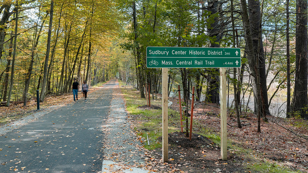
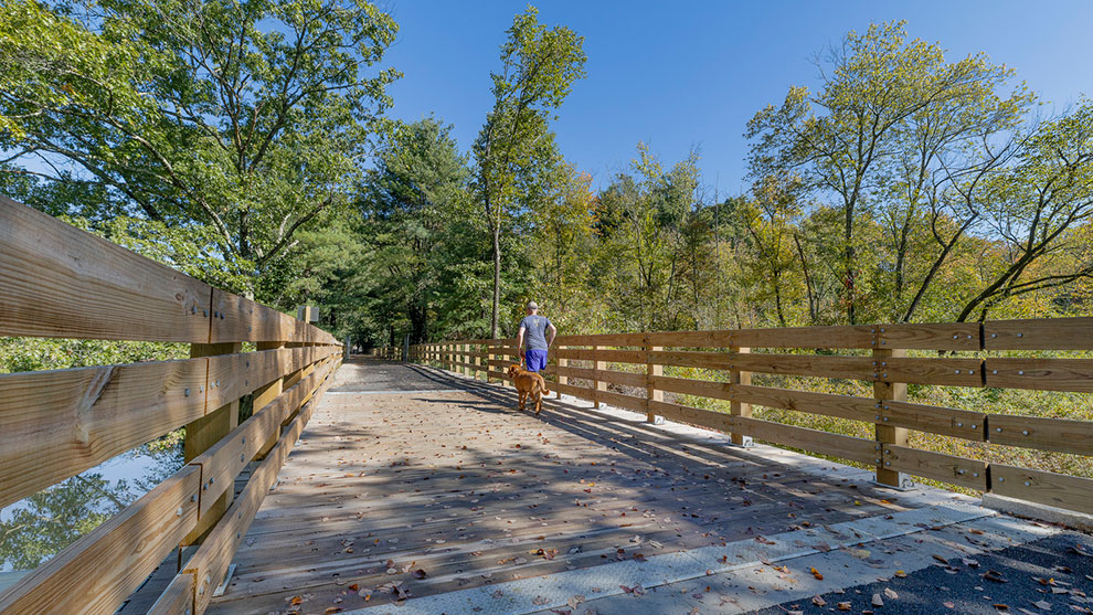
Fuss & O’Neill provided multidisciplinary design services for a 4.4-mile extension of the Bruce Freeman Rail Trail (BFRT), which is a segment of a proposed 25-mile trail along the former Lowell Secondary Track right-of-way of the Old Colony Railroad. This extension into Sudbury extends the total completed miles of the BFRT to 19.

Context-sensitive Design

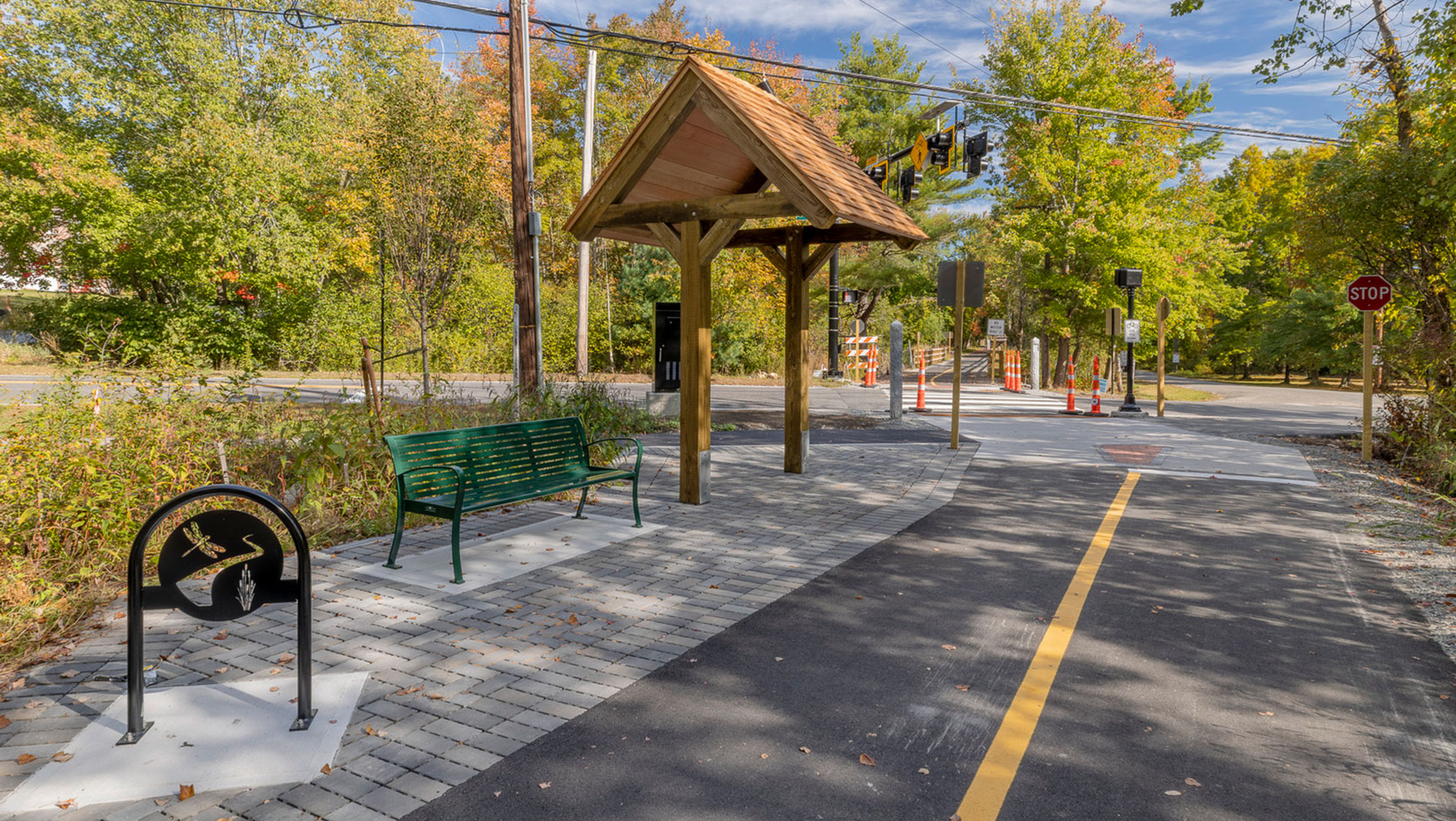
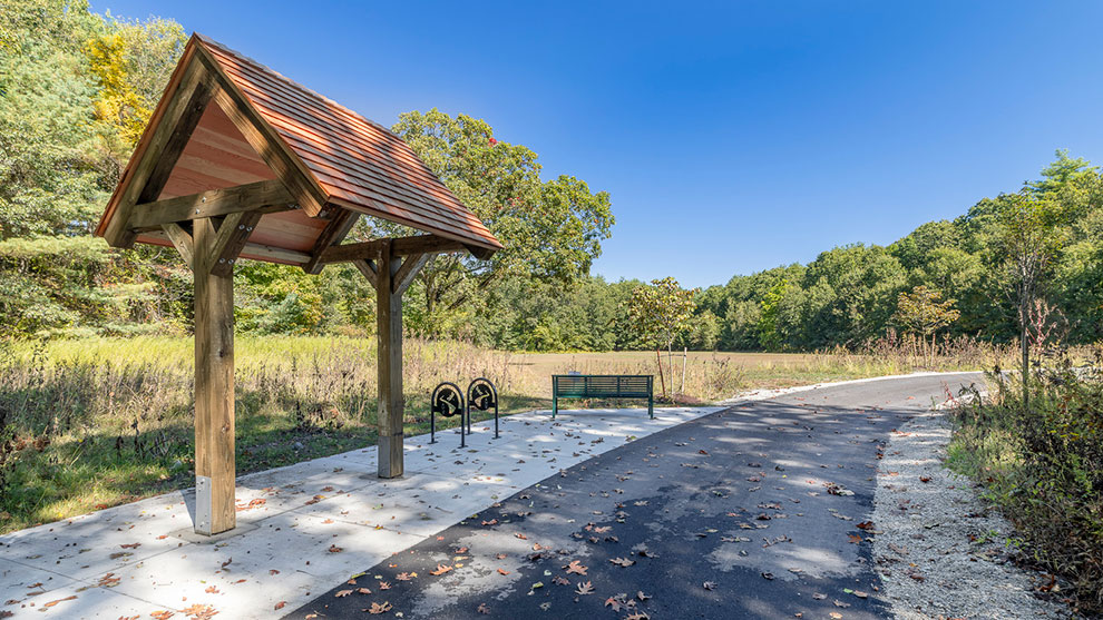
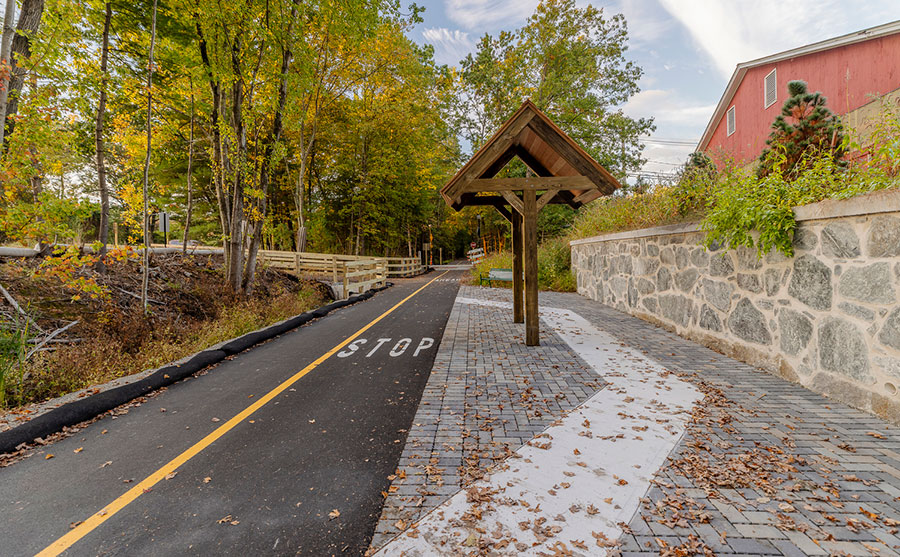
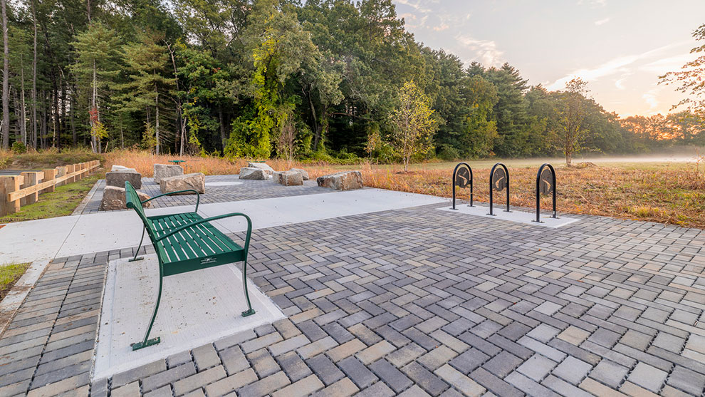
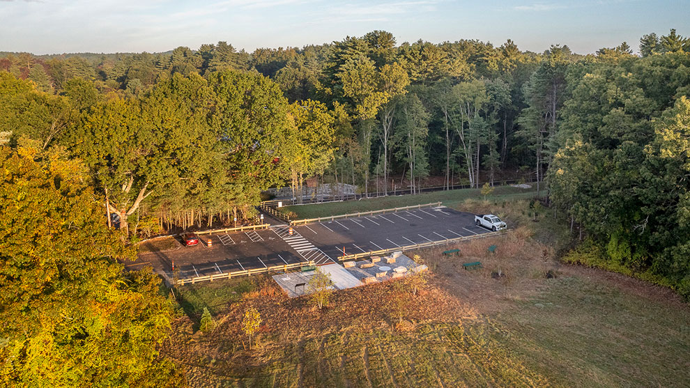
More than a trail, the intent was to create a linear park. As such, Fuss & O’Neill’s design included rest areas, hydration stations, parking facilities, wayfinding signage, mile markers, trail information boards, bike repair stations, and historical interpretation areas at points of interest along the trail.


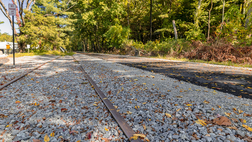
We paid homage to the historic nature of the site by refurbishing historic cattle crossings (bridges) that, in the early 20th century, allowed farmers to move livestock under the railroad. We repurposed historic granite stones from Pantry Brook Bridge as scour protection under a new bridge for the design year stream flows. The stones were also used as sitting and climbing play structures for children on the trail fringe near Pantry Brook. Old steel rails near the major corridor rest area/user hub at Hudson Road were re-set to highlight the significance of the rail-road siding in the Sudbury Historic District.

Multidisciplinary Approach

Fuss & O’Neill provided design and construction administration services in accordance with MassDOT project development processes, including the preparation of design plans, environmental permits, project special provisions, construction cost estimates, right-of-way easement plans, and bidding documents. The scope of work included significant municipal and abutter coordination to ensure a robust public process and stakeholder engagement. Additionally, our services included structural engineering, hazardous material management, stormwater modeling, wetland replication, and stream restoration.

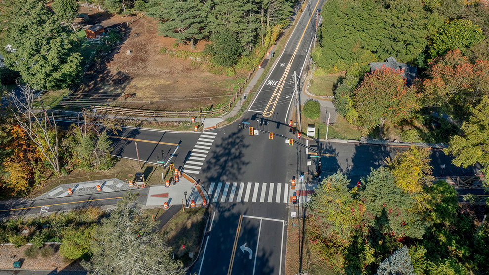
Our traffic and transportation engineers provided safety solutions for multimodal users, as this section of the BFRT crosses seven roads (at-grade crossings): Codjer Lane, Old Lancaster Road, Hudson Road (Route 27), Morse Road, Haynes Road, Pantry Road, and North Road (Route 117). Our design team upgraded the major arterial roadways of Route 27 (Hudson Road) and Route 117 (North Road). Route 27 required a new traffic signal installation in an already congested intersection, and Route 117 required installation of a Pedestrian Hybrid Beacon (HAWK Signal).

Our bridge engineers designed repair and replacement solutions for two structurally deficient stream-crossing structures with granite cut stone abutments.

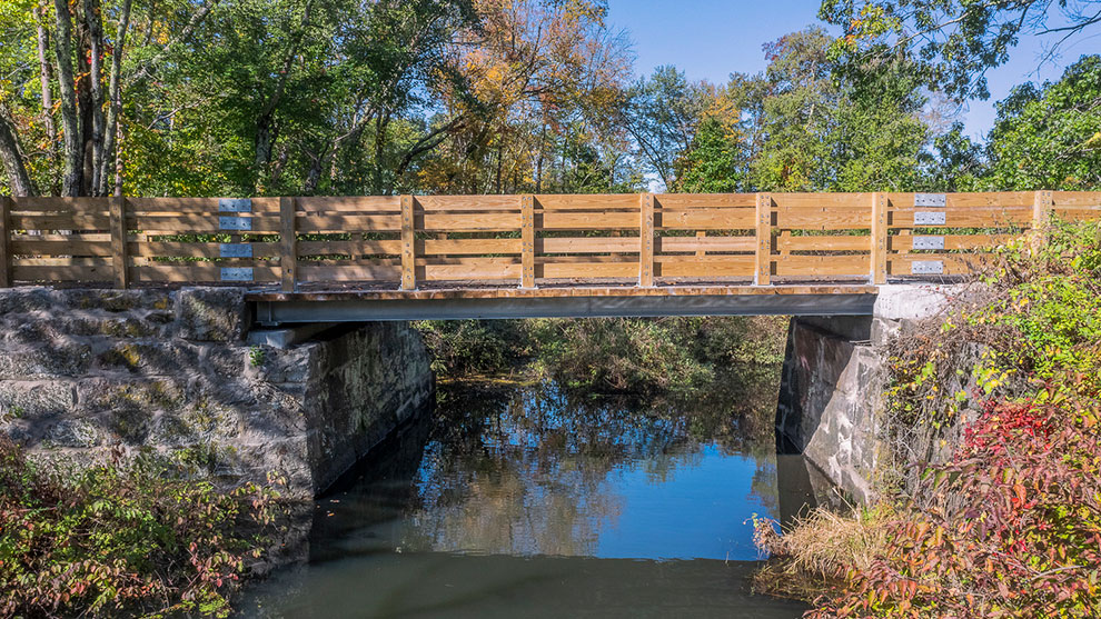
The Pantry Brook Bridge required demolition and removal of the existing superstructure, partial removal of the tops of the stone masonry wingwalls, removal of the concrete portion of the abutment backwall, construction of beam seat and wingwall caps, and a new superstructure. The existing structural steel was salvaged back to the Town, and the new superstructure consisted of seven rolled beams with a timber deck and timber bridge rail.

Bridge over the Pantry Brook

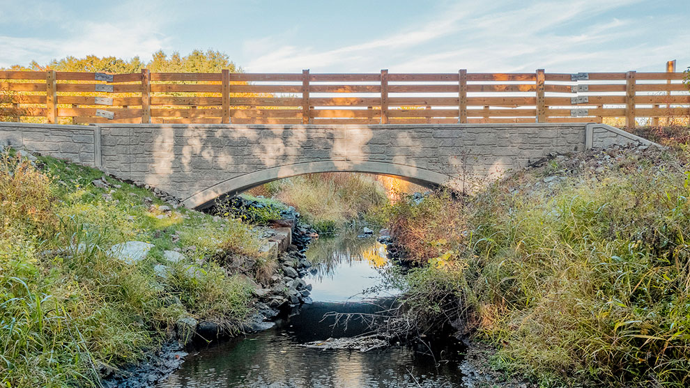
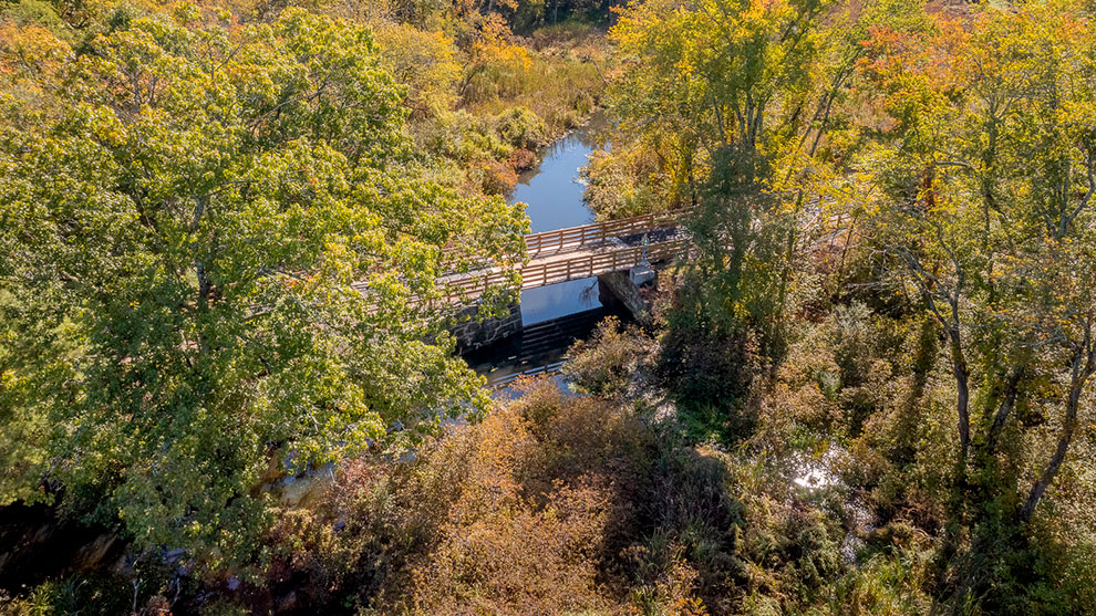
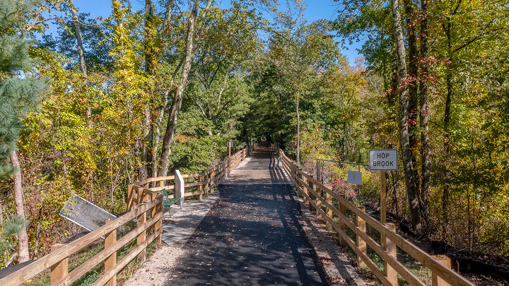
The Hop Brook Bridge required demolition and removal of the existing superstructure, partial removal of the tops of the stone masonry abutments and wingwalls, and construction of a replacement structure. Repairs, including repointing and rebuilding a collapsed portion of the existing stone masonry abutments and wingwalls, were included. The replacement structure is a buried precast concrete arch, headwall, and wingwalls on spread footings located behind the existing stone masonry abutments, with a timber bridge rail mounted to the headwall.

Bridge over the Hop Brook

Bird's-eye view of the Hop Brook Bridge on the Bruce Freeman Trail

Outcome

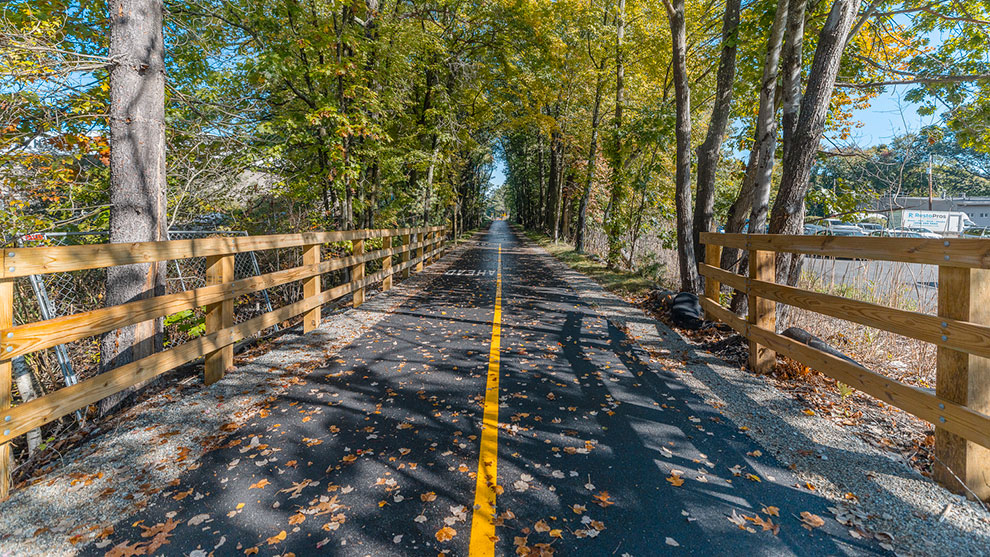
This 10-foot-wide paved path extends through the center of Town, from South Sudbury near Route 20, north to the Sudbury/Concord Town line, and takes pedestrians and cyclists through undisturbed natural areas full of wetlands, streams, vernal pools, and wildlife habitats. The trail provides additional opportunities for transportation,
passive/active recreation, and physical activity, while promoting community and economic growth through increased connectivity.

When the BFRT is fully complete, it will be one of the longest paved, fully accessible, nonmotorized
transportation corridors in New England, connecting gateway cities such as Lowell to urban and suburban employment hubs in Chelmsford and Framingham. Sudbury users will have a direct connection to the West Concord Train Station and service to Boston.

Superload Engineering and Route Analysis

Fuss & O’Neill supports heavy haul operators by providing structural analyses required for superload permitting. Through Fuss & O’Neill’s Superload Engineering and Route Analysis services and our Truck Move Program,  our structural and civil engineers perform route analyses using GIS mapping to identify bridges and other structures along the proposed routes.

Using finite element structural modeling and load distribution calculations, we assess bridge and other structural capacities and determine if alternate routes are necessary. Our engineers escort superload moves and coordinate with state police and field teams to monitor bridge crossings.

Fuss & O’Neill’s comprehensive project support ensures the efficient and safe passage of oversized, non-divisible shipments.

Our Services

  • Structural and Route Analysis
  • GIS Mapping
  • Finite Element Modeling
  • Load Distribution Calculations
  • Engineering Escorts
  • Technical Report Preparation
  • Report Submittal to MassDOT
  • Permitting Support
Download More Information About Our Superload Engineering and Route Analysis Services

Need Help With Your Heavy Haul Project?

Problem solving begins with a conversation. Send us a message so we can start resolving your challenges today.

"*" indicates required fields

This field is for validation purposes and should be left unchanged.

Superload Engineering and Route Analysis for I-84 to I-90 at I-495

High Transit, LLC, a firm that assists heavy hauling companies move oversized and overweight loads, contracted Fuss & O’Neill to provide a structural analysis for a truck route commencing at Interstate 84 (on the Connecticut border) and terminating at Interstate 90 West at Interstate 495 (in Hopkinton, MA). This analysis was performed in support of a MassDOT permit required to move superloads (truck loads exceeding 130,000 pounds gross vehicle weight (GVW), 14 feet 11 inches in height or width, or 115 feet in length).

Fuss & O’Neill analyzed all bridges and structures along the route that were four-feet in span or greater along this 23-step route that included on ramps, off ramps, state routes, and interstate highways. Our team of structural engineers performed route analyses using GIS mapping to identify bridges and other structures along the route. Bridges and other structural capacities were analyzed using finite element structural modeling and load distribution calculations. Additionally, we prepared the Overload Truck Route Survey Report for MassDOT review and provided guidance and support throughout the project.

Providing comprehensive project support, Fuss & O’Neill staff escorted the vehicle during the superload move. Additionally, we coordinated with state police and field teams to monitor bridge crossings, which enabled the safe and timely delivery of materials.

I would like to say it has been a pleasure working with you and your team! There will be more jobs in the future, for sure.

High Transit Employee

Need Help With Your Heavy Haul Project?

Problem solving begins with a conversation. Send us a message so we can start resolving your challenges today.

"*" indicates required fields

This field is for validation purposes and should be left unchanged.

Lexington Fire Headquarters

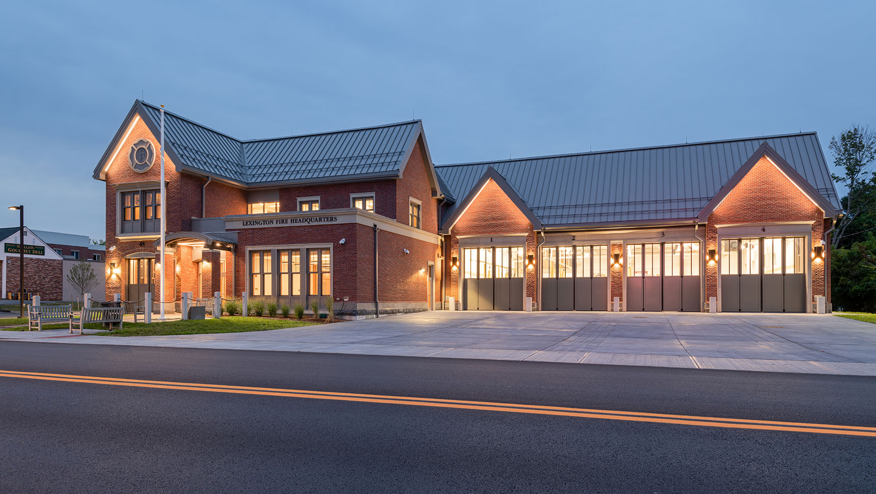
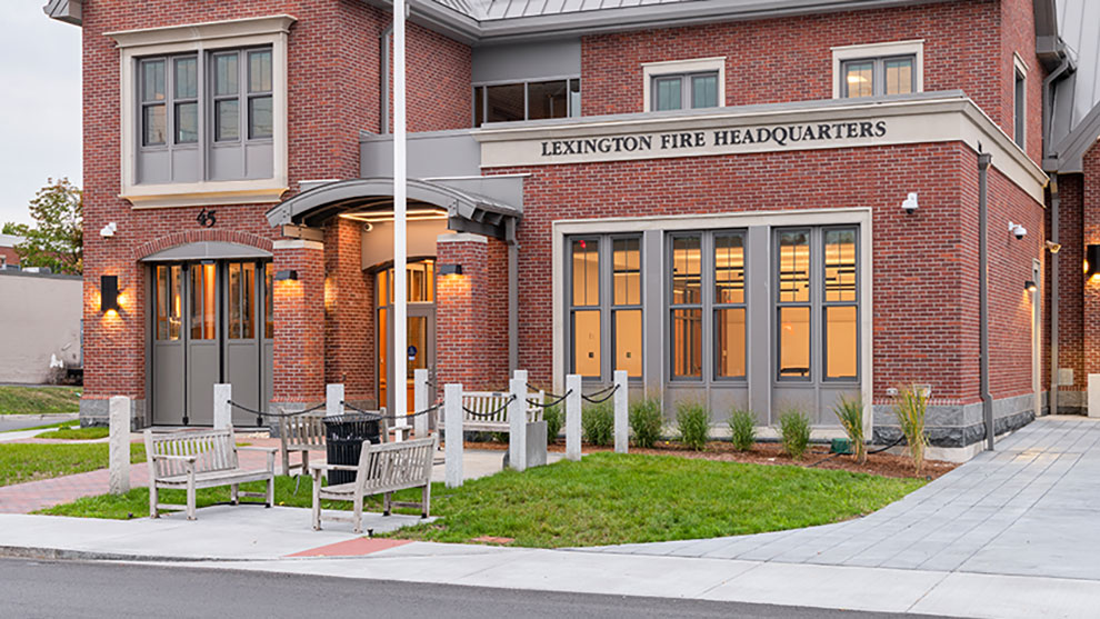
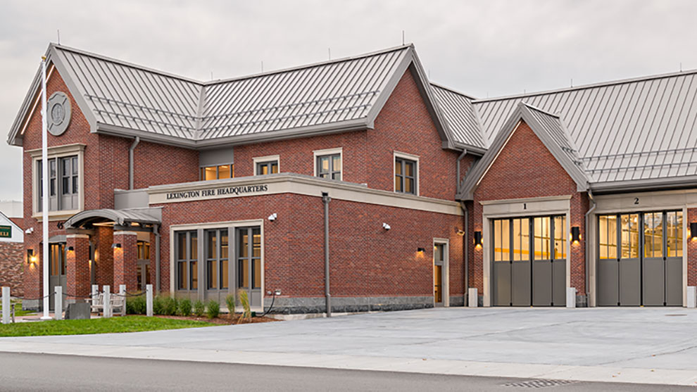
Lexington Fire Headquarters at dusk

The Town of Lexington, MA needed to upgrade their fire headquarters to better serve their 34,000+ community and to meet the needs of their modern department. Lexington is a historic town full of colonial buildings, but it is also a forward-thinking town that promotes sustainable practices.

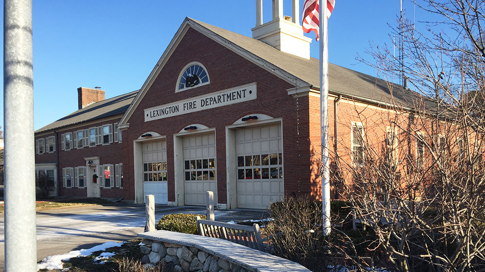
The new facility was constructed on the site of the Town’s fire and rescue headquarters, which is located on a major intersection in the Town’s historic district. The design needed to balance the needs of the department with the historical nature of the area.

Fuss & O’Neill provided multidisciplinary services in support of this $15M project that doubled the size of the fire station (in a compact urban site) and resulted in a one-of-a-kind design. This renovation included a new seven-space parking lot and new utility services.

Former Lexington Fire Headquarters

Forward-thinking Construction Considerations

There could be no disruption of service while the renovations and expansion of the fire station were occurring. Therefore, a very proactive approach was developed to minimize the impact of this project on the fire department personnel and on the community. Prior to the design of the new fire station, an existing Town-owned building was renovated to be a “swing space” (a temporary working environment) for the fire department to occupy during construction. The site included an access easement that had to remain open to pedestrians and vehicles throughout construction to allow access from Bedford Street to the businesses and the Minuteman Bikeway (located behind the project area).

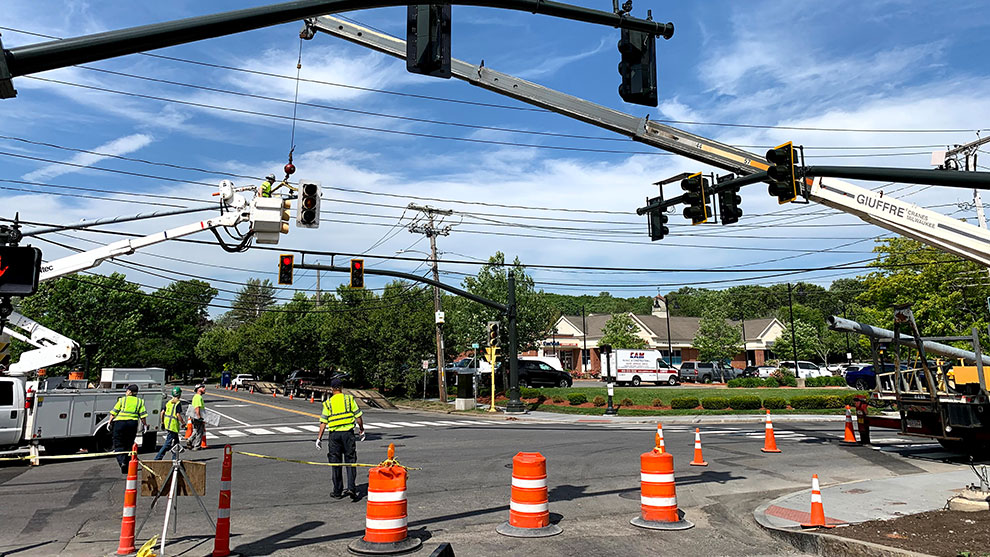
Construction working standing in road near cones while traffic engineering improvements are happening

Traffic Engineering

The station is in close proximity to a major intersection. Fuss & O’Neill’s traffic engineers designed upgrades to the emergency signal for the station driveway, the adjacent intersection signal, and the associated hardscape, including accessible pedestrian facilities. A temporary traffic signal was implemented for emergency access to the swing space.

Additional off-site improvements were completed, including new pre-emption equipment to improve the line of site and to decrease response times. Priority of emergency vehicle passage into downtown Lexington was provided using wireless spread spectrum radio interconnect through two additional signalized intersections up to a mile away.

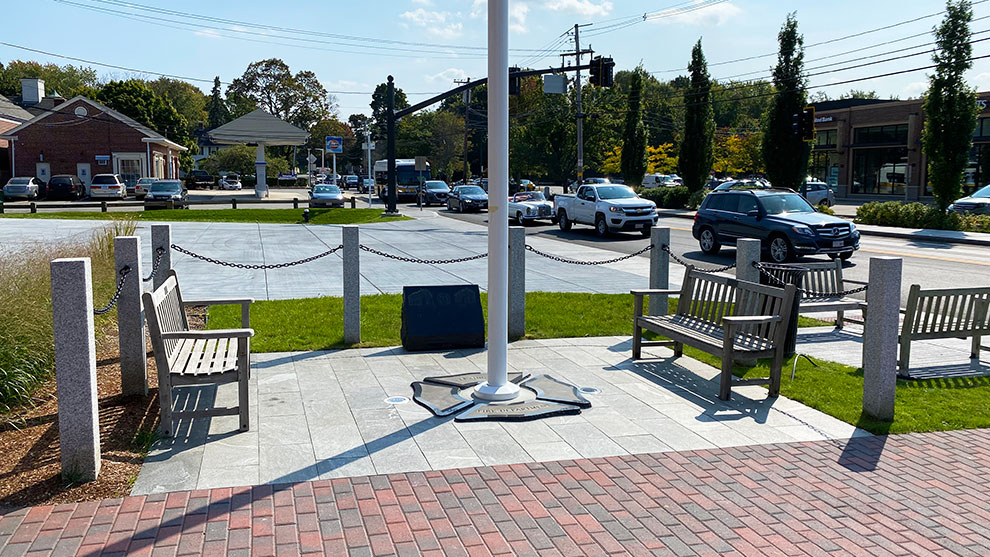
Completed Landscape architecture design at the headquarters

Stormwater Management

The stormwater management system created by Fuss & O’Neill’s civil engineers was unique to this site because of the Town’s regulations regarding historic character management. The site-specific stormwater management system was designed to mimic historic, pre-development conditions and consisted of a series of sediment forebays, bioretention basins, subsurface infiltration systems, and porous pavement. The system captures runoff from all developed portions of the property, which resulted in an increased ability to retain, treat, and infiltrate runoff on site and resulted in a higher quality (i.e., more treated) of stormwater leaving the site under larger wet-weather events.

Sustainable Design

As part of Fuss & O’Neill’s commitment to sustainable design practices, we repurposed granite curbing that was salvaged from the swing space as the bottom of the sediment forebays. This created a hard surface that allowed sediment removal without disturbing vegetation.

Hazardous Materials Management

The redevelopment required abatement of hazardous materials prior to building demolition and removal of more than 3,000 tons of soil containing petroleum, lead, and asbestos. Fuss & O’Neill’s environmental engineers provided assistance to secure the necessary permits for disposal, and provided oversight and testing during construction and final closeout.

Front door of Lexington Fire Headquarters at dusk
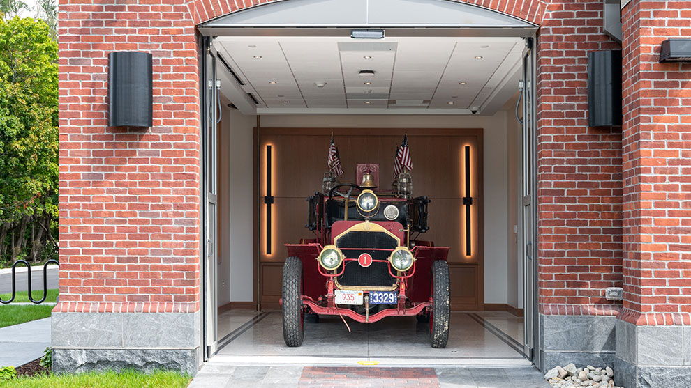
Antique fire truck in a garage bay

Landscape Architecture

Fuss & O’Neill’s landscape architects designed a hardscaped plaza area at the front of the building. In addition to providing a public amenity, the design allowed access to the building for the storage and transport of the Department’s antique fire engine and included the relocation of a firefighter memorial.

Outcome

The new building includes 10 apparatus bays, rooftop photovoltaics, and a unique radiant apparatus floor. There is a large space for recreation and a separate space set aside for training.

The project resulted in modern fire headquarters that improved department operations and response times, created public amenities, and enhanced stormwater quality.

Lexington Fire Headquarters

Awards

  • Firehouse Station Design Awards – Career 1 Gold
  • Fire Industry Education Resource Organization (F.I.E.R.O) Merit Award

Six Corners Roundabout

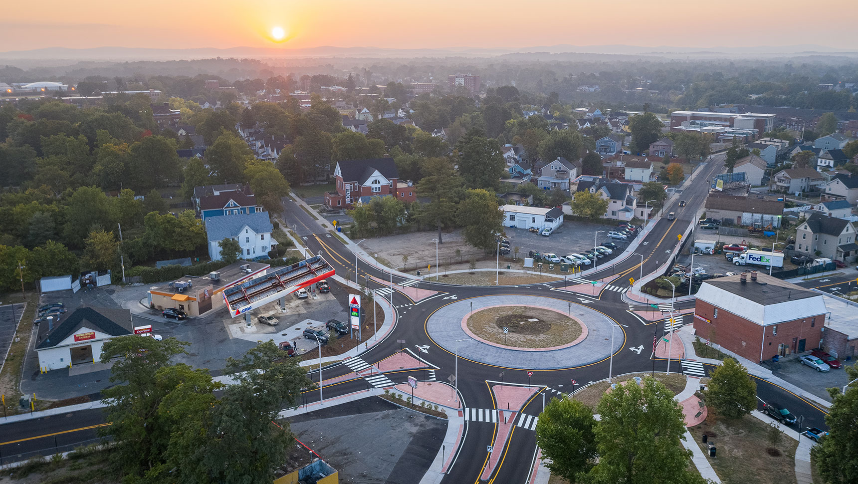
Aerial view of six corners roundabout with sun setting

A rare tornado ripped through multiple areas of western Massachusetts and downtown Springfield suffered major damage. Its landmark Six Corners neighborhood was particularly hit hard, including the namesake six-legged intersection in the center of the neighborhood.

In the wake of this natural disaster, the City recognized an opportunity to address the redesign of the intersection, which was plagued with confusing geometry, numerous accidents, long delays, and concerns for pedestrians. The City looked for ways to maximize the limited funding available for the reconstruction of the area to include a sensible and cost-effective approach to the intersection.

six corners roundabout before

Unique Design

Fuss & O’Neill was hired by the City of Springfield to evaluate potential solutions to the many issues posed by the unique intersection. Initially, more than a dozen conceptual designs were developed and reviewed. The uniqueness of this location, Six Corners, resulted in the design of a six-legged roundabout.

The unique six-legged roundabout design, the first of its size in New England in a condensed urban area, balanced complex geometry challenges that resulted from the locations of four streets, surrounding properties and businesses, and the adjacent Gerrish Park. Right-of-way and space in general were severely limited in this urban area.

The design was refined multiple times to maximize existing rights-of-way and meet applicable roundabout design criteria for entrance and exit angles. These challenges brought about an innovative solution to an urban roundabout.

Road and street signs at six corners roundabout

Fuss & O’Neill’s transportation engineers modeled the proposed roundabout geometry in Torus (a computer program specifically for roundabouts). Once the two-dimensional geometry was developed, the alignments and roadway layout information were integrated into our AutoCAD Civil3D model for the development of final design documents.

Public Outreach

Our team understood that thoughtful reconstruction and acceptance of a new design would be best served with a robust public outreach approach. We coordinated with the Springfield Department of Public Works and the Maple High-Six Corners Neighborhood Council to connect with the surrounding neighborhoods.

Sensitivity to the needs of residents was an iterative process of listening to and incorporating concerns, as well as educating the community on the merits of a roundabout and why it was appropriate for the area. Western Massachusetts has many antiquated rotaries with large diameters and high traffic speeds, making them particularly unsafe for pedestrians. By emphasizing the benefits of a roundabout (speed reduction, traffic calming, lower delays, and safer pedestrian corridors) and explaining the differences between roundabouts and rotaries, public fears were calmed.

Utilizing this critical feedback from local stakeholders and the Neighborhood Council, the Fuss & O’Neill team created a design that was supported by the community and one that would make their neighborhood safer, more assessable, and more aesthetically pleasing.

Safety Improvements

The design and implementation of the Six Corners roundabout has created:

  • A safer traffic flow, which benefits both vehicular and pedestrian travel.
  • A more-efficient traffic flow that reduces vehicle delays at the intersection and improves traffic flow through the area. The low-speed design of the roundabout reduces overall vehicle speeds in the corridor, not just at the intersection itself.
  • A more aesthetically pleasing design. Our team incorporated landscaping in the center of the roundabout and used nearby Gerrish Park as an inspiration for the landscape design, bringing a valuable change to an aging area in need of a catalyst. This intersection also serves as a gateway to Springfield College, and these improvements welcome students, faculty, and visitors.


Awards

  • ACEC/MA Engineering Silver Excellence Award Winner
  • MassDOT Consultant Innovation Award