
Filley Park

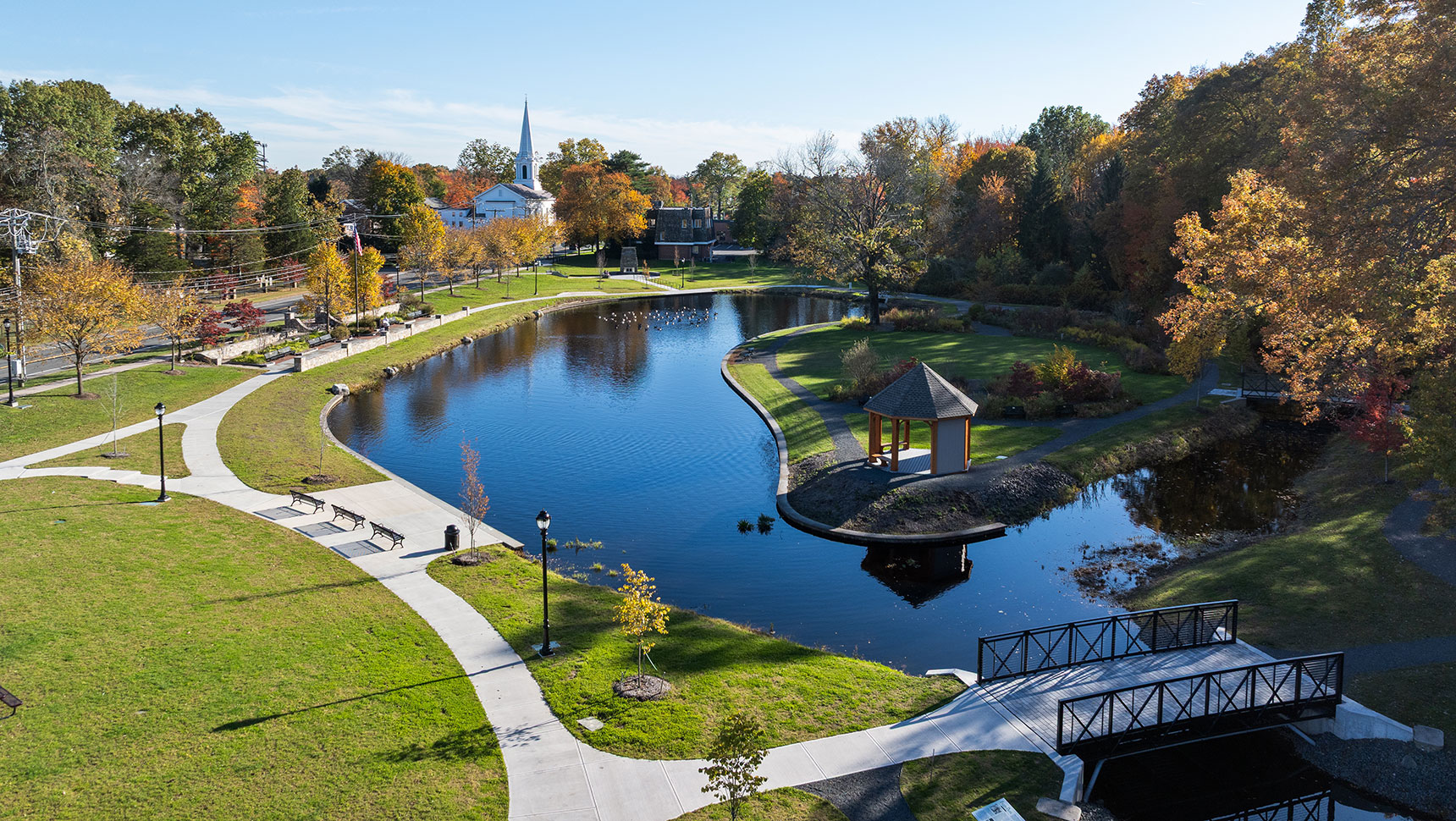
The Town of Bloomfield’s beloved town Center Park was once a recreational hub of activity for residents and visitors, providing space for fishing, ice skating, hiking, and community gatherings.

Over the years, it had fallen into decline and the slow degradation of the park’s structures, pond, brook, and amenities lead to a decline in the park’s usage. The bridges became impassable, and fishing and ice skating were halted due to the rising sediment load in the pond.

The Town of Bloomfield hired Fuss & O’Neill’s multidisciplinary team of landscape architects, designers, bridge engineers, civil engineers, and water resources engineers to revitalize the 17-acre park and pond to its former grandeur.

Completed park photo next to pond with benches sidewalk and plantings
Park benches sidewalk, and trees

Context-sensitive Design

Fuss & O’Neill brought a creative approach to revitalizing Filley Park. Our team developed a sustainable water quality approach to the brook and pond, created a walkable streetscape to the Town Center, and provided new fresh ideas to modernize the park.

The park design features a natural playground, educational nature trails, ice skating, fishing, an outdoor fireplace, and a picnic pavilion. The park’s unique island was transformed into a one-of-a-kind arboretum and event space, which can be used for gatherings, weddings, and educational enjoyment of native plant material.

Project plan showing pond and plantings

Fuss & O’Neill is a proponent of multi-modal design and we leveraged funding for the park revitalization to create an enhanced streetscape along the park frontage, connecting the park to the Town Center, which was once only accessible by car.

Park bench, path, bridge and flowers

Water Quality Improvements

The sustainable water quality construction activities for the park included restoring Wash Brook to an unimpeded water course while removing the existing dam and creating a fish passage.

Removing the pond’s flow offline from the brook decreased sedimentation and provided inlet and outlet control to balance flow between the pond and brook. Our water resource engineers designed a shore-accessible forebay that requires minimal maintenance and allows for ease of future sediment removal. This helped the Town achieve their goal of not continuing to dredge the pond every 10 years.

These improvements provide a sustained improved water quality, ensuring recreational enjoyment of the brook and pond for many years to come.

A completed park with benches sidewalk and pond

Soil Management Support

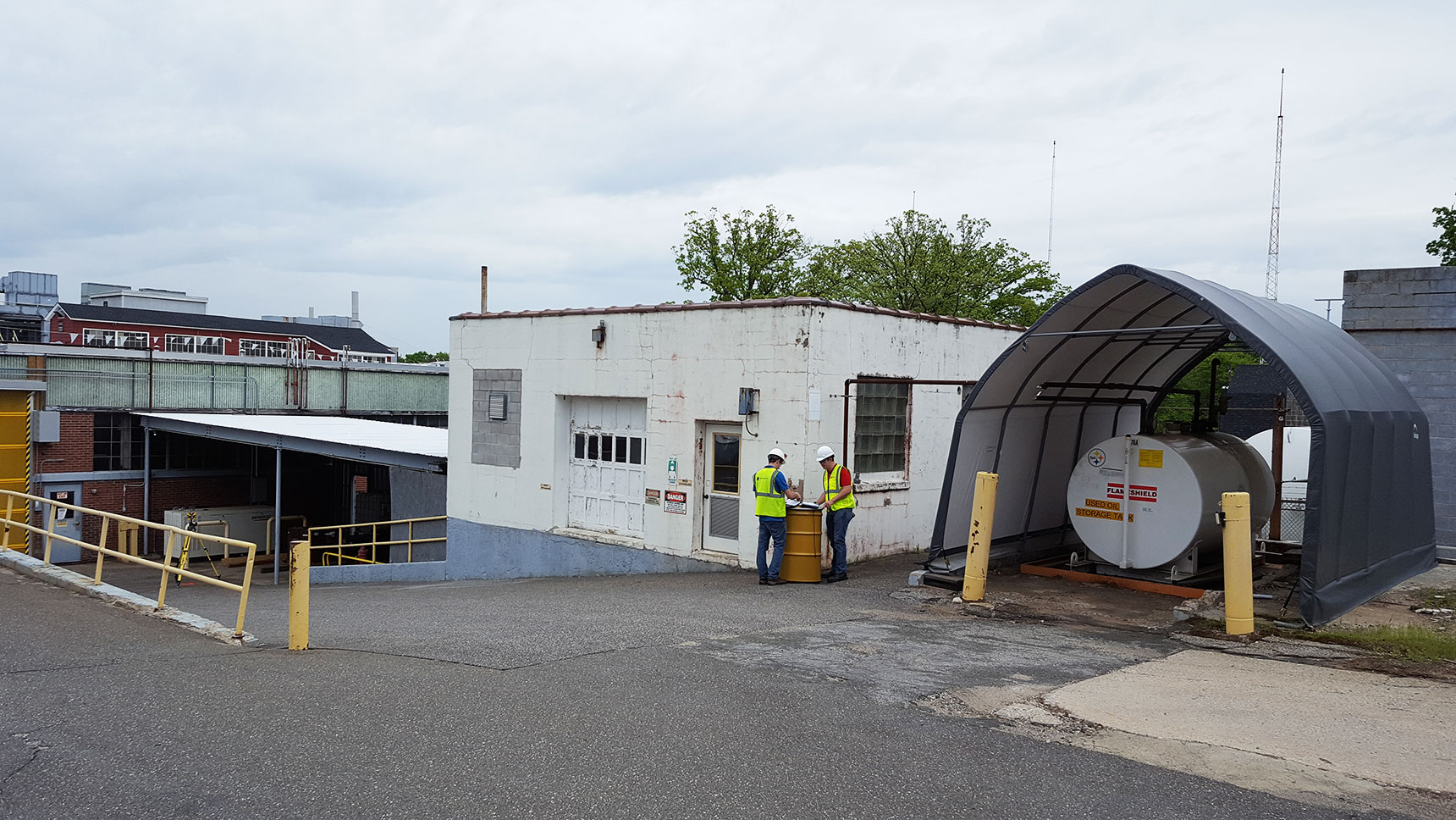
soil yard

The Metropolitan District Commission (MDC) contacted Fuss & O’Neill for assistance with managing excess soil generated during utility installation projects and to update their soil management plan. Excess soil is generated from various water and sewer main installation/replacement projects.

Pilot Study

Services began with a pilot study to compare two methods for soil management: one with extensive pre-characterization soil sampling along the project route and the other without. The results of the pilot study were used to develop and refine the soil characterization and management procedures.

Photo of soil yard

Soil Characterization and Management Services

Fuss & O’Neill is providing soil characterization and management services for the MDC. Services include:

  • soil characterization
  • review of analytical data
  • inspections and oversight
  • management and training support

On-call Support

Fuss & O’Neill has helped the MDC develop a recycling program and we created a soil management planning/budgeting tool to assist MDC Project Managers. These services have been administered through our on-call contract with MDC.

Outcome

The refined approach has significantly improved the overall process. It has created a streamlined procedure for management of excess soil, reduced the excess burden on the contractors and project managers, and has resulted in reduction of overall cost related to managing excess soil.

The process is sustainable and promotes recycling and reuse of excess soil. Widespread use of the recycled material is anticipated to have several environmental and economic benefits.

The Soil Management and Recycling Program has helped the MDC invest the savings generated from the Program to update its utility infrastructure and help communities within its member towns. The process is sustainable and preserves natural resources.

Transit-oriented Development, Connectivity, and Beehive Bridge

The City of New Britain, CT opened a CTfastrak station and high-end bus rapid transit service connecting to the region. The CTfastrak station is located on one side of a state-owned bridge that separated two areas: the City’s vibrant Little Poland neighborhood and downtown New Britain. Both areas were hubs of activity, but the area was not pedestrian friendly and they were separated by the high-speed, five-lane overpass of Route 72, which was neither walkable nor bikeable.

The City of New Britain hired Fuss & O’Neill to improve connectivity to a CTFastrak station and high-end bus rapid transit service and to improve both vehicular and pedestrian passage. This transit-oriented development (TOD) project transformed the pedestrian and bicycle conditions connecting the downtown area to the CTfastrak station and Broad Street neighborhood through innovative public art, complete streets, reimagining and reconstruction a one-of-a-kind bridge, and streetscape designs.

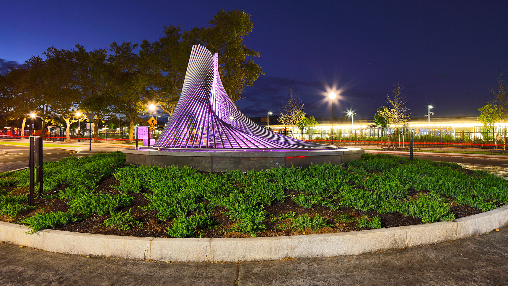
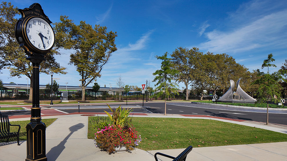
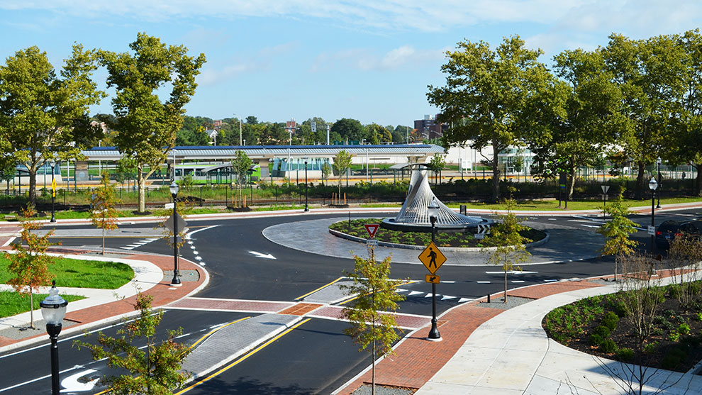
view of sculpture lit up at night in center of rotary

Roadway Improvements

Fuss & O’Neill designed intersection and streetscape improvements to improve pedestrian access to the newly established CTfastrak station. A roundabout was designed, road widths were reduced, sidewalks and intersections were redesigned, and an at-grade railroad crossing was developed.

This project included relocation of local bus service hub, realignment of the Bank Street/Columbus Boulevard intersection to a roundabout intersection, and pedestrian improvements to the Main Street/ Columbus Boulevard intersection, including a new traffic signal. Main Street underwent a road diet between Columbus Boulevard and the East Main/Myrtle Street intersection. Lower speeds were promoted within the project limits.

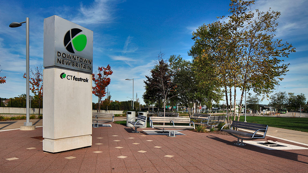
CT fastrak station signed

Railroad Crossing

Fuss & O’Neill worked with Pan Am Railways and CTDOT to develop an at-grade crossing that was safe, functional, and aesthetically complimentary to the other portions of the project. This complex design included proposed sight lines to railroad and traffic appurtenances, mast arm placement, removal of the existing overhead railroad gantry to at-grade signal heads, accommodation of pedestrians, and logistical coordination for installation of the proposed roadway/streetscape features along with the new railroad equipment.

Beehive Bridge

Collaboration

This was a truly collaborative project, including the Mayor, City staff, and dedicated stakeholders, and an extensive public outreach program was used to reach public consensus and endorsement for this project.
Design development began with a public workshop process and collaboration among design team members, city officials, and other project stakeholders on the Project Advisory Committee.

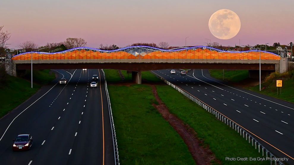
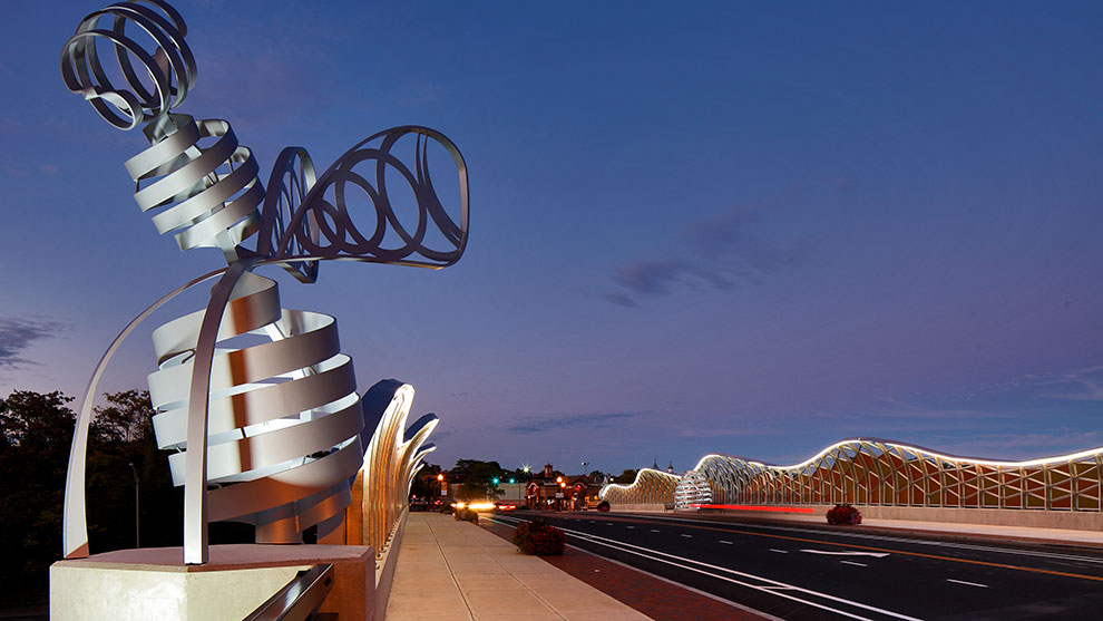
beehive bridge with panels lit and moon rising in the background

Our charge was to create an iconic structure that spoke to the history of the city, while embracing a bright future and remaining uniquely New Britain.

The design inspiration for Beehive Bridge comes from the City’s motto: “industria implet alveare et melle fruitur”, which translates to “industry fills the hive and enjoys the honey”.

Singular Design

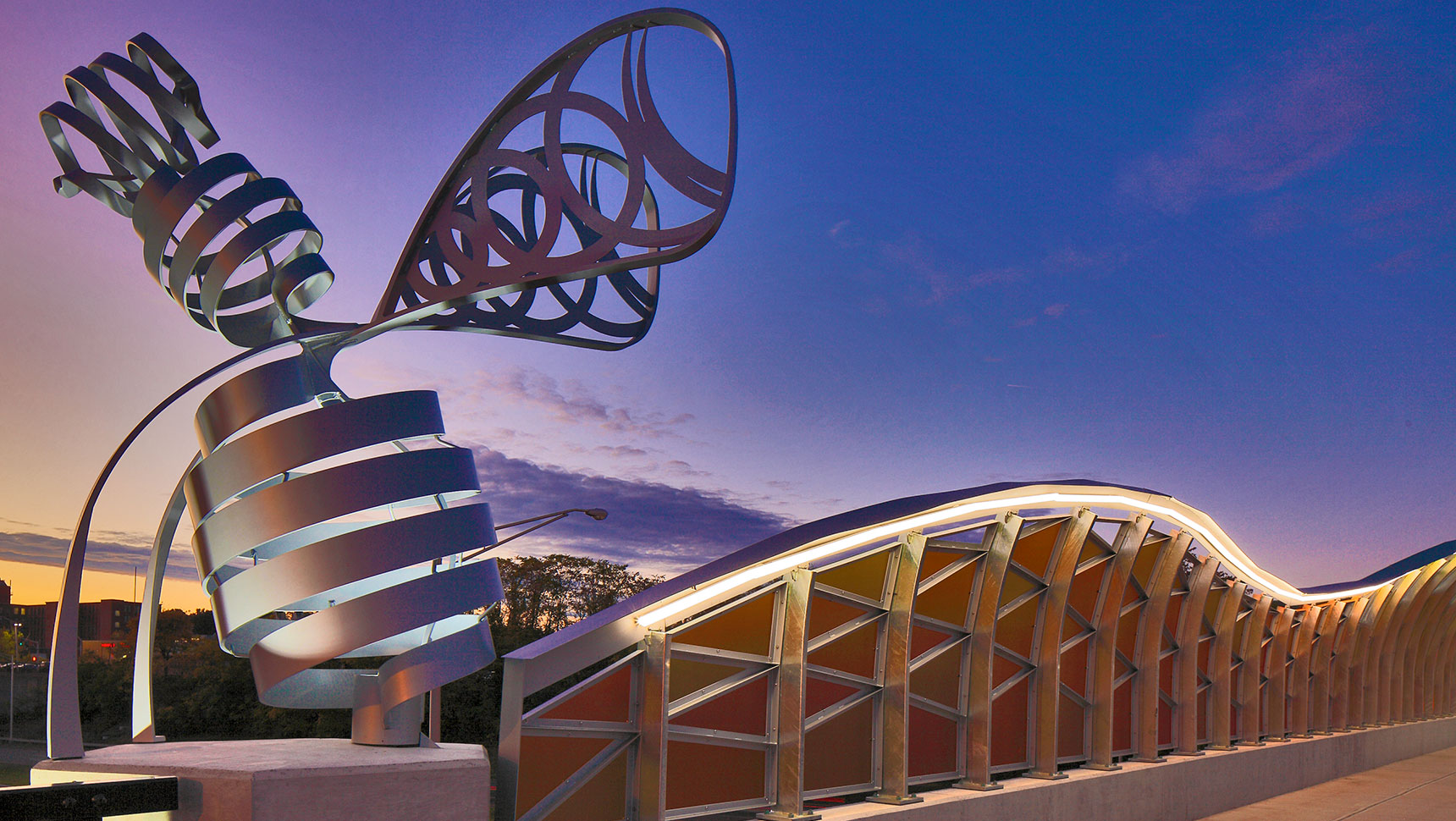
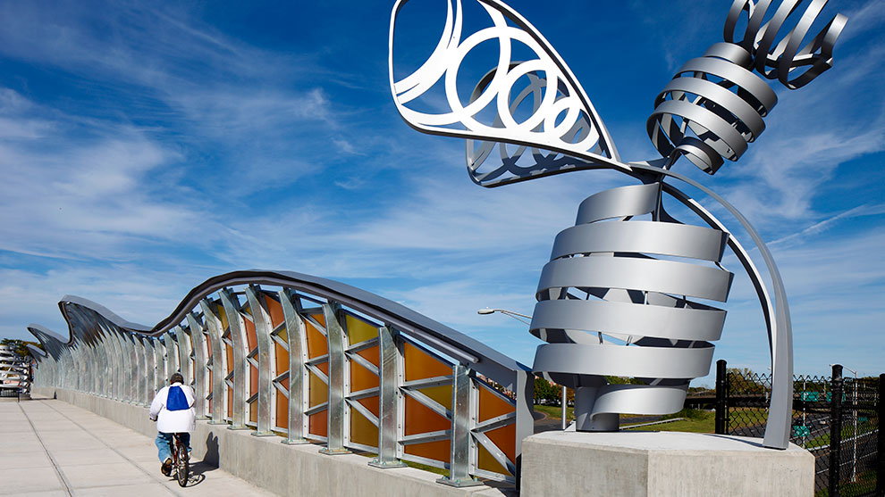
Beehive Bridge was designed to be noticed. The unique artwork of panels in varying shades of translucent orange panels are set within aluminum framing. The curving pattern is intended to look like a giant honeycomb and to mimic the flight of a bumble bee.

These panels also operate as a safety component, serving as sunscreens and reducing both wind and noise.

bee sculpture

These walls are installed to a minimum of 8 feet above the deck (as required by the Connecticut Department of Transportation) and reach a height of 16 feet in some places. As the sun moves across the sky, sunlight drifts through the panels, creating changing patterns of shadows on the streetscape. These parabolic walls are lit by programmable LED lighting for a dramatic nighttime effect.

Between the steel-post spine is a lattice network of aluminum members arranged into geometric shapes (mostly triangles with a few quadrilaterals). This framework runs along the edges and supports each of the multi-colored, half-inch-thick polycarbonate panels that make up the amber-honey colors of the beehive enclosure. Each leg of this lattice consists of a structural angle with a third aluminum fin welded onto it, making a lopsided “T”.

beehive bridge night view

The fins were individually measured and custom-welded to control the angle of the fin to the aluminum angle base. This was necessary because each of the three sides of every polycarbonate support frame, made up by three separate aluminum “Ts”, needed to be co-planer to be flush-mounted to a flat piece of polycarbonate. Most of the aluminum frame member supports two separate polycarbonate panels, one panel resting along one leg of the structural angle, the other along the adjacent aluminum fin, each member at a slightly different angle, but always remaining co-planer with the matching support legs for each individual panel. To accomplish this geometric jigsaw, significant computer modelling, coordination, and shop work was needed to ensure that the panels would each have their required edge supports.

To add to the geometric complexity of the enclosure, the bridge is skewed 18 degrees out of perpendicular to the roadway below it and is built along a vertical highway curve. This was a design challenge because, though the two parapets match the vertical curve at the same given point along the highway baseline, due to the skew of the bridge, the two pedestrian enclosures start and stop at different points along the curve. The net result for fabrication was that no two panels of the bridge were exactly alike – each panel piece (all 137 between the 138 posts plus 4 end pieces) had to be custom manufactured horizontally and vertically to properly fit its exact spot on the bridge deck.

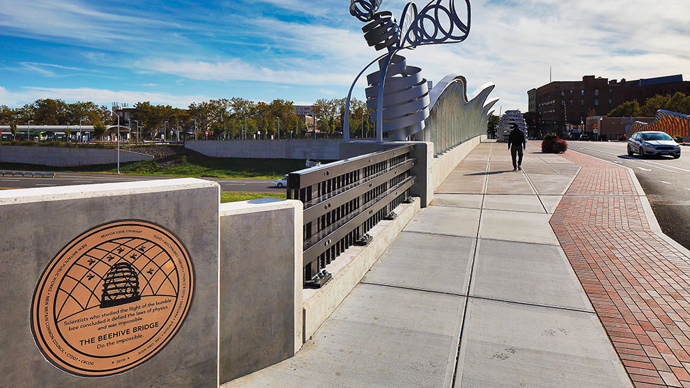
two people walking on bridge

Unique and Purposeful Aesthetics

Unique sculptures and pedestrian enclosures create an iconic structure that enhances the new walkable space. The bridge is anchored by large, whimsical bees at all corners and a 12-foot-tall “hive” sculpture was created in the center to serve as pedestrian enclosure.

The pedestrian enclosure was built on a squat, non-standard concrete parapets. Rebuilt as a part of this project, these parapets act to raise the pedestrian enclosure superstructure and are oversized to support the full width of enclosure posts’ base plates. They also conceal several embedded conduits that feed the LED lighting (designed so that the bridge would be a desirable option at any time of the day) scattered throughout the structure. Paraffin joints in the parapet, requested by the Connecticut Department of Transportation, are matched up with scoring lines in the sidewalk to help to blend them into the overall aesthetic.

Beehive bridge sidewalk and Bee sculpture

Safety and Streetscape

The state-owned bridge was transformed to be more pedestrian friendly. The exiting five lanes were reduced to three lanes, creating space for bike lanes, wider sidewalks (growing from a 10-foot width to as much as 21-feet wide), trees, and plantings.

Though creating walkable space was desired, the impact on traffic was a concern. Fuss & O’Neill created multiple traffic models and the City smartly striped the new traffic lanes a full year prior to construction, proving to travelers that this traffic calming would not adversely affect their commute. This road diet was extended down Main Street, creating a safer district.

The City’s desire for real brick pavers embedded into the concrete deck to match the streetscape on the approaches was unusual for a bridge. Our design team accomplished installation by deepening the notch for the bricks to include a drainage mat at the bottom. This mat is rated for pedestrian and tire loads, and is pitched to deposit water out of the paver notch and out of one of several scupper downspouts on the structure.

View of clock and rotary
Transit-oriented development lottery

Economic Development

Beehive Bridge is a community showpiece and a source of pride. Since implementation, the Connecticut Main Street Center advocated, and contributed early financing, for a TOD within walking distance of CTFastrak. Under construction is Columbus Commons, a $58M mixed-use TOD with 160 new apartment units, and the community is using the bridge to get to the neighborhoods from which they were once divided.

Awards

  • ACEC CT Engineering Excellence Award
  • ENR New England Best Project Award
  • ACEC Engineering Excellence National Merit Award
  • CT Main Street, Public Space & Placemaking Award
  • AIA CT Design Award
  • American Architecture Award, Chicago Athenaeum Museum of Architecture and Design

Wieland Rolled Products North America, LLC – Title V Permit Renewal

two people in safety vests standing next to building

Wieland Rolled Products North America, LLC (Wieland) is the leading manufacturer and converter of copper and copper-alloy sheet, strip, foil, tube, and fabricated components in North America. Fuss & O’Neill has been providing Wieland with support services to maintain compliance with record keeping and monitoring requirements for many years.

manufacturing facility

To assist with the renewal of their Title V Operating Permit, Fuss & O’Neill has:

  • Gathered appropriate information on air emissions sources throughout the facility.
  • Prepared computations on the facility’s actual and potential emissions.
  • Worked with the Connecticut Department of Energy and Environmental Protection to outline the compliance obligations in their permit.

The Clean Air Act Amendments of 1990 (CAAA) require that each state develop a Title V operating permit program to permit major sources of air pollution and other sources subject to federal Clean Air Act requirements. The Connecticut Department of Energy and Environmental Protection, Bureau of Air Management, has established the Title V operating permit program codified in the Regulations of Connecticut State Agencies (RCSA) 22a-174-33.

Wieland received their operating permit, which is a facility-wide permit, bringing all applicable air pollution control requirements together into a single document.

Maintenance and Repair of the Hartford Flood Control System

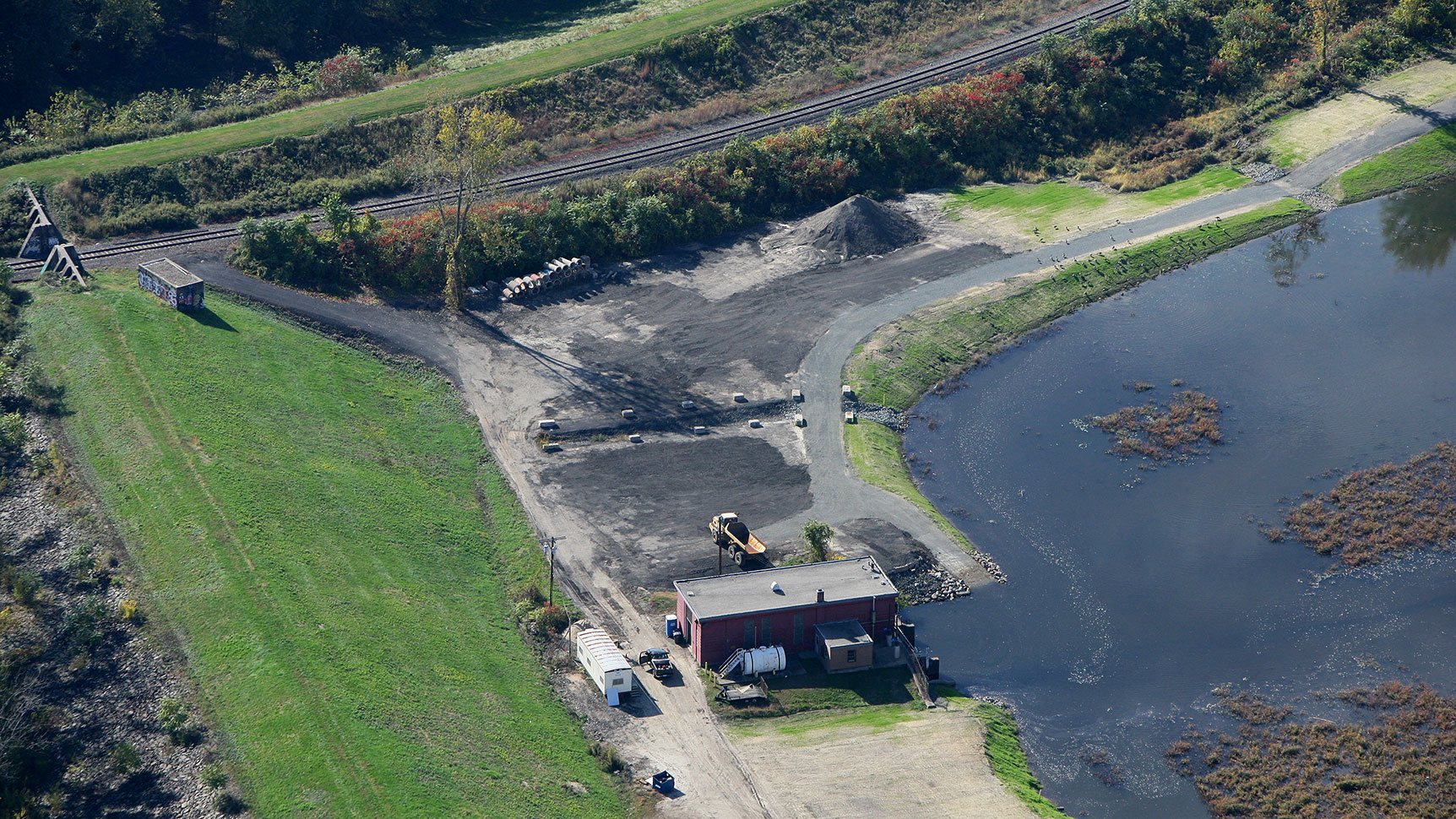
Aerial view of construction area

Fuss and O’Neill has been working with the City of Hartford to maintain and repair components of their flood control system for many years. The Hartford system is considered to be one of the most complex flood control systems in New England. 

The system is comprised of:

  • 34,000 feet of Earthen Dikes
  • 4,400 feet of Concrete Floodwalls
  • 6 Pumping Stations
  • 2 Stormwater Runoff Storm Ponds
  • Park River Conduit (16,300 feet)
  • Park River Auxiliary Conduit (9,100 feet)
  • 2 Other Pressure Conduits
Flooded the area next to the Connecticut River

Initial Project – FEMA Accreditation

In 2008, Fuss and O’Neill teamed with another engineering firm to provide the Federal Emergency Management Agency (FEMA) with the proper documentation and certifications in order for the flood control system to become fully accredited. This consisted of demonstrating that the flood control system met the hydraulic and structural standards required to be considered by FEMA as providing protection from a 100-year flood event.

Ongoing Multidisciplinary Support

Since assisting with the FEMA accreditation process, Fuss & O’Neill has provided multidisciplinary project support (water/wastewater engineering, structural engineering, MEP engineering, and site/civil engineering) to maintain and repair the Hartford Flood Control System. These flood control, climate resilience, and stormwater management and compliance projects include the following:

Quarterly and Annual Inspections

We provide routine quarterly and annual inspections of the Hartford Flood Control System in accordance with the City’s System-Wide Improvements Framework (SWIF), which Fuss & O’Neill helped develop. The quarterly and annual inspections conducted by Fuss & O’Neill include the following:

  • Perform quarterly inspections of the City’s six stormwater pumping stations.
  • Perform annual inspections of the 8 major drainage structures and 13 Park River conduit gate valves that are serviced by the Metropolitan District Commission.
  • Perform megger testing at all six of the City’ stormwater pumping station.

Levee Repairs

Our water/wastewater engineers have prepared design and permitting documents and provided construction administration services for repairs to the levee system. Repairs have included:

  • Repairing animal burrows along the levee system. Burrows created by animals can lead to rapid levee failure if not addressed.
  • Evaluation and repair of the levee toe drain system.
  • Replacement and repair of disturbed rip rap along the levee.
view of the Connecticut River

Hydrologic and Hydraulic Interior Drainage Analysis

Fuss & O’Neill performed an interior drainage analysis in accordance with 44 CFR § 65.10 (b)(6) in order to satisfy FEMA requirements associated with the accreditation of the Hartford Levee and Flood Control System. The interior drainage components include pump stations and pressure conduits that convey stormwater and floodwaters past the line of protection (the levee) to the Connecticut River. The purpose of the analysis is to identify whether the 1% annual chance ponding level of stormwater within the protected area creates flooding of greater than 1 foot in depth.

Stormwater Pumping Station Improvements

Fuss & O’Neill assessed pump capacity and condition at six stormwater pumping stations that serve the flood control systems. The pumping stations have pumps that range in size from 16 to 36 inches, with capacity from 3,500 to 45,000 gpm per pump, and discharge against heads ranging from 5 – 38 feet.

Fuss & O’Neill’s water/wastewater engineers conducted condition assessments, including capacity testing, visual inspection of components, ultrasonic vibration monitoring, electrical system testing, and megger testing, to determine the integrity of the system, to ensure compliance with FEMA and U.S. Army Corps of Engineers Flood Control System design, and to ensure compliance with operation and maintenance requirements.

Our team developed a comprehensive plan for repairs and upgrades and provided engineering and construction support services for the highest priority pumping station repairs. We designed Phase I improvements, consisting of the most critical repairs, to satisfy the U.S. Army Corps requirements. Projects included 12, 36-inch valve and operator replacements, safety improvements, and pump rotating assembly repairs at 4 of the 6 pumping stations. A measurement system was custom designed and installed in the pump’s suction and discharge piping to compare actual performance with published pump curve data.

Auxiliary Conduit Sediment Removal and Storage Ponds Sediment Removal

Sediment removal was necessary at an auxiliary conduit and at the North and South Meadows storage ponds. Sediment was removed as part of preventative maintenance to restore to the auxiliary conduit and storage ponds to design conditions. We prepared design and permitting documents and provided construction administration for these projects. In total, approximately 8,200 cubic yards of sediment was removed from the auxiliary conduit and approximately 43,000 cubic yards of sediment was removed to restore the North and South Meadows storage ponds.

Large truck delivering equipment to the site

Folly Brook Conduit Rehabilitation

The Folly Brook Conduit is located along the Hartford/Wethersfield town line. Our team inspected the conduit and evaluated the conduit’s structural integrity. Several alternatives to restore the integrity of the structure were evaluated; however, the following work was recommended for repair:

  • Install a concrete invert on the bottom of the corrugated metal pipe section.
  • Install a concrete invert where the original invert was missing.
  • Repair deteriorated areas of concrete and seal cracks.

Our team prepared contract documents and provided construction administration services for the rehabilitation of the Folly Brook Conduit mentioned above.

Hartford Levee Breach Analysis

The City of Hartford was required to supply FEMA with the proper information and certifications for the Hartford Flood Control System to become fully accredited. For Hartford’s Flood Control system to obtain a favorable inspection rating, one required element is a comprehensive Floodplain Evacuation Plan.

As part of this certification effort and the City of Hartford’s ongoing effort to review and update its flood emergency response planning, Fuss & O’Neill performed a hypothetical breach analysis of the Hartford levee. The resulting flood estimate data are meant to serve as a basis for flood response planning for all functional emergency annexes, including the evacuation annex.

Hartford Operation and Maintenance Manual

Fuss & O’Neill developed the City of Hartford’s Flood Control Operation and Maintenance (O&M) Manual. This manual provides instructions for the operation and maintenance of the Hartford Local Protection Project, which was designed to provide flood protection within the City of Hartford from the Connecticut River, Park River, North and South Branches of the Park River, Gully Brook, and Folly Brook. The manual presents detailed information to be used as a guide to comply with existing federal flood control regulations.

As part of Fuss & O’Neill’s involvement in the accreditation process and development of the O&M Manual, we routinely provide administrative and technical coordination with FEMA and the U.S. Army Corps of Engineers.

Viewof equipment next to river

Outcome

The work completed by Fuss & O’Neill has enabled the City of Hartford to maintain USACE “active” status. The consequences of not maintaining USACE “active” status are profound. If the flood control system were to fail and receive an “Unacceptable” rating from the USACE, levee accreditation with FEMA would be jeopardized, which would impact insurance rates for residential and commercial properties currently protected by the levee. There are 3,000 acres in the City that are protected by the flood control system, and skyrocketing insurance rates would essentially make the bulk of the City of Hartford un-insurable.

Hartford HealthCare Environmental Compliance Audits and Phase I Site Assessments

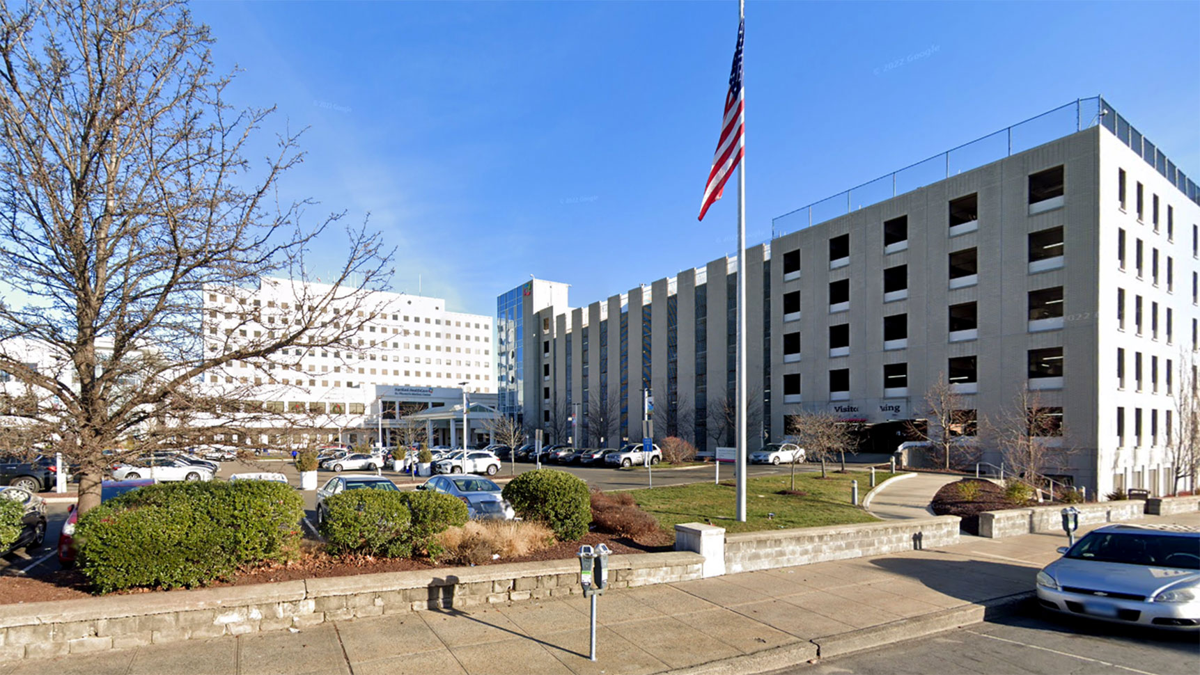
Exterior view of Hartford Healthcare

Hartford HealthCare applied for funding through the Connecticut Health and Educational Facilities Authority (CHEFA), a prerequisite of which included completion of environmental due diligence requirements.

To assist Hartford HealthCare, Fuss & O’Neill’s environmental engineers completed 14 Phase I Environmental Site Assessments (ESAs) and Environmental Compliance Assessments in the St. Vincent’s Medical Center portfolio to support the due diligence requirements. Of the 14 healthcare facilities assessed, 7 of these were acute care facilities.

Hartford Healthcare sign on top of building

Additionally, multi-media Environmental Compliance Assessments were performed at each location in accordance with the CHEFA Environmental Requirements. Our team drafted a comprehensive report for each healthcare facility, detailing our evaluation of their adherence to CHEFA’s “Core Laws”.

Fuss & O’Neill assembled a large team of experts to complete the Phase I ESAs and Environmental Compliance Assessments in approximately five weeks. All of the environmental reports were completed and submitted on time to CHEFA in order for Hartford HealthCare to receive their funding.

Hartford Healthcare hospital insurance

The Hartford Data Center Expansion

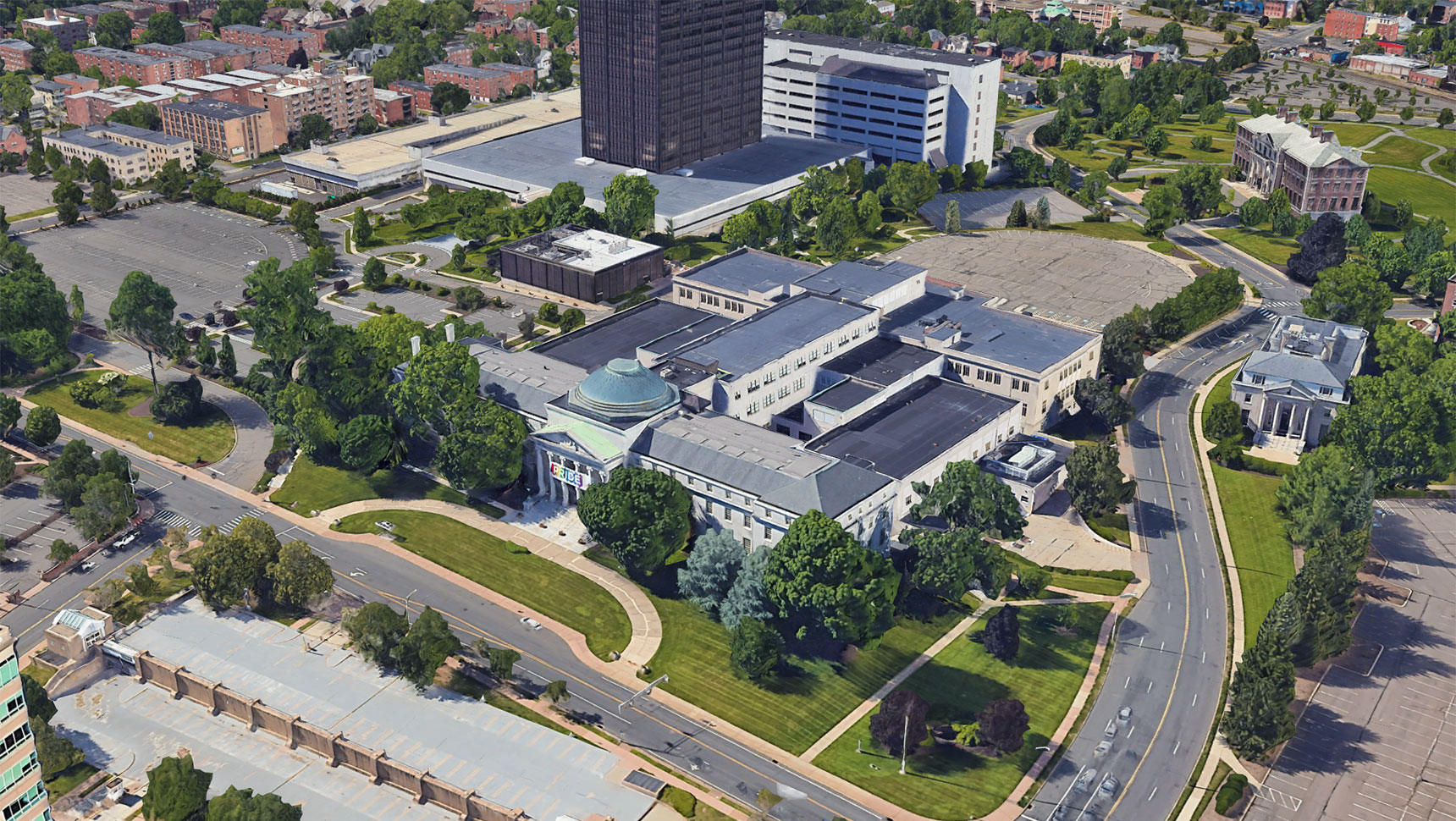
Aerial view of the Hartford

The Hartford, a leader in property and casualty insurance, group benefits, and mutual funds based in Hartford, CT, continues to grow even after 200+ years in business. Their existing data center did not have sufficient capacity to support the company’s growth.

Fuss & O’Neill was hired to develop a solution that included both new space through an addition and reallocation of existing space through renovation. Our structural engineers provided design services for a new 40,000 square-foot, four-story addition to the existing data center and for renovations to the existing 100,000 square-foot data center.

Close up of a person writing notes down on a clipboard

The footprint of the building addition is significant in relation to the overall available space on the site and its proximity to the existing building. Having experience in the area and knowing that the soil conditions in this part of Hartford are not favorable for heavily loaded, multi-story construction, Fuss & O’Neill brought a specialized geotechnical engineering partner onboard early in the design process to assist with developing a creative deep foundation system that would minimally disrupt adjacent occupants working in the existing building and also limit excavation as there was little room to store the excess material on site.

We strategically developed economical framing and foundation systems to meet stringent design requirements for the project, which included a floor live load capacity of 400 psf. Additionally, our structural engineers evaluated existing concrete waffle slab floor systems within the existing data center to determine if they could support new vibration-sensitive mechanical equipment. We designed unique strengthening measures where required.

Considering our client’s future needs and possible future expansion, we included additional equipment expansion into the layout and design of the addition and renovation to ensure that minimal additional capital expenditures would be needed in the future to accommodate further growth.

Our team provided continuous support during the billing and construction phases. Additionally, we responded to bidder and contractor questions, provided clarifications, and reviewed submittals.

As data center operations are critical to The Hartford and could not be interrupted for this significant capital improvement project, our design included a unique and sophisticated phased approach to construction that maintained data center operations throughout the duration of construction.

Parking Garage Evaluation and Repairs

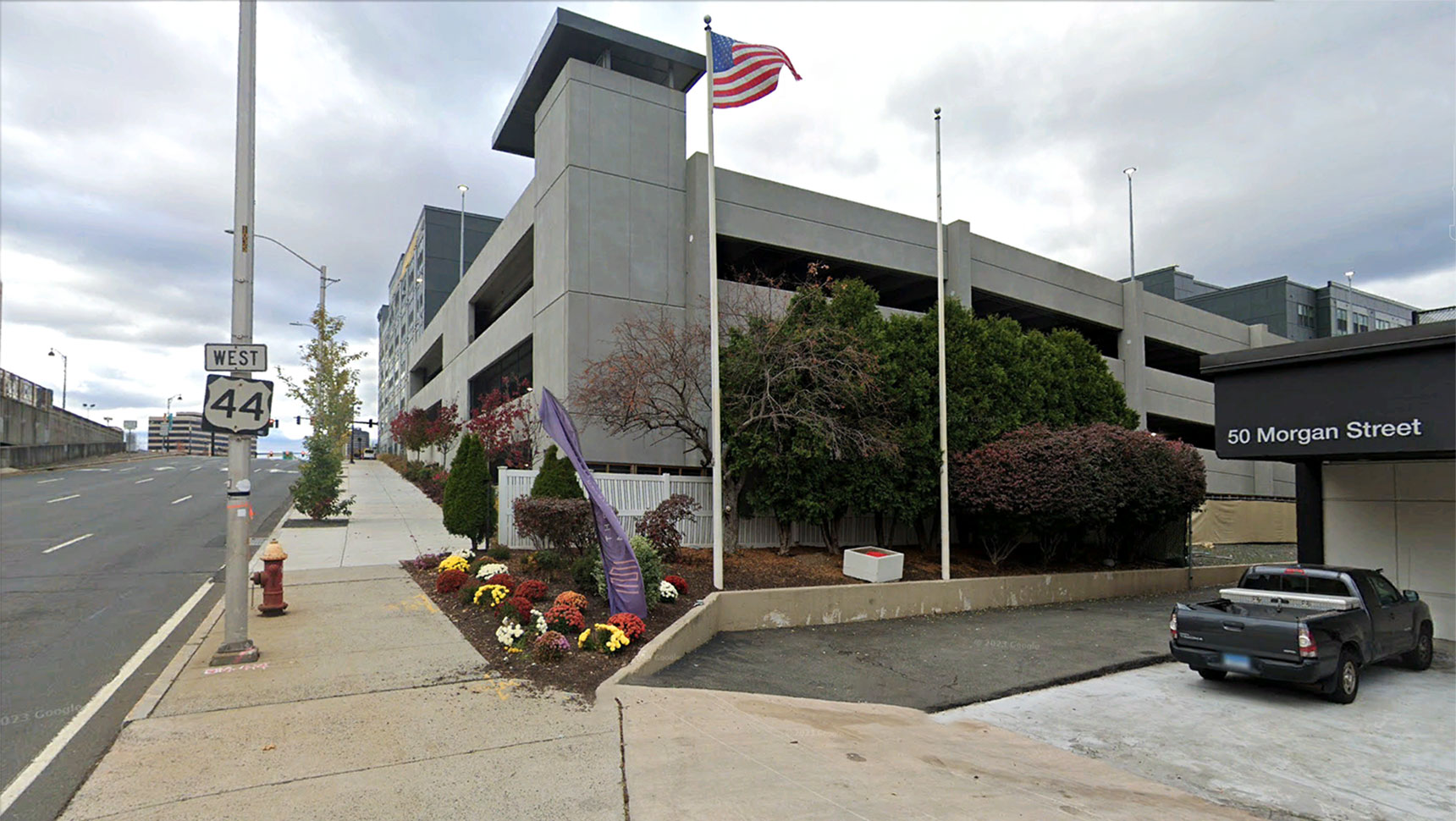
parking garage in Hartford, CT

The City of Hartford has been undergoing revitalization in its downtown. One of these redevelopment projects is the conversion of an existing hotel to modern and sophisticated apartments. Adjacent to the luxury apartments is a three-level parking garage that could provide parking for residents. However, the existing structure was not safe, as it had significant structural deficiencies and had experienced deterioration.

Fuss & O’Neill was hired by the real estate development company to make this parking garage safe for use. First, our structural engineers completed several detailed assessments of the parking structure, including destructive material testing, to determine the extent of damage and the necessary repairs.

After completing the visual assessments and reviewing the material testing results, Fuss & O’Neill worked with the developer to complete design documents for the repair of the parking structure.

At the client’s request, we created a repair plan that could be implemented in phases to allow for partial occupancy of the garage throughout the duration of construction.

Our team coordinated closely with the City of Hartford to communicate our plan to strengthen the garage and to determine the portions of the structure that could safely continue to support vehicles while other portions were being repaired and strengthened.

Design solutions included repairing cracks and spalls with cementitious mortars, strengthening concrete beams with structural steel, and leveraging new concrete walls to reduce existing beam spans and to guard against shear failures.

The garage had extensive damage due to a previously failed drainage system. One unique aspect of this project was the installation of a new waterproofing membrane to protect the garage from future damage from water infiltration and harmful deicing chemicals.

This unique and comprehensive waterproofing membrane protects our client’s investment in repairing the garage.

We also developed an operating maintenance plan to maximize its remaining useful life.

Fuss & O’Neill is a multidisciplinary firm, so in addition to our structural solutions, our transportation engineers designed parking and circulation plans for the parking garage and we provided construction inspection services to ensure conformance with the design drawings.


Springborn Dam

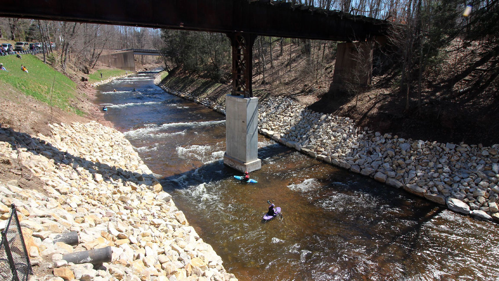
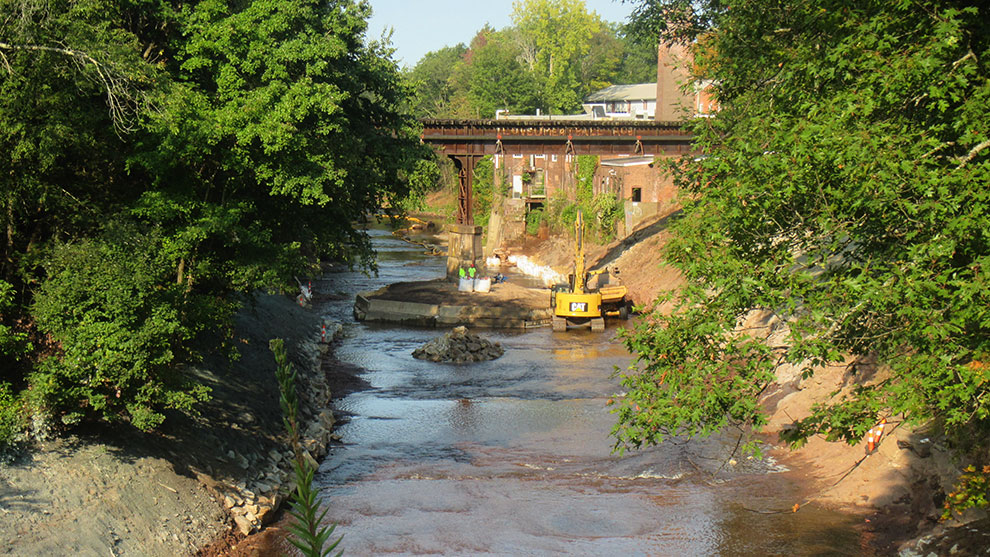
Kayaks on the river at old springborn dam site

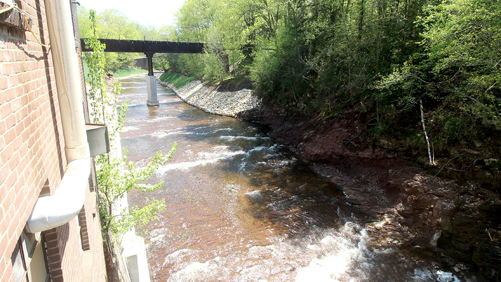
Springborn Dam, a 25-foot-high stone masonry dam, was originally constructed in 1840 and was used in the early 19th century to power machinery at an adjacent mill. The dam has undergone reconstruction and modification several times, and has been deteriorating for decades due to lack of use and maintenance. The dam was in such poor condition that catastrophic failure was a possibility. The deteriorated dam presented an obstacle to fish passage on the Scantic River, limited natural cold-water fisheries, and limited recreational access such as canoeing and kayaking.

Our client, the State of Connecticut Department of Energy & Environmental Protection (CT DEEP), is committed to restoration of rivers to their natural state wherever feasible. Removal of this high hazard dam would reconnect 2.6 miles of upstream fish habitat, restore natural riverine functions, increase community resilience in the face of future storms, remove risk of damage to downstream property, and eliminate a public safety risk.

The dam removal was funded by a U.S. Fish and Wildlife Service Hurricane Sandy Resiliency Grant Program. Coordination with both the adjacent mill building owner and the Connecticut Department of Transportation (CTDOT) were integral components to project success.

Strategic Multidisciplinary Approach

Springborn Dam was topped with six feet of timber cribbing and was located in a bedrock gorge with very limited accessibility. Our multidisciplinary team helped overcome many significant challenges during the project.

Major concerns regarding dam removal were cost and environmental impact from construction activity and contaminated sediment trapped behind the dam. Fuss & O’Neill provided a complete feasibility analysis and dam removal design with in-house capabilities, including hydrologic and hydraulic engineering, wetlands and sediment quality and permitting expertise, geotechnical engineering, and structural engineering. Impact of the dam removal on an upstream drinking water well field was assessed to ensure that there would be no substantial reduction in availability of potable water. Fuss & O’Neill also provided full time construction oversight, documentation, and design interpretation services during construction.

A major construction problem with removing the dam was the extremely limited access to the dam, which abutted the mill building on the south side. No legal access from the north side was available. Therefore, all work needed to be performed in the water. Extensive sub-surface investigations, including mechanized drilling into the river channel from a floating platform, and underwater inspections to sample sediments were provided.

Fuss & O’Neill designed and permitted temporary access roads to the riverbed from the steep upstream south embankment. A temporary crushed stone road was designed in the riverbed for construction equipment to access the dam from a point a quarter-mile downstream of the dam, including design of a temporary crossing over a tributary to the Scantic River. Following construction, all temporary in-river access roads and the temporary stream crossing were removed. The steep embankment slopes were stabilized with stone armor.

Hydrologic and Hydraulic Engineering

Fuss & O’Neill’s provided hydrologic and hydraulic (H&H) engineering as part of dam removal design. Our team examined the feasibility of options for dam removal, such as full removal, partial removal, and full restoration of the original dam. They used the latest HEC software to model base and flood flows for the river. With the results of their modeling, potential downstream impacts of dam removal were analyzed.

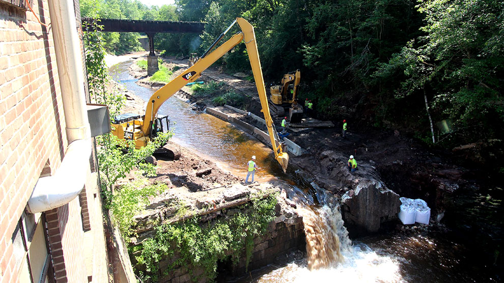
Our engineers designed a critical temporary access road into the impoundment to allow removal of dam materials and significant contaminated sediment volumes; designed a scour wall to protect the mill building; designed riverbank protection; designed scour protection for the downstream railroad pier located in the center of the channel; designed scour protection for the downstream Route 191 bridge; and designed reconstruction of the river bottom with change of grade structures if they were found to be necessary. Sediment mobility was studied to assess the potential for sediment to collect downstream and form natural barriers to river flow.

During construction, Fuss & O’Neill engineers coordinated dam removal activities with the water levels in the upstream Somersville Pond Dam, using the upstream pond to help control storm flows to Springborn Dam during construction/ They also coordinated water control with a CTDOT large-diameter culvert replacement project at the Terry Brook crossing of Route 191 and with a mill building demolition project adjacent to the Scantic River upstream of Springborn Dam.

Excavator working in the river

Geotechnical Engineering

Fuss & O’Neill’s geotechnical engineers performed an investigation of sediment depths, as well as an investigation of the footing depth and type of the downstream railroad center pier located in the middle of the dam impoundment. The sediment depth investigation was performed using a modular barge with a skid-mounted drill rig, stabilized with cables at both the north and south embankments. Sediment depths were obtained to quantify the sediment volume and collect samples for grain size testing and sediment quality testing. The results indicated that approximately 12,500 CY of sediment would need to be removed for full dam removal.

During construction, the river was dewatered and Fuss & O’Neill’s geotechnical engineers oversaw a test pit adjacent to the railroad central pier to ascertain the type of pier foundation and whether the footing was founded on bedrock. This data was to be used by Fuss & O’Neill’s H&H engineers to evaluate the scour potential around the pier under proposed dam removal conditions. The results indicated that the central railroad bridge pier was founded on a rock and soil-filled timber crib, and the crib was founded on bedrock.

Based on our observations, Fuss & O’Neill determined the pier had deteriorated and was not stable, and either a new foundation would be needed to support the pier, or the pier would need to be replaced in its entirety. CTDOT directed CTDEEP to design and replace the pier as part of the project.

Excavator working in the river

Structural Engineering

Structural services in support of this project included design of a scour wall to protect the mill building adjacent to the river and repairs to an existing CTDOT railroad bridge concrete pier in the Scantic River just upstream of the dam. Our structural team designed a new railroad bridge pier and developed a method to support the bridge during demolition and construction. We collaborated closely with CTDOT Rails, CTDEEP, and the contractor to design and permit the new pier on an expedited basis within the original design and construction services budget.
The railroad bridge presented problems due to its legal standing as an active rail line (although it had not been used in decades and was severely deteriorated), and because it supported an 18-inch diameter jet fuel pipeline crossing the Scantic River. Because dam removal would scour the deteriorated center bridge pie foundation, Fuss & O’Neill’s structural engineering staff expedited the demolition of the old pier and design of a new pier.

The existing bridge needed to be supported during pier replacement with almost no movement of the fuel pipeline (the active petroleum fuel pipeline could not be moved more than ¾” vertically or horizontally), so Fuss & O’Neill’s structural engineers designed a pair of temporary support towers to support the bridge on either side of the center pier to be removed. The temporary supports consisted of 40’ tall steel towers in the river on each side of the pier that were slid into place on temporary concrete pads. The bridge was jacked 1/8” vertically to relieve the load and reconstruct the pier, then lowered back to its original position on the new pier, with no adverse effects on the pipeline or bridge. The footing for the temporary towers consisted of poured concrete on the existing bedrock, requiring multiple diversions of the river. The new pier was constructed while the river was diverted to both sides of the construction, and the settlement of the bridge following removal of the temporary support towers was negligible.

Sediment Management

Fuss & O’Neill collected sediment samples in the river behind the dam and at suspected outfalls from the mill building and found there were chemical contaminants exceeding allowable concentrations of heavy metals, PAHs, and chlorinated pesticides. During construction, sediment was excavated and stockpiled in the riverbed while fast-track testing was performed to determine acceptable disposal sites for the polluted sediment, which was then trucked directly to approved disposal facilities. This was accomplished without causing delays in the construction.

Additionally, based on the sediment volume and contamination levels, Fuss & O’Neill’s wetland scientists and biologists performed a toxicity study to assess the consequences if the contaminated sediment was allowed to move downstream following dam removal. The results indicated that unacceptable impacts to fauna and flora would occur if the sediment were not removed prior to dam removal.

Completed view of springborn dam

Outcome

The project was a complete success. The dam was removed to existing bedrock with virtually no contaminated sediment moving downstream, and monitoring has shown no significant scour of downstream structures or the existing mill building. The center pier of the railroad bridge is stable, and the jet fuel pipeline is active is safer than it was previously.

Fish passage has been restored, and the stretch of the Scantic River interrupted by the dam now allows cold water fisheries and unobstructed canoeing and kayaking opportunities, including an annual canoe race. Lowering the water levels around buildings, bridges, and other infrastructure improved the ability of the community to respond and adapt to storms. Reconnecting fish habitats strengthened the natural ecosystem by extending these runs to geographic areas from where they have been absent for over 100 years, thus also increasing species’ population size.

Horizontal Curve Signing Project

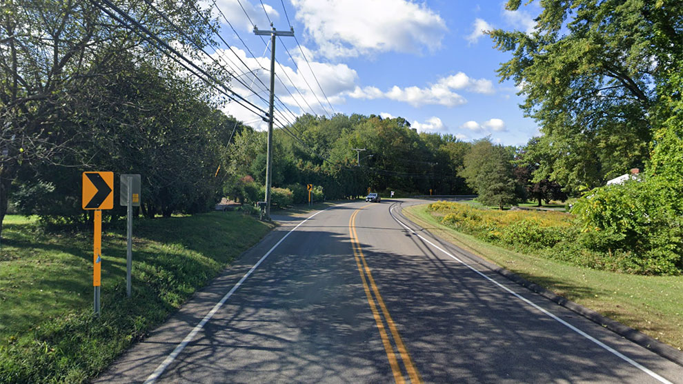
Roadway that is a horizontal curve and has arrow signage

Fuss & O’Neill performed professional services for the Connecticut Department of Transportation (CTDOT) for the development of systematic countermeasures to reduce the instances of roadway departure crashes along horizontal curves (a horizontal curve is the bend in a road between two straight segments of roadway) on state-owned and maintained roads and ramps throughout District 1.

Paved road heading into a curve

Curve Identification and Data Collection

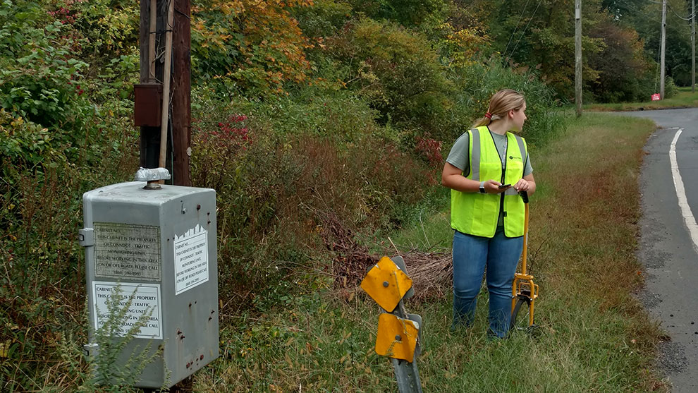
Under this project, approximately 1,750 curves were identified by CTDOT that would benefit from enhanced signing. Innovative electronic field data collection methods utilizing GIS were developed by Fuss & O’Neill and were employed to accurately locate, update attributes, and catalog photos of road-curve signs and related assets.

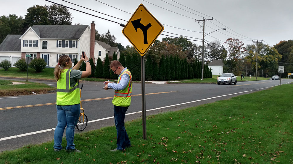
We conducted a field review of each curve, which included reviewing the existing conditions using a ball-bank indicator and GIS mapping to determine appropriate advisory speeds. The ball-bank indicator registers the overturning force (side friction), measured in degrees, on the vehicle while being driven through a curve at the currently recommended speed.

Each curve is driven three times from each direction, for a total of six passes. Data were uploaded in real time to our GIS database server and visualized in our customized project dashboard where information was QC’d and adopted to the design environment.

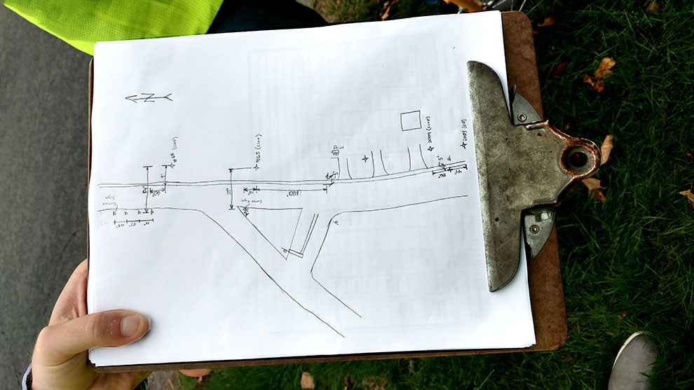
Additionally, site-specific data were recorded for context (e.g., was signage appropriately placed and in good condition, were trees overgrown and affecting the line of sight, etc.). At some sites, detailed field sketches were made, photographs were taken, measurements between points of interest (utilities, signage, road markings, etc.) were noted, sign conditions and landmarks were recorded, and recommendations were made.

People in safety vests taking pictures of the project site
clipboard depicting a drawing of a horizontal curve
Two people in a car getting ready to survey the horizontal curves

Design

During the Preliminary Design Phase, we developed curve design spreadsheets documenting the data obtained and calculated for each curve, and we created plans utilizing aerial photos that clearly showed the locations and descriptions of what signs were to be removed, installed, or reset.

Based on these spreadsheets, advanced warning signs, advisory speed plaques, and chevrons may be proposed. The proposed signs are based on the advisory speed we measured at each curve; if there is an advisory speed of 5 mph below the posted speed, an advanced warning sign is proposed. Anything greater than 5 mph requires an advanced warning sign, speed plaque, and chevrons.

The spreadsheets, plans, and corresponding estimates were submitted to CTDOT, a few routes at a time, clearly showing the locations, dimensions from fixed objects, and descriptions of what signs shall be removed, installed, or reset. The CTDOT commented on the overall plans regarding safety and placement of proposed signs.

Woman in a safety vest on the side of the roadway

Outcome

In the Semifinal Design Phase, we incorporated CTDOT comments on the overall plans regarding safety and placement of proposed signs. Under the Final Design phase we compiled a full Traffic subset that included more than 300 plan sheets. Fuss & O’Neill developed construction plans for installing warning signs and advisory ramp speeds signs at the project locations.