
Wood-Pawcatuck Watershed Improvement Projects
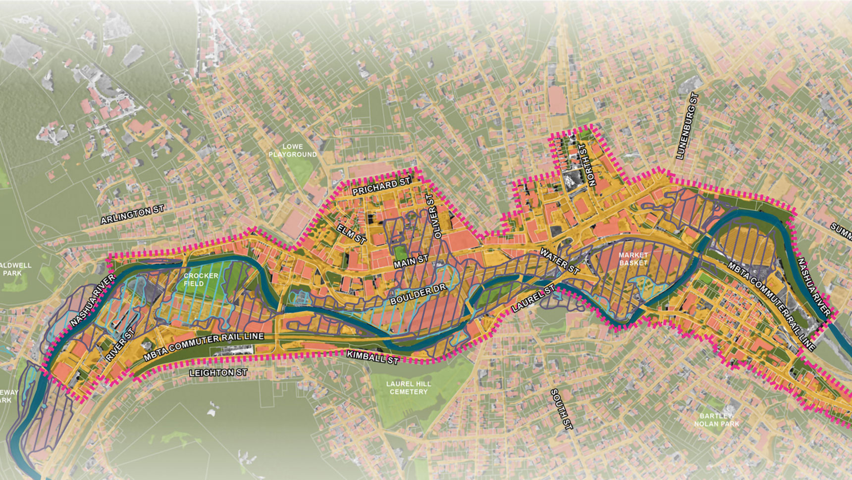
The Wood-Pawcatuck watershed, a 300 square-mile area in southwestern Rhode Island and southeastern Connecticut, is vulnerable to flood-related impacts.
Flooding has damaged properties and structures, and this area has experienced overtopping and washout of roadways; bridge and culvert damage; and dam impairment and failure. The flood effects have been exacerbated by outdated and aging infrastructure (e.g., culverts, bridges, dams, and storm drainage systems). Rainfall in southern New England is expected to continually increase due to climate change, which will increase the risk of future river-related flooding in the watershed. The Wood-Pawcatuck watershed was also experiencing water resources challenges in the form of degraded water quality and habitat.
Fuss & O’Neill was contracted to first develop two plans:
The comprehensive flood resiliency management plan assessed the watershed’s vulnerability to the growing risks from flooding, erosion, and associated storm-related threats. The watershed-based management plan included solutions to protect and enhance the watershed communities’ resilience to future flood damage and to improve river and stream ecosystems. It included management recommendations (that incorporated climate change considerations) for nature-based flood resilience measures and conceptual designs.
Fuss & O’Neill performed field assessments of 400+ road-stream crossings (culverts and bridges) throughout the Wood-Pawcatuck watershed using methods adapted from the North Atlantic Aquatic Connectivity Collaborative (NAACC). Prioritization of structures for replacement was based on hydraulic capacity, structural condition, geomorphic risk, flooding impact potential, aquatic organism passage, and climate change considerations (including projections of future precipitation and flood flows).
The road-stream crossing assessment, combined with geomorphic assessments of 40 stream miles and river corridor, an assessment of 70 dams, and green stormwater infrastructure retrofit assessments, identified dozens of site-specific project concepts in the watershed
From these assessments, Fuss & O’Neill was selected to complete detailed planning and design for priority resilience and ecological restoration projects throughout the watershed.
The culvert assessment methodology also served as the basis for a statewide road-stream crossing assessment protocol and guidance document that was developed by Fuss & O’Neill for the Rhode Island Department of Transportation.
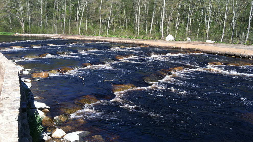
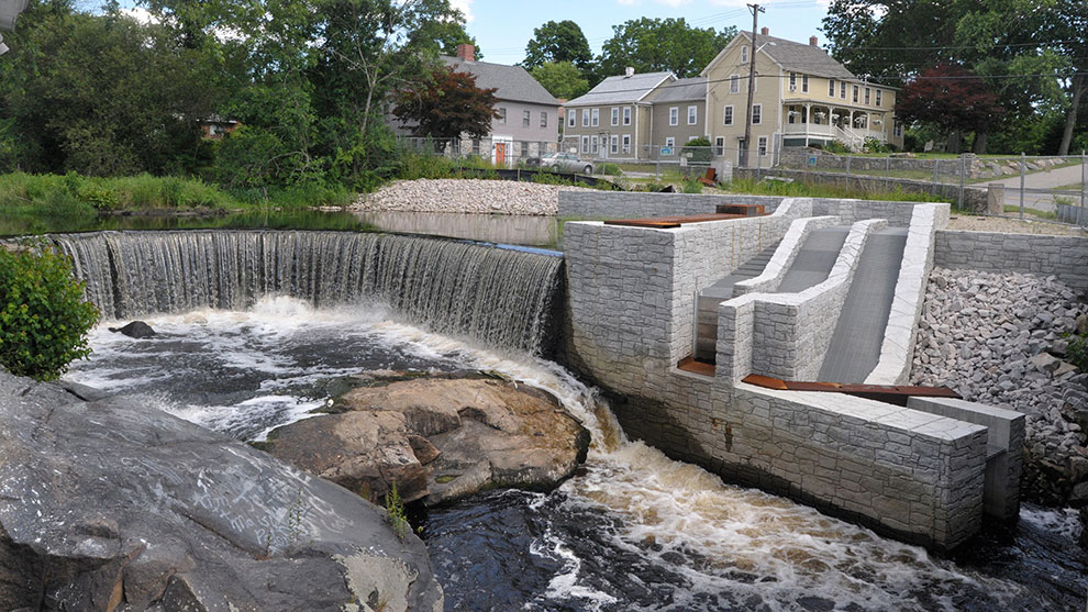
The Kenyon Mill Dam, which is located on the Pawcatuck River in Kenyon, RI, was constructed to support mill operations at an adjacent textile mill. In conjunction with two other fish passage projects immediately downstream, the Wood-Pawcatuck Watershed Association, in cooperation with NOAA and RIDEM, secured funding to modify the structure to provide fish passage at the site for Blueback Herring, Atlantic Salmon, American Shad, and American Eel.
The mill site relied on the dam’s impoundment as a water source for its fire suppression system. Fuss & O’Neill worked closely with the mill owner to evaluate alternatives that would allow removal of the dam by providing replacement water storage facilities.
Our team assessed upstream impacts to bridges and natural resources in the state’s largest freshwater wetland system resulting from dam removal. We performed hydrologic/hydraulic analyses of flood flows and prepared FEMA floodplain map revision submittals. We conducted field investigation of impounded sediments and developed designs to minimize mobility and impacts to upstream bridge.
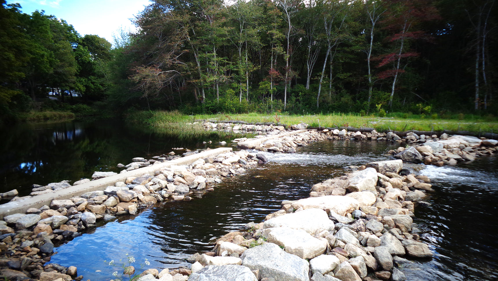
The final design was construction of a nature-like rock ramp fishway that maintains the impoundment. During construction of the improvements, construction phasing was used to ensure that headpond elevations were maintained for the mill’s fire suppression system.
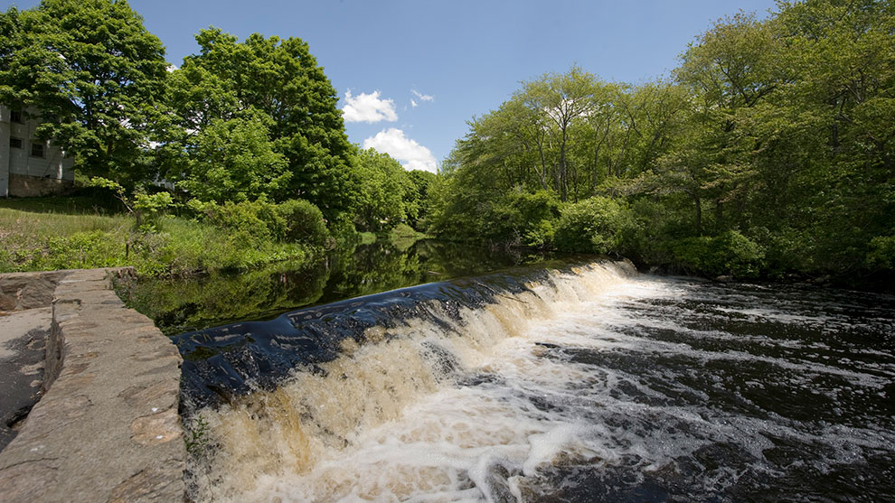
The Horseshoe Falls Dam is an iconic landmark in the state of Rhode Island and is listed on the National Register of Historic Places. The site was experiencing a critical impediment to eel passage. Typical practices to provide eel passage were not feasible due to both aesthetic and maintenance concerns, as well as significant site layout constraints.
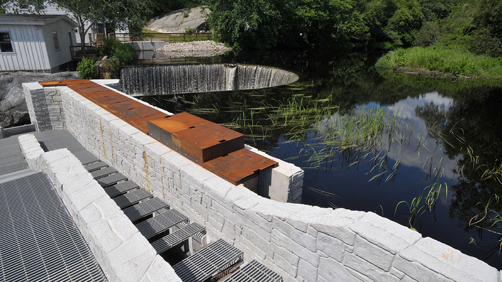
Fuss & O’Neill was contracted by the and other state and federal project partner agencies to develop an innovative approach to provide level flow control autonomously at the Horseshoe Falls Dam. Because our team’s proposed approach was the first of its kind, our mechanical engineers built a prototype outside our office and tested it with live eels at a hydraulic laboratory.
With support from Wood‑Pawcatuck Watershed Association and project agencies including NOAA, RIDEM, USFWS, and USGS, the customized flow control assembly was fabricated and installed as an integral component of the fish ladder. The flow control assembly is adaptable to other sites, avoiding the cost of an electrical service or solar panels and the maintenance burden of pumps. This device operates autonomously through varying headwater elevations, providing consistent flow to the downstream eel pass channel without the use of pumps.
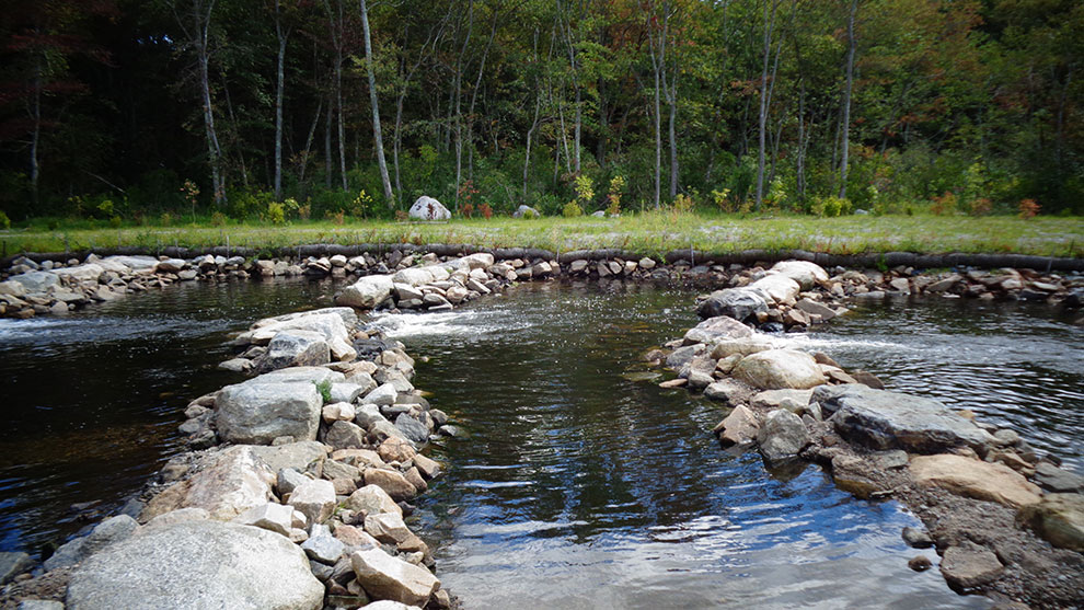
This timber dam, located on a natural falls on the Pawcatuck River in Richmond, RI, was originally built for a grist mill. The Wood-Pawcatuck Watershed Association, in cooperation with NOAA and NRCS, secured funding to remove this dam as it was inhibiting passage of fish, including Atlantic Salmon, American Shad, and American Eel.
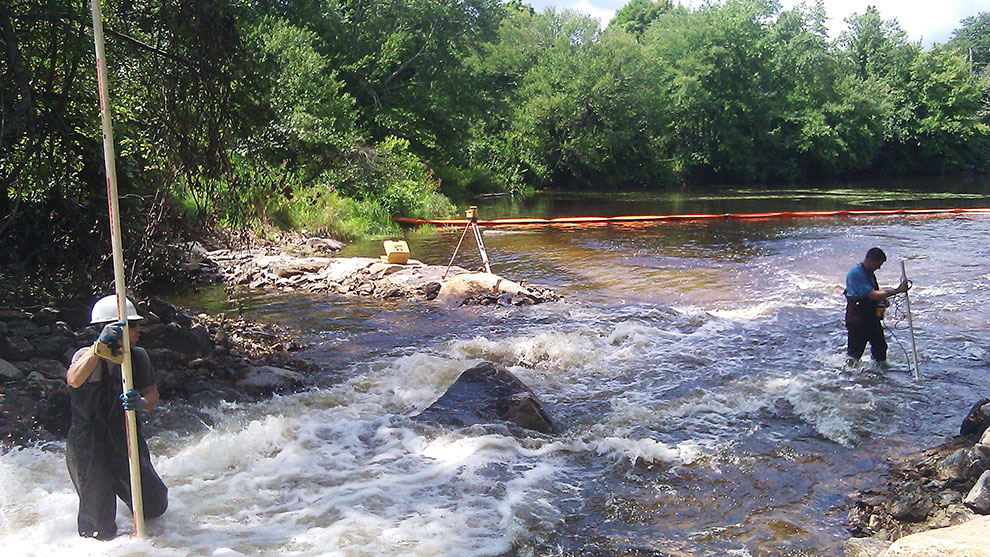
Our team assisted federal agencies in coordinating assessment of historic features in and adjacent to the river channel, and designed details to protect features to remain through construction.
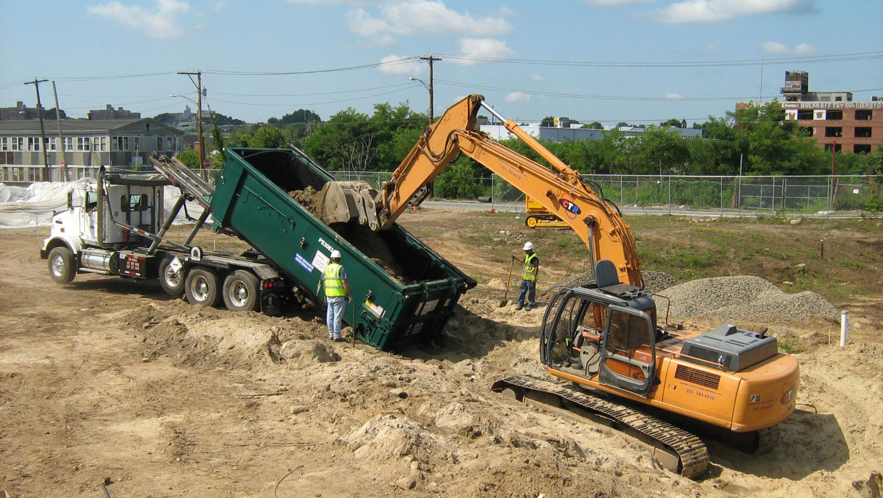
We quantified and characterized contaminated sediment impounded behind the dam, performed a sediment mobility study, and designed a removal approach to manage sediment through construction.
Detailed hydrologic and hydraulic analyses of flood and seasonal fish passage flows were performed to assess alternative channel configurations. We evaluated fish passage feasibility recommendations under a detailed modeling analysis to prepare design plans, details, and specifications for construction.
Our team completed assessment and characterization of adjacent wetland resources and evaluation of potential impacts to upland wetland resources following dam removal.
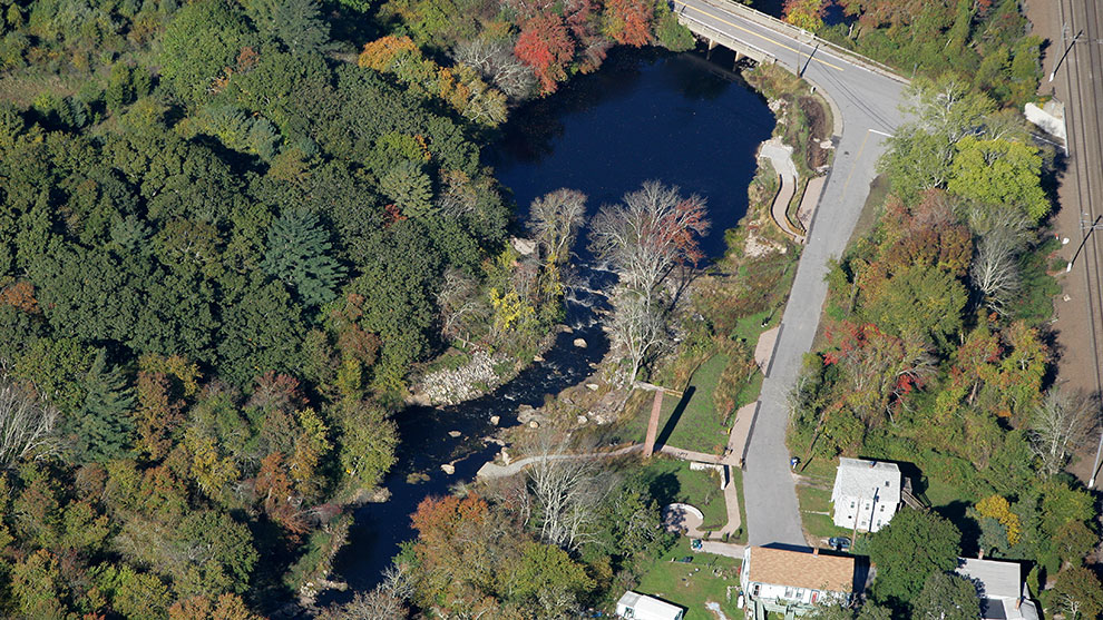
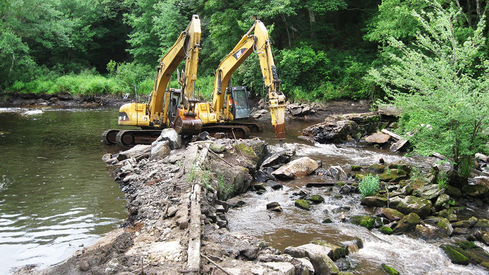
This was the first full dam removal project in Rhode Island. Several other dam removal projects were already underway when we began this project; however, our partnerships with regulatory agencies regarding how to best manage the project through their regulatory programs allowed our team to rapidly execute this project, bringing it to completion prior to any of the projects that began before.
Fuss & O’Neill developed a cold-water stream restoration plan for the Upper Wood and Beaver River subwatersheds in collaboration with the Wood-Pawcatuck Watershed Association, RIDEM, and The Nature Conservancy.
The numerous obstructions (e.g., perched culverts, dams, remains of dams, and natural head cuts) in the headwater streams within the Upper Wood and Beaver River subwatersheds reduce aquatic organism passage or contribute to stream warming, detrimentally impacting cold-water habitats and local Brook Trout populations.
Improvements to stream flow can reduce the threats facing Brook Trout by enhancing connectivity and reducing water temperatures. These improvements can include removal of obstructions (e.g., defunct mills and agricultural dams), culvert replacement, stream channel restoration, fish passage using nature-like fishways, and riparian corridor restoration.
Fuss & O’Neill and our project partners developed a phased prioritization process to identify and select priority restoration projects in both subwatersheds. Projects were prioritized based on the nature of the obstruction, key findings from existing studies or data sources, preliminary information on potential restoration project elements, the anticipated scale and degree of benefits to cold-water fisheries, infrastructure opportunity (geomorphic vulnerability and safety impact), existing physical barriers (aquatic organism passage and barrier locations), and ecological impacts. A final list of priority projects was selected based on estimated project cost and complexity.