
Coastal Vulnerability Action Plan
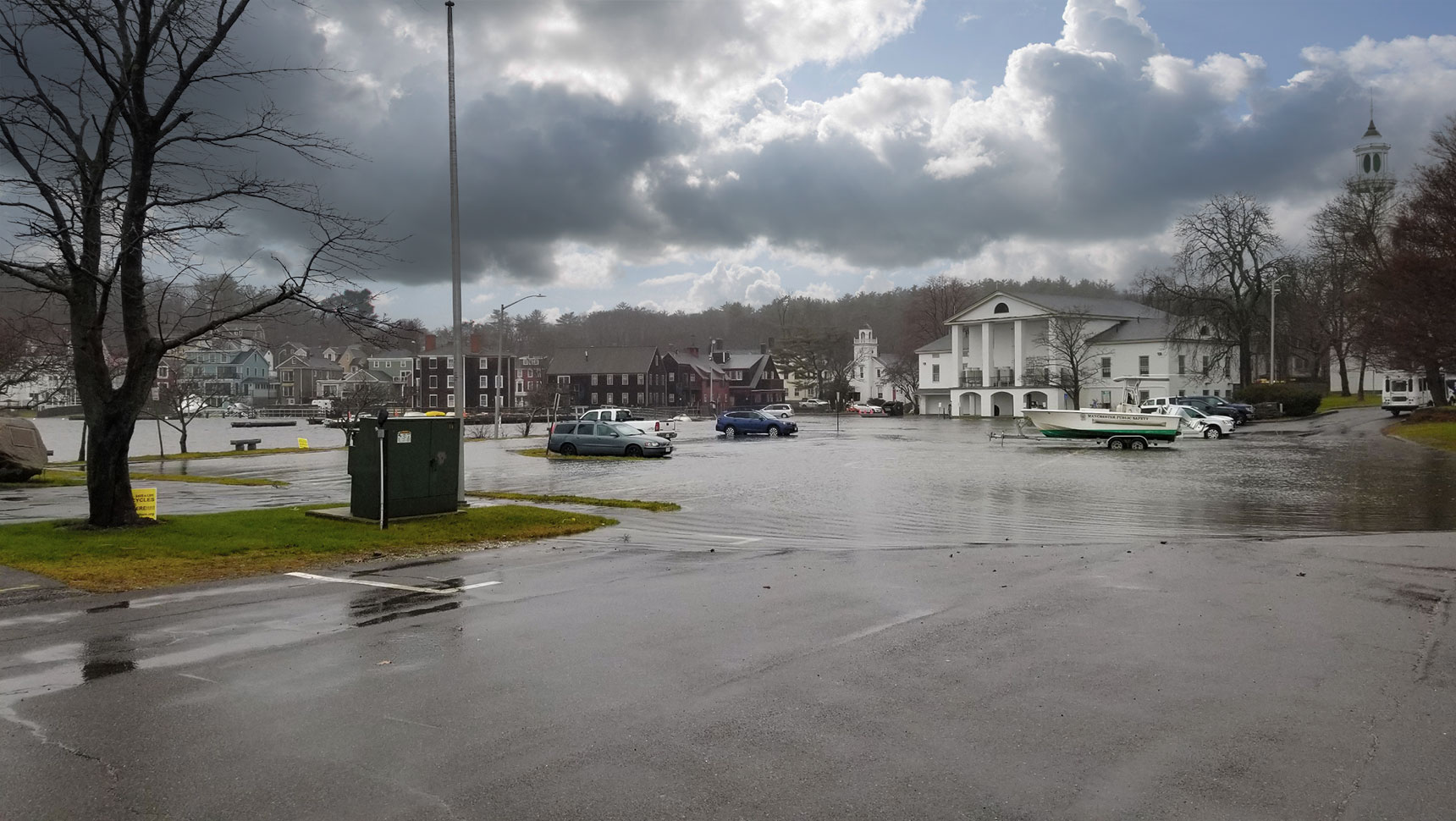
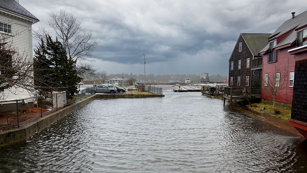
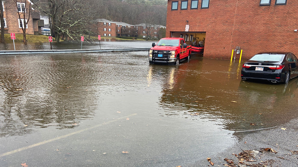
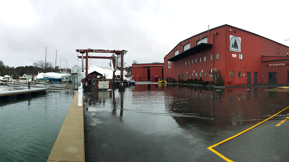
The Town of Manchester-by-the-Sea experiences frequent coastal flooding in the downtown core and inner harbor, putting much of the Town’s critical infrastructure at risk. With the support of a Coastal Resilience Grant from the Office of Coastal Zone Management (CZM), the Town hired Fuss & O’Neill, and our teaming partners at Woods Hole Group, to develop a Coastal Vulnerability Action Plan.
The purpose of the plan was to establish a conceptual roadmap for Manchester to reduce coastal flood risks and increase coastal resilience in the downtown and inner harbor area. Stakeholder and community engagement were central to guiding the development of the plan, as community feedback and priorities were incorporated into each stage of the planning process.
Fuss & O’Neill helped lead and facilitate several meetings throughout the planning process so that community feedback and priorities could be incorporated into the plan at each stage.
As part of a phased and multidisciplinary approach, Fuss & O’Neill developed the plan by providing the following services:
During the first phase of the project, the project team completed an existing conditions assessment that consisted of:
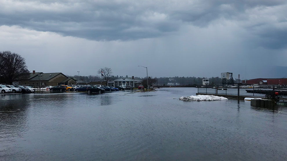
During the second phase of the project, an updated vulnerability assessment was completed to assess current and future flooding and water surface elevations, in conjunction with projected habitat change as a result of sea level rise.
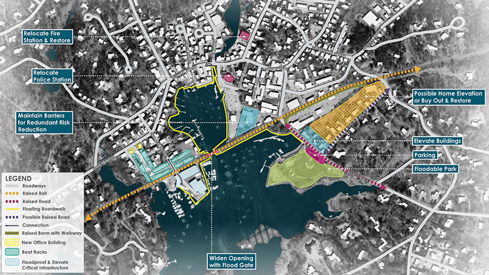
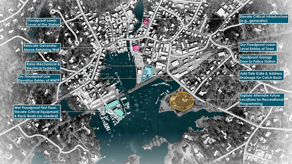
GIS-based inundation maps and figures were developed for the 2030, 2050, and 2070 planning horizons, and an asset-specific assessment was conducted for buildings within the study area. This helped the project team identify and prioritize opportunities to implement flood mitigation strategies over time.
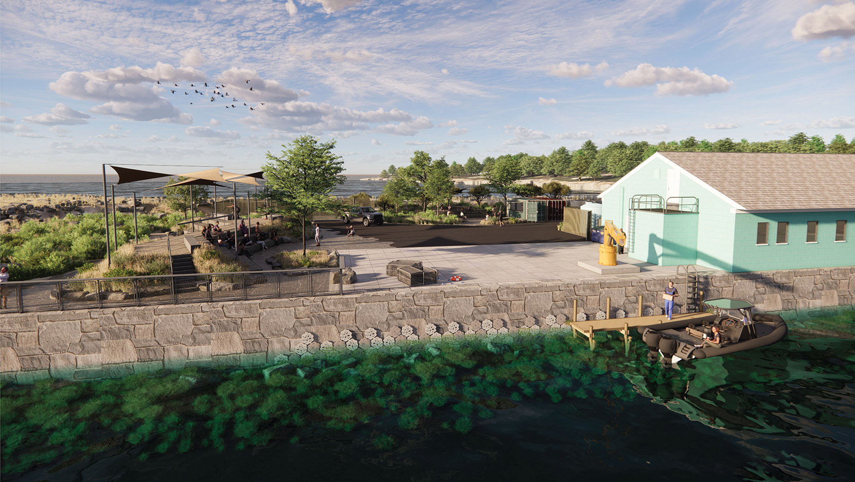
The team identified potential neighborhood-scale and site-scale alternatives for flood risk reduction. Alternatives were developed to maximize the potential of nature-based and hybrid design approaches, and the phasing of improvements was proposed to match several future climate risk scenarios.
Following an analysis of alternatives, the project team developed a recommended action plan based on the results from the existing conditions assessment, vulnerability assessment, alternatives analysis, and feedback received throughout the project.
Since developing the Coastal Vulnerability Action Plan, Fuss & O’Neill has helped the client secure an additional two years of CZM grant funding to support the implementation of several near-term priority actions identified in the plan.