Integrated Water Infrastructure Vulnerability Assessment and Economic Development for Climate Resiliency

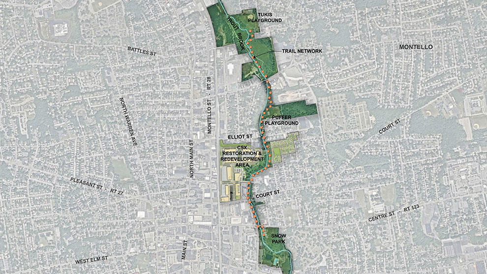
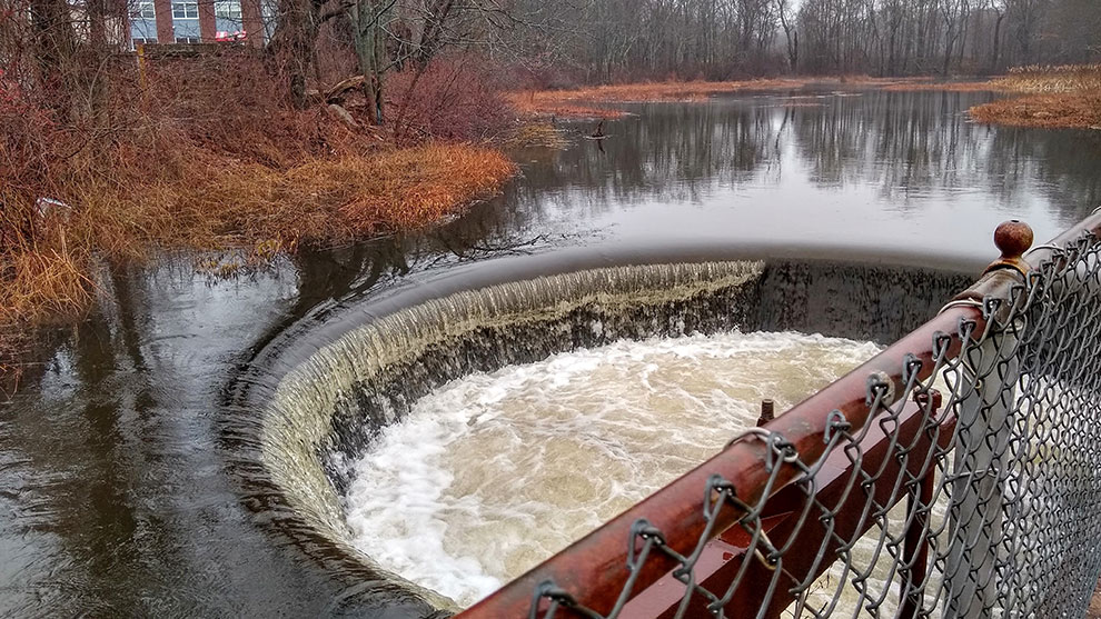
In 2019 the City of Brockton received a Municipal Vulnerability Preparedness (MVP) Action Grant from the Massachusetts Executive Office of Energy and Environmental Affairs. This funding was used to conduct a study that would develop an accurate understanding of risks to infrastructure, environment, and residents resulting from flooding events in the City and to identify solutions to address those risks and increase flood resiliency along Salisbury Brook and the Salisbury Plain River.
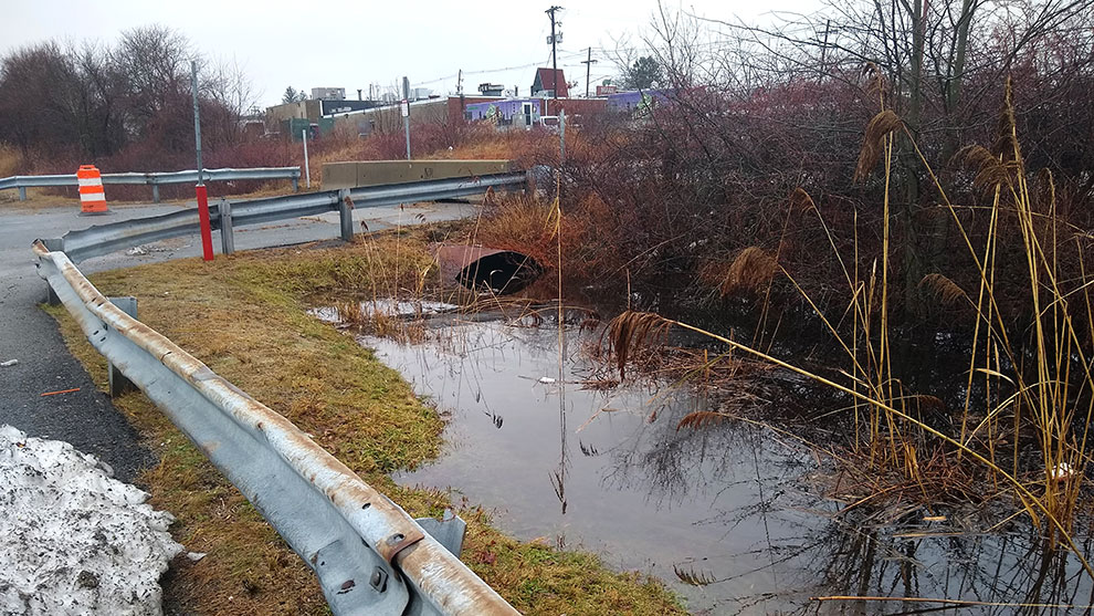
This project continues Brockton’s commitment to better understand opportunities and threats associated with their urban waters. Fuss & O’Neill is creating an updated hydrologic model and a new hydraulic model that will provide an accurate understanding of risks associated with flooding events and climate change that threaten public safety (dwellings, evacuation routes, critical services, etc.), economic activities (retail operations, large employers, recreation, etc.), infrastructure (culverts, bridges, dams, roads, treatment facilities, etc.), and the environment (21E sites, brownfields, landfills, etc.).
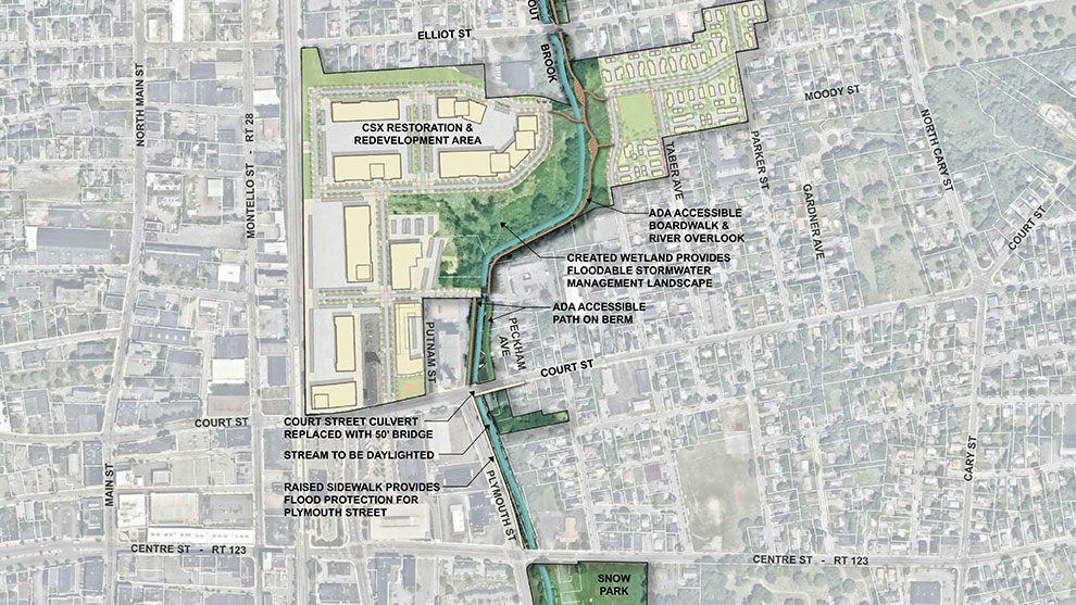
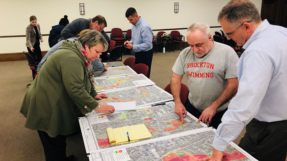
The City, using the model data, will prioritize actions and response to residents, public infrastructure, and privately-owned development. Modeling data will allow the project team to identify potential nature-based solutions to reduce flooding and enhance or restore the corridor along Salisbury Brook and the Salisbury Plain River. Focusing on the Westgate Mall and Kmart Plaza, this project also uses model data and stakeholder engagement to define resiliency and environmental mitigation opportunities that couple with the City’s economic development and redevelopment goals.
Deliverables include public infrastructure and private development risk assessments that will categorize both the level of risk associated with a flood event and potential impacts on tax revenues and economic development (e.g., jobs) in the City. Additionally, the City utilized Fuss & O’Neill’s GIS services to provide information and garner feedback to the community via a user-friendly website that we created for them.
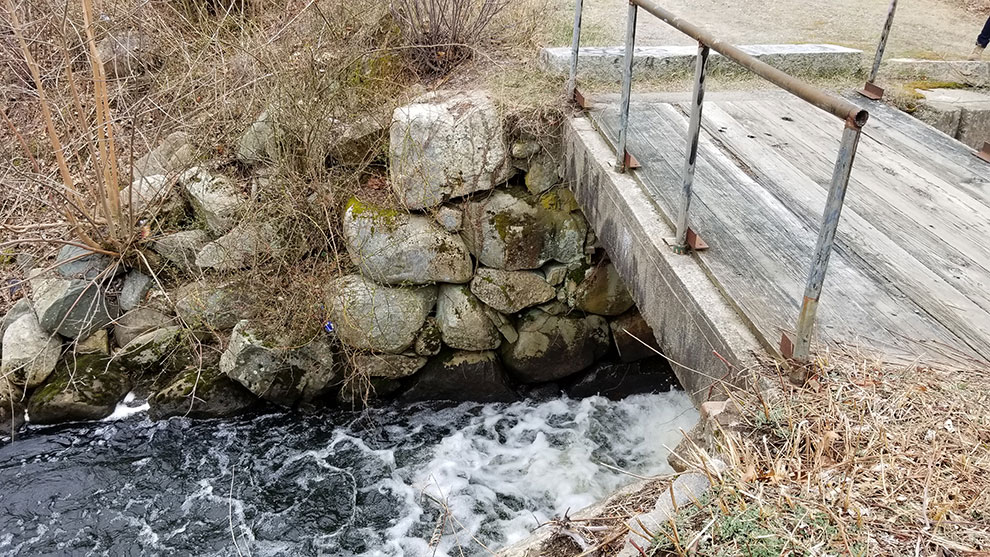
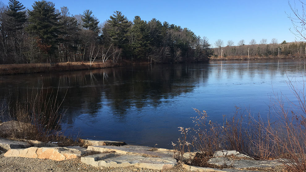
In order to develop a plan to address these flooding issues on a citywide scale, rather than on a site-by-site basis, the City partnered with Fuss & O’Neill to design a project to assess the viability of using nature-based solutions (e.g., restoration of wetlands and floodplain or implementation of green infrastructure to address both riverine flooding and stormwater drainage-driven flooding) and to prioritize future projects to increase flood storage capacity and mitigate flooding risk.
Fuss & O’Neill used hydraulic modeling to develop a cost-effective, high-impact solution that will create additional flood storage at key points in the river system, resulting in up to 18-inch reductions in flood elevations during more frequent flood events.
We identified a suite of nature-based approaches to increase flood storage volume along the Salisbury Plain River and Salisbury Brook. Targeted resilience projects at Ellis Brett Pond and three undeveloped parcels along the river will reduce existing flood inundation limit.