by Jennifer Babowicz, PE
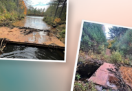
Two years ago, almost to the day, our Marketing Manager spent the day learning about a project that I’ve been working on for the Connecticut Department of Transportation (CTDOT). She rode along with a couple of our Transportation Engineers as they evaluated horizontal curves throughout central Connecticut. If you’re like me, and you’re having trouble remembering anything that happened before March, check out that blog for a quick refresher.
In the two years that have passed, we’ve done a lot of field work and have moved on to the analysis and design portion of this project. For some reason our Marketing Manager didn’t want to sit and watch data be input, so she asked me to explain what happens when we get back to the office.
After collecting data in the field, we need to record it. We track the advisory speed data in spreadsheets (an example is shown below) to address the safety and need of a specific curve. And, yes, each line of data is all for one curve.

As part of the field work, the locations of fixed objects (like catch basins, utility poles, and guide rails) are recorded using ArcGIS software. (If you need a refresher about what ArcGIS software is, check out our blog celebrating GIS day. The data collected in ArcGIS is exported into a shapefile (simple images that show locations and objects) and referenced in the plans that we create and provide to the CTDOT. Based on the previously mentioned spreadsheets, advanced warning signs, advisory speed plaques, and chevrons may be proposed. The proposed signs are based on the advisory speed we measured at each curve; if there is an advisory speed of 5 mph below the posted speed, an advanced warning sign is proposed. Anything greater than 5 mph requires an advanced warning sign, speed plaque, and chevrons.

We present our plans to the CTDOT, a few routes at a time under a “preliminary design phase” clearly showing the locations, dimensions from fixed objects, and descriptions of what signs shall be removed, installed, or reset. The CTDOT comments on the overall plans regarding safety and placement of proposed signs. We incorporate these changes into the “semifinal design phase” and CTDOT does another review. We are in the process of compiling plans for all of District 1 to be submitted for final design in the spring. These plans will be used by the CTDOT to implement the proposed changes.

So what does this all really mean? Simple – it means safer roads and safer travel. It means that a lot of thought has been given to how fast you’re supposed to drive and to ensure that you have plenty of advanced warning when the direction of the road is about to change. So please obey speed limits and posted signs, consider roadway conditions and environmental conditions, and remember that how you drive affects others. Everyone’s main goal is that we all get home safe, and following these signs is a major component to doing that.

About the Author
 Jennifer Babowicz, PE joined Fuss & O’Neill’s Transportation Business Line after working nineteen years CTDOT. She has experience with traffic signal design, traffic impact studies, Maintenance & Protection of Traffic plans, traffic signal system design, transportation planning and analysis, and complete streets design. Jennifer has considerable knowledge in the processes and procedures of the CTDOT, including production of digital contract plans, specifications, and supplemental contract documents.