Route 114 Resilience Plan

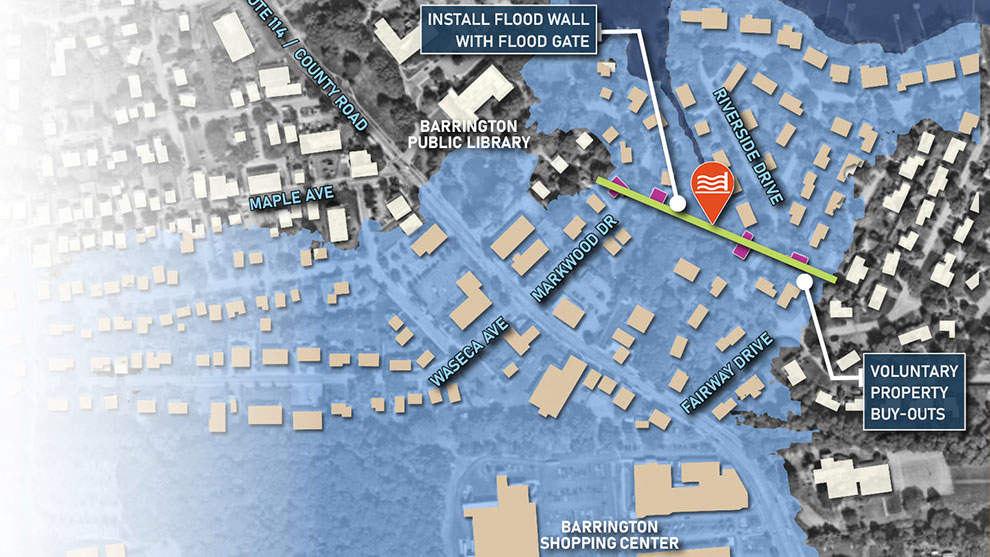
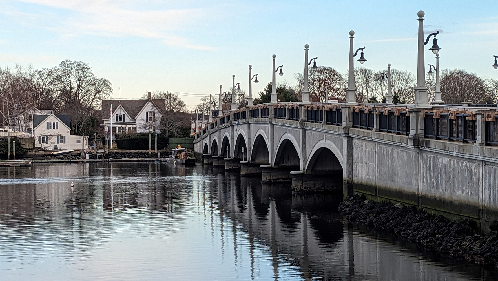
Route 114 in Rhode Island is a 46-mile, north-south regional connector in the state’s East Bay transportation network that provides critical connections between commercial, educational, and residential land uses. Currently, several low-lying segments of the Route 114 corridor are periodically inundated during coastal flooding events, and these conditions are only expected to worsen in the future with the increasing rise in sea levels and greater intensity of coastal storms.

The towns of Barrington, Bristol, and Warren – along with support from the Rhode Island Division of Statewide Planning (RIDSP), the Rhode Island Public Transit Authority, and the Rhode Island Department of Transportation – worked with Fuss & O’Neill to develop an action-oriented resilience plan for Route 114 that assessed the current and future vulnerabilities of the Route 114 corridor and established conceptual alternatives for reducing coastal flood risks and improving overall resilience in key areas of vulnerability throughout the region.

Project Goals

The goal of the Route 114 Resilience Plan was to prioritize actions that support long-term community goals and balance flood risk reduction with potential project costs to generate benefits that create value beyond coastal flood resilience.
The project was organized into six phases, as shown in the image below.
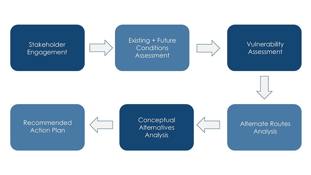
Project Approach Image

Existing and Future Conditions Assessment

Fuss & O’Neill’s project team of resilience specialists, water resources engineers, and environmental planners collected and reviewed mapping data related to utilities, buildings, roadways, open space, zoning, historic properties, and land use. They gathered climate and transportation modeling from key state resources, including STORMTOOLS and Sea Level Affecting Marsh Migration Model. The team reviewed existing plans and studies and conducted site visits and interviews with key project partners to refine resilience evaluation and planning approaches.

The data collected was combined into a geodatabase using GIS and used to generate existing and future condition base maps highlighting key areas of vulnerability.
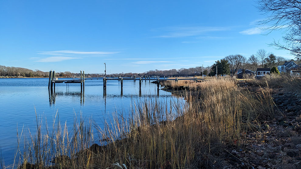
Dock on water

This phase of the project included a review of existing and projected sea levels and coastal storm scenarios for Rhode Island. This included mapping the 10% and 1% annual exceedance probability flood events for both current and future two-foot sea level rise scenarios using data collected from STORMTOOLS. The full coastal flood assessment was included as part of the final plan.

Vulnerability Assessment

A vulnerability assessment was conducted to evaluate transportation infrastructure, social, and cultural vulnerabilities within each area of vulnerability (AOV). The assessment considered current and future climate stressor scenarios caused by sea level rise and coastal storms. Quantitative frameworks for scoring each of these vulnerability dimensions were developed to generate vulnerability scores for each area of vulnerability. These scores would help to prioritize future decision-making regarding any regional resilience planning related to Route 114.
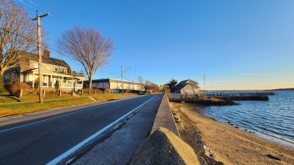
Route 11

Conceptual Alternatives Analysis

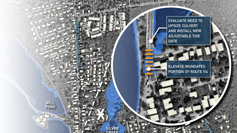
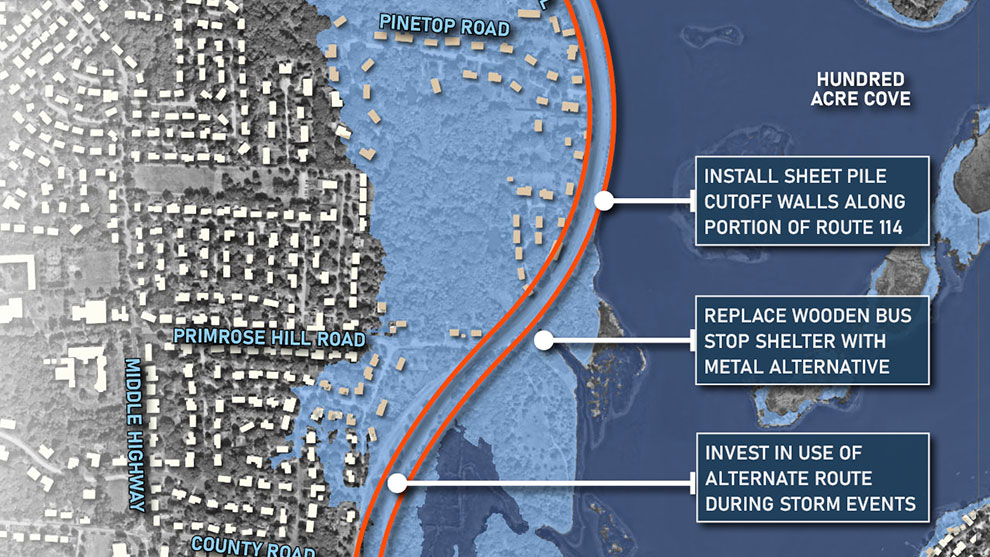
The Fuss & O’Neill team developed conceptual alternatives for improving the resilience of Route 114. For each AOV, low- and high-risk reduction alternatives were developed, which provided the towns with a variety of resilience and flood mitigation options.
Stakeholder Engagement

The Route 114 Resilience Plan project engaged local, regional, and state stakeholders in developing a purposeful and actionable plan that positions the Barrington, Bristol, and Warren communities to maximize the value of the future investments that will be required to make the Route 114 corridor more resilient to future flooding.

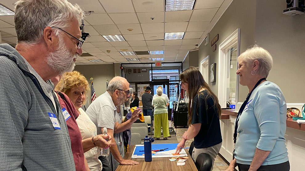
Stakeholders and members of the public had six opportunities to engage in the planning process. Three public workshops (each held twice) were conducted. The workshops following the completion of each planning phase to review key project milestones. To maximize opportunities for public engagement, the workshops were held in in different locations, featured an online-accessible simulcast, and they were recorded.
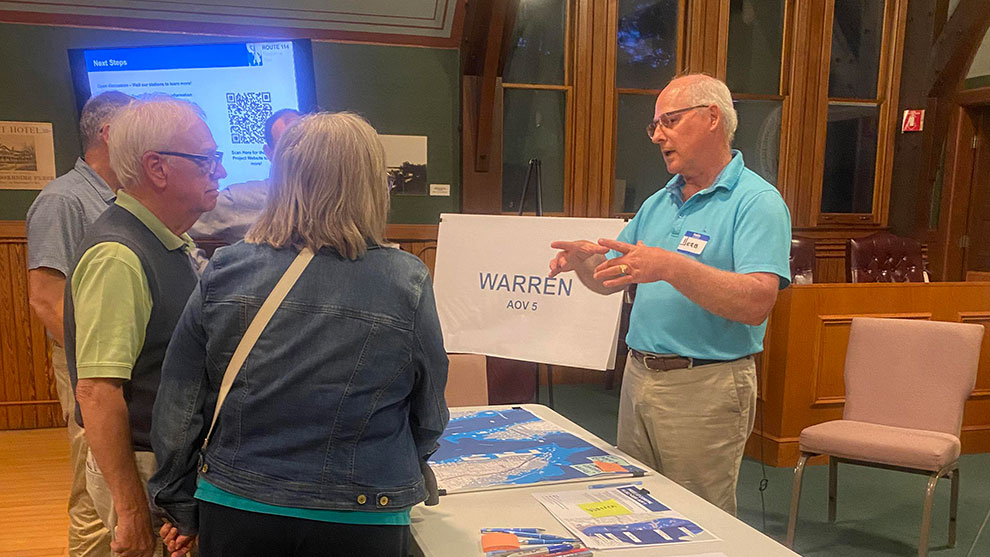
A website, hosted by RIDSP, was also created for this project. The workshop recordings were posted on the site, accompanied by a written summary of each workshop and its outcomes. The website provided regular updates on project activities, publications of project materials, and information on how to engage with the project.
Recommended Action Plan

The action-oriented resilience plan included:

  • An inventory of vulnerable road segments
  • Assets categorized by their vulnerability and risk to the impacts of climate change, including flooding due to sea level rise and storm surge
  • Recommended alternative routes to use during short- and long-term road detours caused by coastal flooding

The Resilience Plan identified and assessed the vulnerability of Route 114 segments in the towns of Barrington, Bristol, and Warren and examined the feasibility of potential solutions and resilience actions. This action-oriented plan will help these towns address and reduce damage to infrastructure, minimize economic production loss, and maintain critical emergency services.

The Route 114 Resilience Plan can be used by other municipalities and regional collaboratives as a blueprint for future flood resilience planning studies.

Route 114 Resilience Plan

Awards

  • RI ASLA Honor Award in Planning & Analysis
Walker Farm Recreation and Resilience Improvement Project

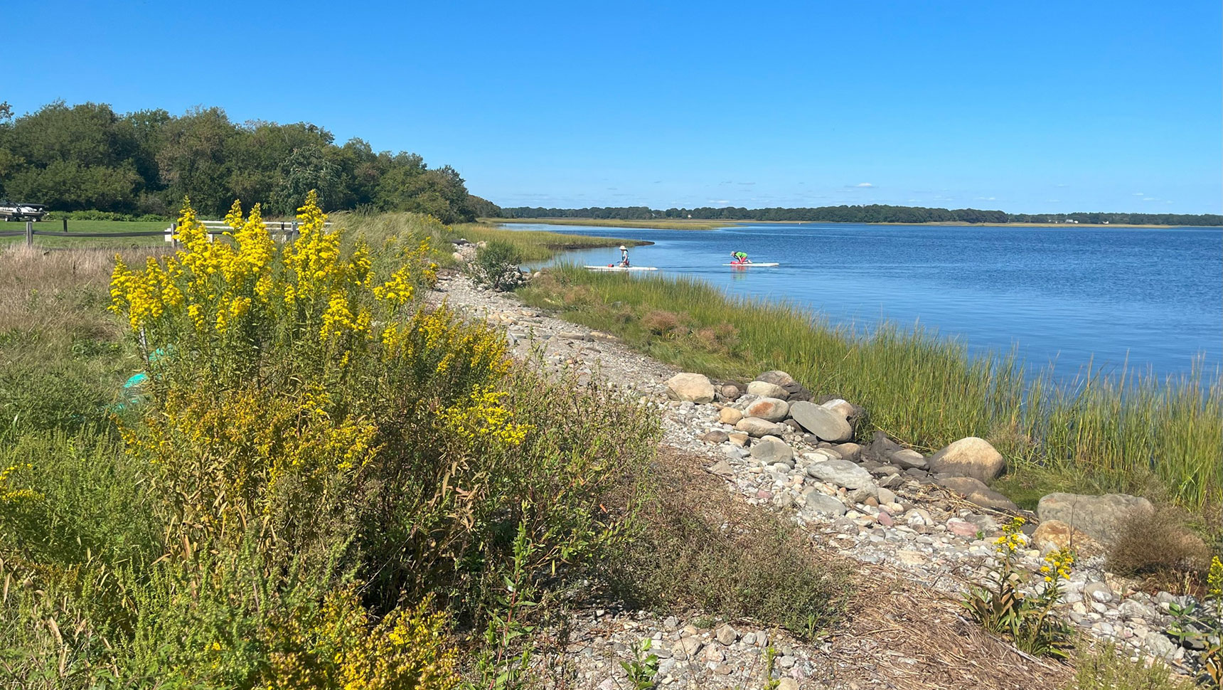
View of the project site with a path, grasses and water in view

Walker Farm, which is owned by the Town of Barrington, RI, is located at the southern end of Hundred Acre Cove. While an important waterfront access point for community members, it offered only basic recreational facilities, was inaccessible to people with limited mobility, and was being eroded due to the changing climate conditions.

The Town recognized a unique opportunity: They could invest in an idea that would make the space a true community asset – one that achieves form and function at the same time.

The Town hired Fuss & O’Neill to develop the project from concept to construction.

This project created Rhode Island’s first resilient floodable park.

Walker Farm project area concept drawing

Five Objectives

This multifaceted project achieved five objectives:

  1. To restore ecological features, this project removed dumped asphalt and concrete fill along the shoreline and restored a “living shoreline” to increase habitat and resilience. Above the high tide line, a 50-foot natural buffer was created and allowed to form meadow habitat to make the area more resilient. A large low-lying area in the center of the property will be converted back to salt marsh allowing daily flow and provide stormwater storage and filtration ecological services.
  2. It was critical that site infrastructure be made adaptable to become more resilient to site inundation events. To prevent future flooding, the access road was elevated and reconfigured, new parking areas were created with pervious paving, and site lighting was converted to Dark Sky™ compliant solar fixtures with high-mount batteries to be above flood surges. The site also serves as the Town’s composting facility and emergency brush storage area after storm events; these improvements increase site functionality for those critical Town uses.
  3. Though a very used and active site, the current layout presented safety concerns. This project created a fully accessible venue for human-powered watercraft activities (kayaking, rowing, paddleboarding, etc.) in more a more appropriate location, away from motorized craft. A new step-in launch area of concrete platforms was constructed to increase kayak and canoe facilities and new kayak racks installed to increase capacity. A low-profile dock was installed to allow accessible, ADA-compliant water access for rowers and paddlers. Benches and pathways were added for birdwatchers and sightseers enjoying scenic views across Hundred Sacre Cove.
  4. The former site of an old boathouse had a damaged concrete foundation. The foundation was repaired, and a new accessible, ADA-compliant deck was created to allow visitors to enjoy the area that projects into the Cove. During rowing events, this serves as a popular viewing and cheering platform located at the finish line area.
  5. Walker Farm needed site safety, access, and parking improvements. Overall site circulation was reconfigured and turning areas for boat trailers were improved. Gravel roadways were improved and raised, with camber for improved stormwater movement to drainage areas. Parking was reorganized and improved, with dedicated parking for boat trailers.


The site of the viewing platform before it was built.

Accessible Viewing Platform – Before

Accessible viewing platform at Walker Farm. Bench on deck overlooking water.

Accessible Viewing Platform – After

Ecological Restoration

The shoreline in the project area was created by previous site owners who dumped asphalt and concrete demolition materials to fill in the existing marsh. This resulted in an uneven, unnatural, and dangerous shoreline for anyone seeking to access the water. Ecologically, it was poor habitat for native flora and fauna and remained barren.

Shoreline reconfiguration and living shoreline restoration required the removal of several hundred tons of dumped asphalt and concrete debris from more than 700 feet of shoreline, followed by careful regrading of the shoreline slope and placement of native boulders, stones, and cobble.

Once the dumped asphalt and concrete debris were removed, the shoreline was carefully reconfigured with the appropriate pitch and materials to accommodate replanting, as well as to accommodate wave action without erosion. At the top of slope, native species were replanted and seeded to hold the sediments and provide habitat for native species.

The area that had been subsiding and flooding with rain events was reconfigured as a functional salt marsh. An opening to allow regular tidal flow in and out was created, the soils were amended with sand, and appropriate salt marsh species were planted in close cooperation with Save the Bay.

The plantings in the restored marsh are thriving, and the threatened salt marsh sparrow have been returning to the project area.

Kayak and Rowing Step-in Launch Area

Step-in-Launch Area

Collaboration

This project was a collaborative effort. The State of Rhode Island played a significant role as project partners from permitting to project funding from the RI Infrastructure Bank. The Barrington Public Works Department supported the project from design through construction. Save the Bay (a nonprofit organization dedicated to habitat restoration and adaptation) collaborated with the Town and site design team regarding configuration for shoreline restoration, replanting wetland areas, and buffer habitats. Save the Bay also organized several volunteer-led planting events with students and civic groups to replant the new salt marsh areas and wildlife habitat buffers.

Key stakeholder groups of site users provided valuable insight for the facility rehabilitation design. Kayakers and rowers shared their goals for optimal site design and function. Accessibility advocates informed the design of the fully-accessible viewing platform and its relationship to accessible parking areas and pathways between.

During the development of the design, the Town and community organizations presented at meetings of Barrington’s Resilience and Energy Committee, the Harbor Commission, Planning Board, Recreation Board, Town Council, and the Rhode Island Coastal Resources Management Council. At each of these meetings, project advocates and Town leaders worked together to solicit design recommendations and secured valuable support for the final project design.

Walker Farm Restored Salt Marsh

Outcome

The completed project at Walker Farm has created the state’s first resilient floodable park, vastly improved recreational function, increased public accessibility for all, while restoring native habitats for flora and fauna.

Sustainability and climate resilience were primary design drivers for the project. Project outcomes include: removal of invasive species and dumped debris from the shoreline; restoration of a living shoreline with native species and natural contours; installation of habitat buffers with native species; restoration of functional salt marsh on site to serve as flood storage and habitat; reconfiguration of all site access roads and parking areas to improve resilience to flooding events; improved management of stormwater with pervious paving; and installation of solar-powered and Dark Sky™ compliant site lighting. A large low-lying area in the center of the property has been regraded and converted to functional salt marsh allowing daily flow and provide stormwater storage and filtration ecological services.

A primary goal of the project for participating Town of Barrington departments was to increase the site’s ability to serve the public in both quantity of audiences served and improved experience and safety. During the 2024 season, the Town hosted 80+ kayaks and canoes on the new racks at the paddlecraft launch area. An estimated 25 group trips launched from the site. Over 180 rowers participated in East Bay Rowing’s programs on the site.

Awards

  • American Planning Association Rhode Island Award, Excellence in Plan Implementation with an Emphasis on Sustainability and Resiliency
  • Smart Growth Award, Grow Smart RI
Accepting the APA RI Award

Pine Street Transit-oriented Development District Mobility and Green Infrastructure Improvements

people riding bikes on Pine Street

This transit-oriented development (TOD) project centers on the development of a $47M commuter rail station and inter-modal bus hub. The Rhode Island Department of Transportation (RIDOT) will construct improvements to Pine Street between Goff Avenue and the rail right-of-way, a bus turn-around, and a “kiss and ride” area on Pine Street, directly south of the rail right-of-way.

The existing area provided little impervious surface for stormwater runoff, and the City of Pawtucket hired Fuss & O’Neill to provide planning, design, and construction for reconstructed access to new train station (Pawtucket Central Line Station) and RIPTA bus station, as well a design services for the green stormwater infrastructure (GSI) improvements along Pine Street.

Phase 1: City-wide Stormwater Management

For the first phase of this project, Fuss & O’Neill developed a city-wide plan to holistically address stormwater pollution. This plan placed special emphasis on future design and construction of green stormwater infrastructure that would address stormwater while adding neighborhood amenities.

Someone walking down Pine Street

TOD Design and Collaboration

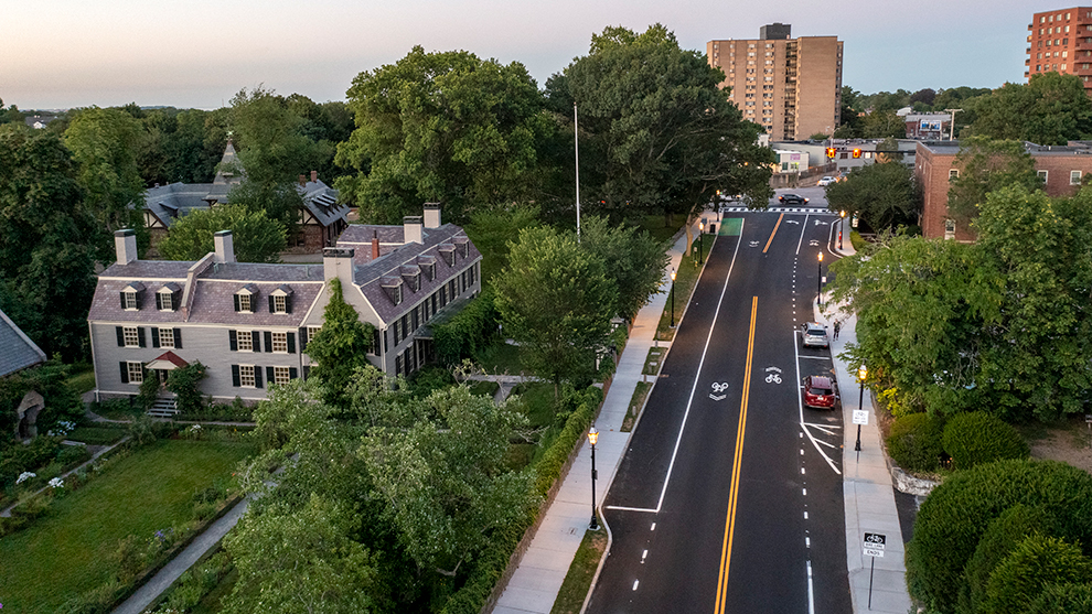
Our design for the Pine Street corridor within Pawtucket’s TOD Conant Thread District included roadway lane diets to provide a shared multi-use path to increase bikeability and walkability to the train station at the terminus of Pine Street.

The design was developed in charrette format that included key stakeholders in the district, including City officials, Rhode Island Public Transit Authority (RIPTA) planning staff, direct abutters, the RIDOT train station project management team, and the RI State Planning Commission.

Green Stormwater Infrastructure

A key component of the design was the incorporation of GSI into the primary access to the new train station from Main Street. GSI has been incorporated into the design to improve neighborhood livability and attract redevelopment. The design includes neighborhood amenities such as parklets.

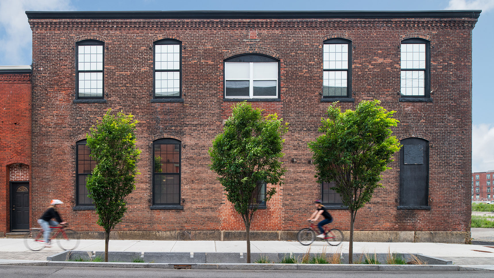
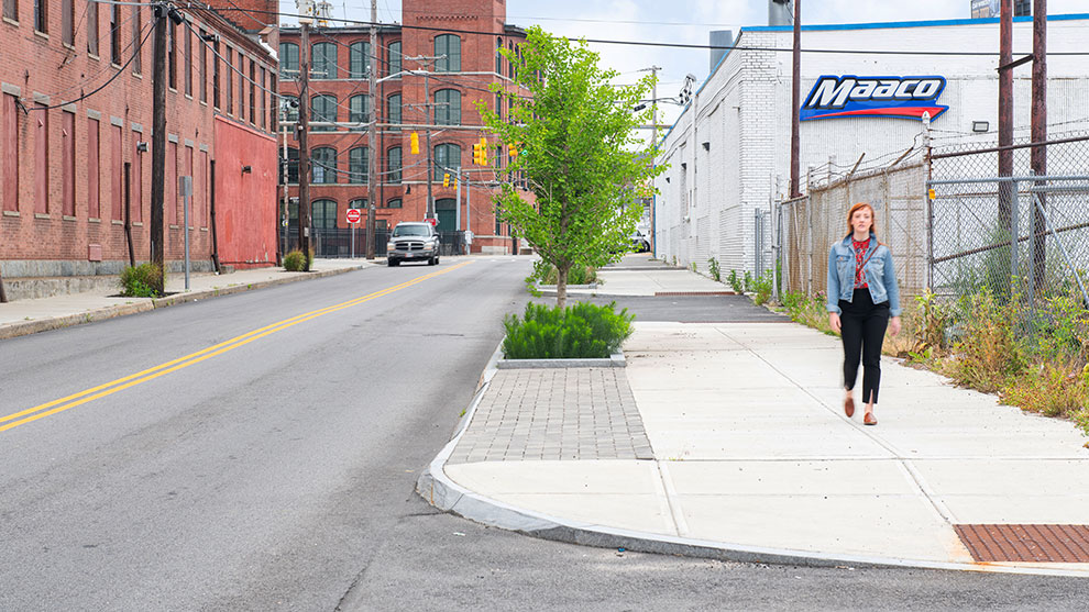
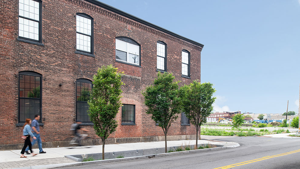
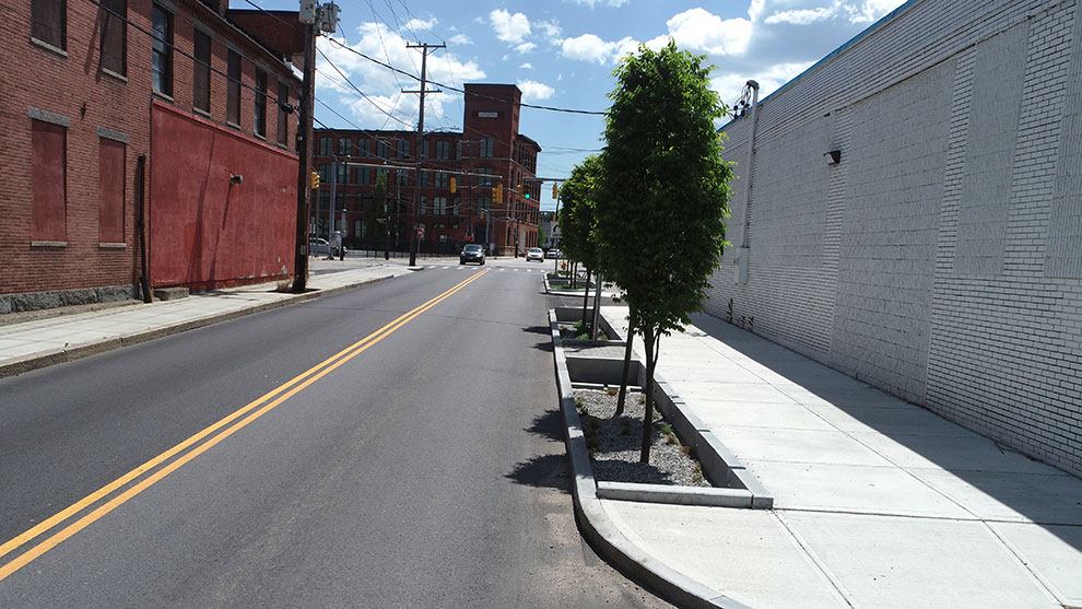
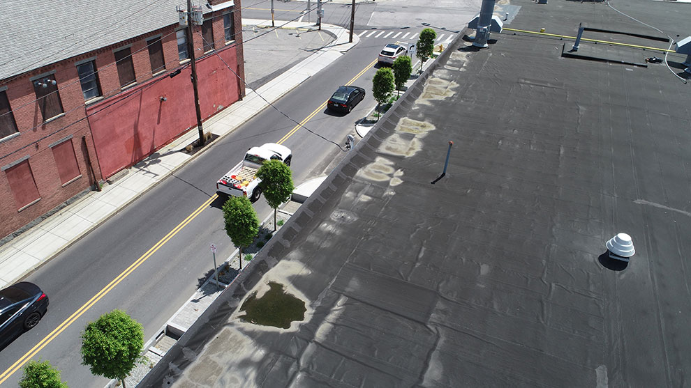
Bioretention stormwater planters were incorporated into the design to help reduce peak runoff into the City’s combined sewer system and to promote infiltration. The bioretention planters were placed along the curbside and included inlets to capture roadway runoff.

Pine Street, street view

Approximately 2.3 acres of stormwater runoff are managed by these improvements.

Pine street overhead image

The planters provide a separation buffer from the roadway, which enhances the pedestrian experience. The planters include engineered soil media and pretreatment sediment forebays, and are planted with low maintenance flowering perennials and native warm season grasses. Planters include flowering native perennials, engineering soil media, as well as pretreatment sediment forebay and inlet sumps.

The planters were designed to minimize future DPW maintenance. Our team also developed GSI ownership and maintenance educational materials.

Wood-Pawcatuck Watershed Improvement Projects

Wood Pawcatuck watershed with view of rocks and the watershed

The Wood-Pawcatuck watershed, a 300 square-mile area in southwestern Rhode Island and southeastern Connecticut, is vulnerable to flood-related impacts.

Flooding has damaged properties and structures, and this area has experienced overtopping and washout of roadways; bridge and culvert damage; and dam impairment and failure. The flood effects have been exacerbated by outdated and aging infrastructure (e.g., culverts, bridges, dams, and storm drainage systems). Rainfall in southern New England is expected to continually increase due to climate change, which will increase the risk of future river-related flooding in the watershed. The Wood-Pawcatuck watershed was also experiencing water resources challenges in the form of degraded water quality and habitat.

Planning

Fuss & O’Neill was contracted to first develop two plans:

  1. Flood Resiliency Management Plan
  2. Watershed-based Management Plan

The comprehensive flood resiliency management plan assessed the watershed’s vulnerability to the growing risks from flooding, erosion, and associated storm-related threats. The watershed-based management plan included solutions to protect and enhance the watershed communities’ resilience to future flood damage and to improve river and stream ecosystems. It included management recommendations (that incorporated climate change considerations) for nature-based flood resilience measures and conceptual designs.

Road-Stream Crossing Assessment

Fuss & O’Neill performed field assessments of 400+ road-stream crossings (culverts and bridges) throughout the Wood-Pawcatuck watershed using methods adapted from the North Atlantic Aquatic Connectivity Collaborative (NAACC). Prioritization of structures for replacement was based on hydraulic capacity, structural condition, geomorphic risk, flooding impact potential, aquatic organism passage, and climate change considerations (including projections of future precipitation and flood flows).

The road-stream crossing assessment, combined with geomorphic assessments of 40 stream miles and river corridor, an assessment of 70 dams, and green stormwater infrastructure retrofit assessments, identified dozens of site-specific project concepts in the watershed

From these assessments, Fuss & O’Neill was selected to complete detailed planning and design for priority resilience and ecological restoration projects throughout the watershed.

The culvert assessment methodology also served as the basis for a statewide road-stream crossing assessment protocol and guidance document that was developed by Fuss & O’Neill for the Rhode Island Department of Transportation.

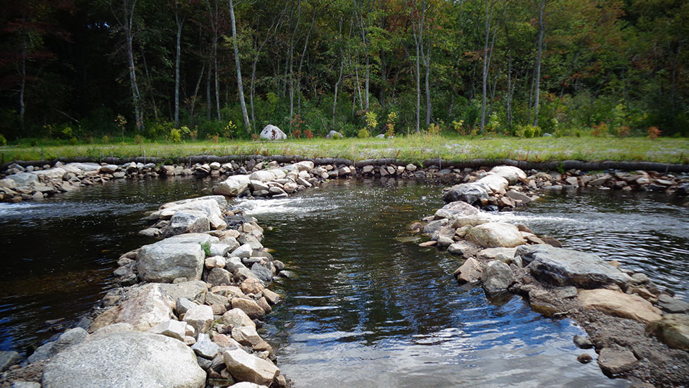
Kenyon Mill Dam Nature-like Fish Passage

The Kenyon Mill Dam, which is located on the Pawcatuck River in Kenyon, RI, was constructed to support mill operations at an adjacent textile mill. In conjunction with two other fish passage projects immediately downstream, the Wood-Pawcatuck Watershed Association, in cooperation with NOAA and RIDEM, secured funding to modify the structure to provide fish passage at the site for Blueback Herring, Atlantic Salmon, American Shad, and American Eel.

The mill site relied on the dam’s impoundment as a water source for its fire suppression system. Fuss & O’Neill worked closely with the mill owner to evaluate alternatives that would allow removal of the dam by providing replacement water storage facilities.

Our team assessed upstream impacts to bridges and natural resources in the state’s largest freshwater wetland system resulting from dam removal. We performed hydrologic/hydraulic analyses of flood flows and prepared FEMA floodplain map revision submittals. We conducted field investigation of impounded sediments and developed designs to minimize mobility and impacts to upstream bridge.

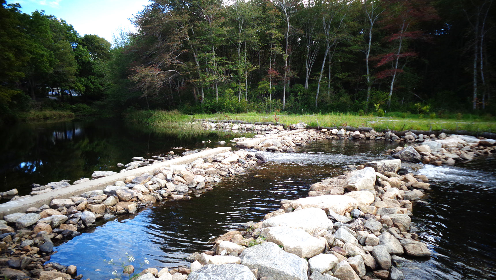
The final design was construction of a nature-like rock ramp fishway that maintains the impoundment. During construction of the improvements, construction phasing was used to ensure that headpond elevations were maintained for the mill’s fire suppression system.

watershed
watershed

Horseshoe Falls Dam Fish Passage and Innovative Eel Passage Design

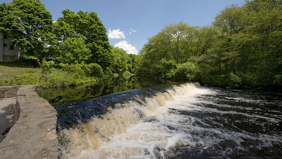
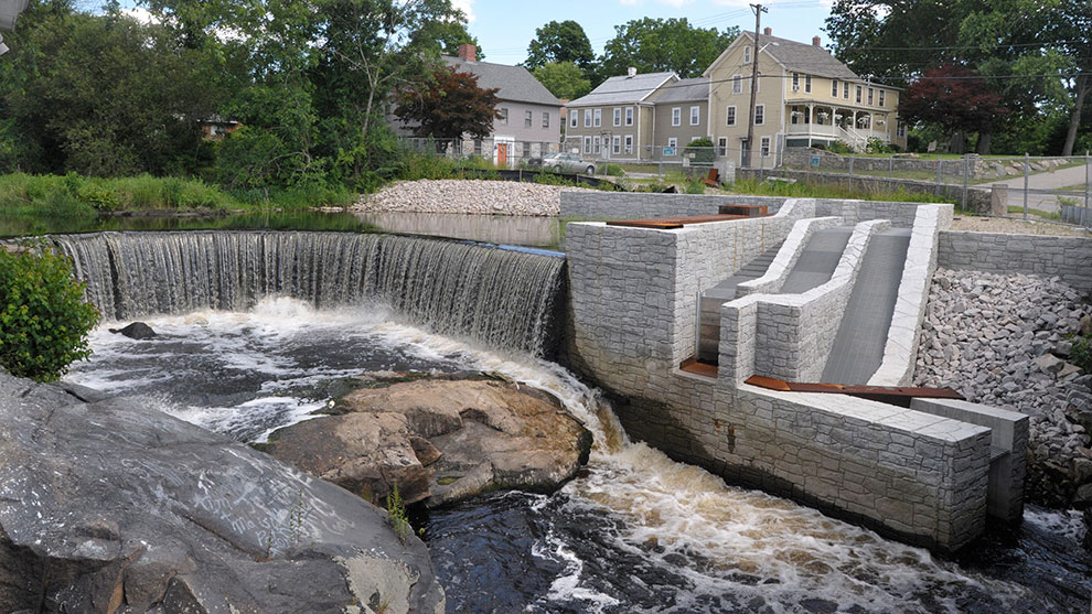
The Horseshoe Falls Dam is an iconic landmark in the state of Rhode Island and is listed on the National Register of Historic Places. The site was experiencing a critical impediment to eel passage. Typical practices to provide eel passage were not feasible due to both aesthetic and maintenance concerns, as well as significant site layout constraints.

Fish passage
Wood Pawcatuck fish passage

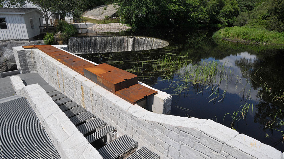
Fuss & O’Neill was contracted by the and other state and federal project partner agencies to develop an innovative approach to provide level flow control autonomously at the Horseshoe Falls Dam. Because our team’s proposed approach was the first of its kind, our mechanical engineers built a prototype outside our office and tested it with live eels at a hydraulic laboratory.

With support from Wood‑Pawcatuck Watershed Association and project agencies including NOAA, RIDEM, USFWS, and USGS, the customized flow control assembly was fabricated and installed as an integral component of the fish ladder. The flow control assembly is adaptable to other sites, avoiding the cost of an electrical service or solar panels and the maintenance burden of pumps. This device operates autonomously through varying headwater elevations, providing consistent flow to the downstream eel pass channel without the use of pumps.

Lower Shannock Falls Dam Removal and Fish Passage Restoration

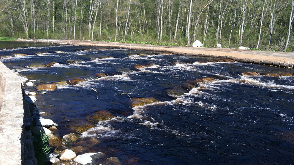
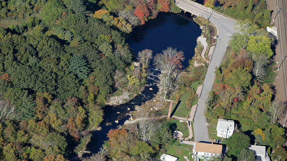
This timber dam, located on a natural falls on the Pawcatuck River in Richmond, RI, was originally built for a grist mill. The Wood-Pawcatuck Watershed Association, in cooperation with NOAA and NRCS, secured funding to remove this dam as it was inhibiting passage of fish, including Atlantic Salmon, American Shad, and American Eel.

Our team assisted federal agencies in coordinating assessment of historic features in and adjacent to the river channel, and designed details to protect features to remain through construction.

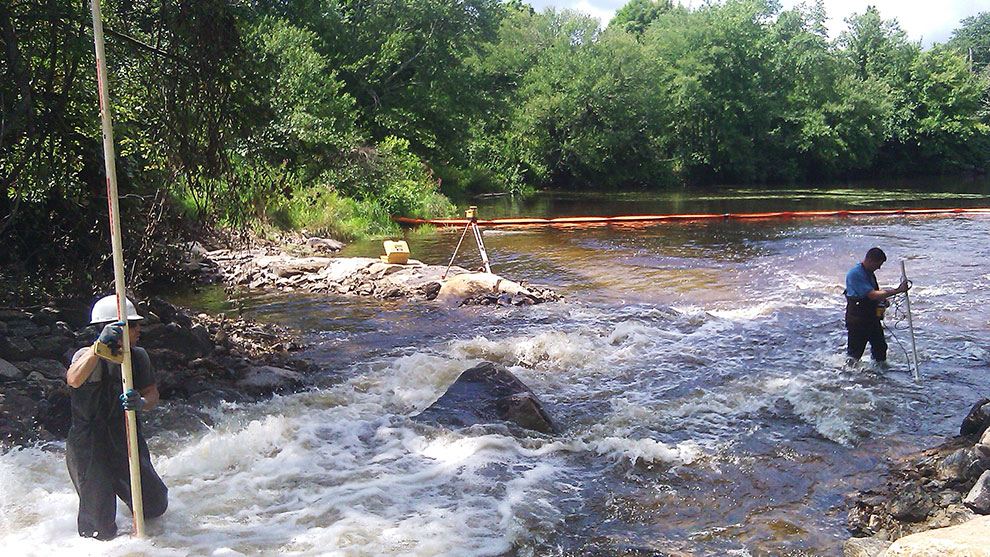
We quantified and characterized contaminated sediment impounded behind the dam, performed a sediment mobility study, and designed a removal approach to manage sediment through construction.

Detailed hydrologic and hydraulic analyses of flood and seasonal fish passage flows were performed to assess alternative channel configurations. We evaluated fish passage feasibility recommendations under a detailed modeling analysis to prepare design plans, details, and specifications for construction.
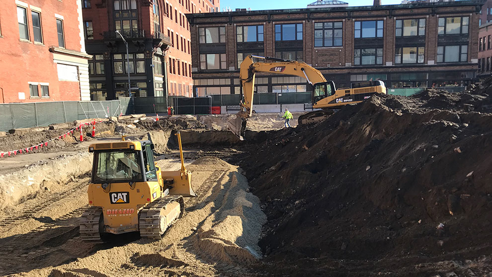
Our team completed assessment and characterization of adjacent wetland resources and evaluation of potential impacts to upland wetland resources following dam removal.

Aerial view of watershed
Surveyors standing and surveying in the watershed
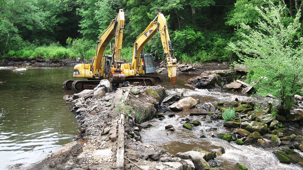
Excavators working in the watershed

This was the first full dam removal project in Rhode Island. Several other dam removal projects were already underway when we began this project; however, our partnerships with regulatory agencies regarding how to best manage the project through their regulatory programs allowed our team to rapidly execute this project, bringing it to completion prior to any of the projects that began before.

Wood-Pawcatuck Cold-Water Stream Restoration Plan

Fuss & O’Neill developed a cold-water stream restoration plan for the Upper Wood and Beaver River subwatersheds in collaboration with the Wood-Pawcatuck Watershed Association, RIDEM, and The Nature Conservancy.

The numerous obstructions (e.g., perched culverts, dams, remains of dams, and natural head cuts) in the headwater streams within the Upper Wood and Beaver River subwatersheds reduce aquatic organism passage or contribute to stream warming, detrimentally impacting cold-water habitats and local Brook Trout populations.

Improvements to stream flow can reduce the threats facing Brook Trout by enhancing connectivity and reducing water temperatures. These improvements can include removal of obstructions (e.g., defunct mills and agricultural dams), culvert replacement, stream channel restoration, fish passage using nature-like fishways, and riparian corridor restoration.

Fuss & O’Neill and our project partners developed a phased prioritization process to identify and select priority restoration projects in both subwatersheds. Projects were prioritized based on the nature of the obstruction, key findings from existing studies or data sources, preliminary information on potential restoration project elements, the anticipated scale and degree of benefits to cold-water fisheries, infrastructure opportunity (geomorphic vulnerability and safety impact), existing physical barriers (aquatic organism passage and barrier locations), and ecological impacts. A final list of priority projects was selected based on estimated project cost and complexity.

Electric Bus Charging Stations

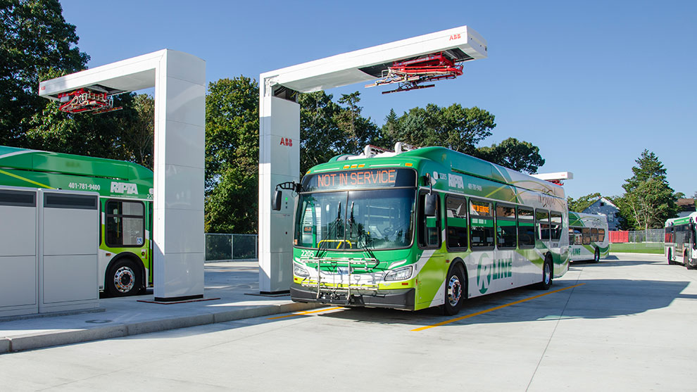
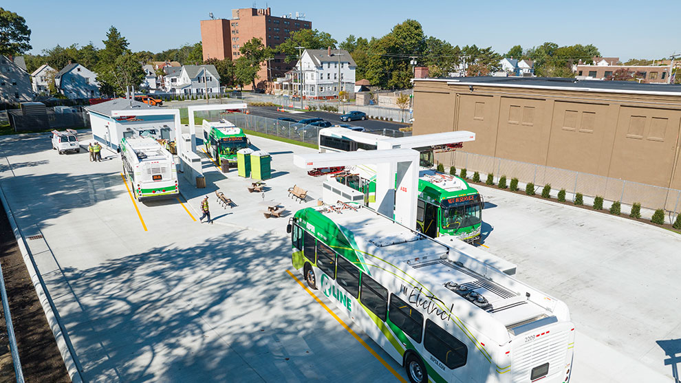
Electric buses charging

The Rhode Island Public Transit Authority (RIPTA) provides public transportation to more than 40,000 Rhode Island commuters daily. Buses are their primary mode of transportation, and they have many facilities throughout the state that administer operations. These facilities require both routine maintenance and forward-thinking upgrades to ensure the best service for their customers.

As the transportation sector is a significant contributor to greenhouse gas emissions, RIPTA is invested in reducing its carbon footprint as part of the State of Rhode Island’s Act on Climate, which committed to reducing state-wide carbon emissions to net-zero by 2050.

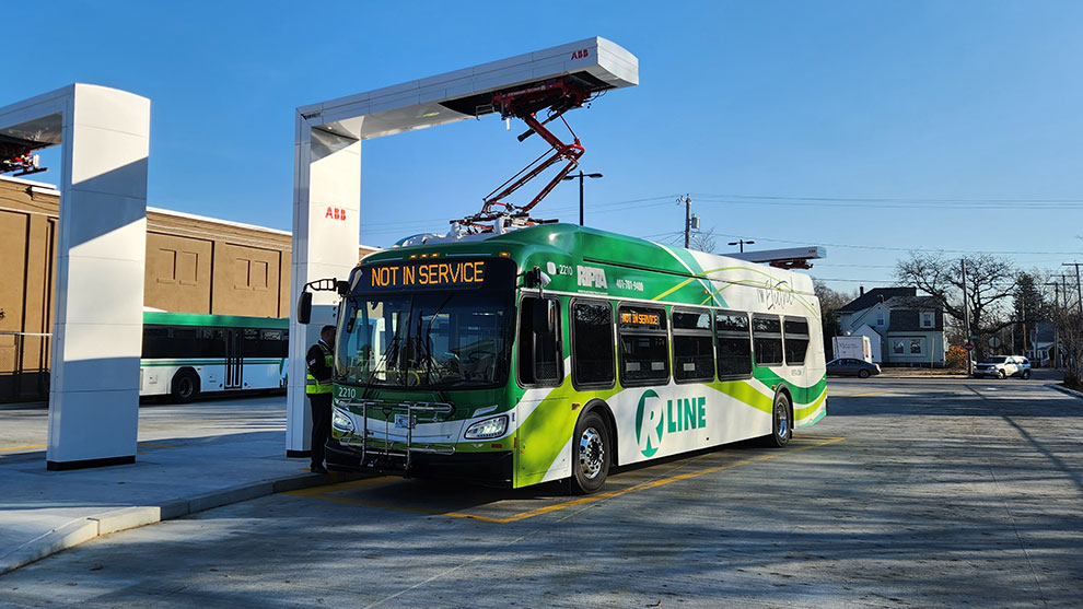
RIPTA bus ready to hookup and start charging

RIPTA has recently invested in upgrading its fleet to electric buses to replace the aging diesel fleet. These electric buses require fast and reliable charging stations that need significant infrastructure upgrades and maintenance.

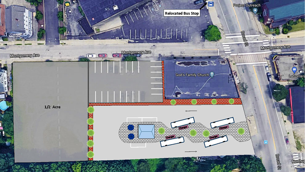
Bus charging station concept drawing

Assessment and Coordination

Fuss & O’Neill worked with RIPTA to determine the optimal facilities for the electric buses and their charging stations. After the site selections were made, our team assessed the existing electrical infrastructure at each site and worked with National Grid (now Rhode Island Energy) to determine the optimal facility for the buses and chargers, as well as the existing electrical service impacts. We coordinated closely with the manufacturer and RIPTA to determine locations of equipment, day-to-day access for RIPTA personnel, and maintenance of the equipment.

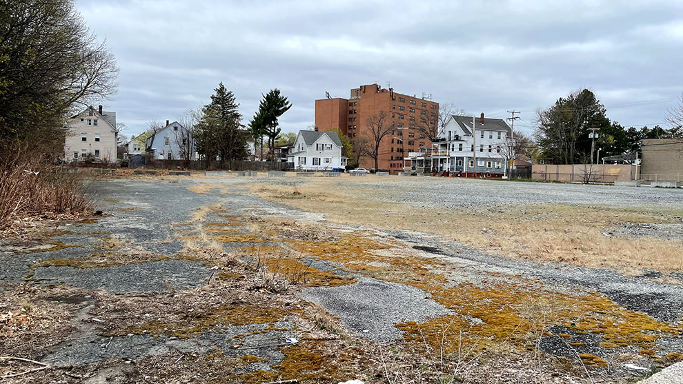
View of the empty site before construction began
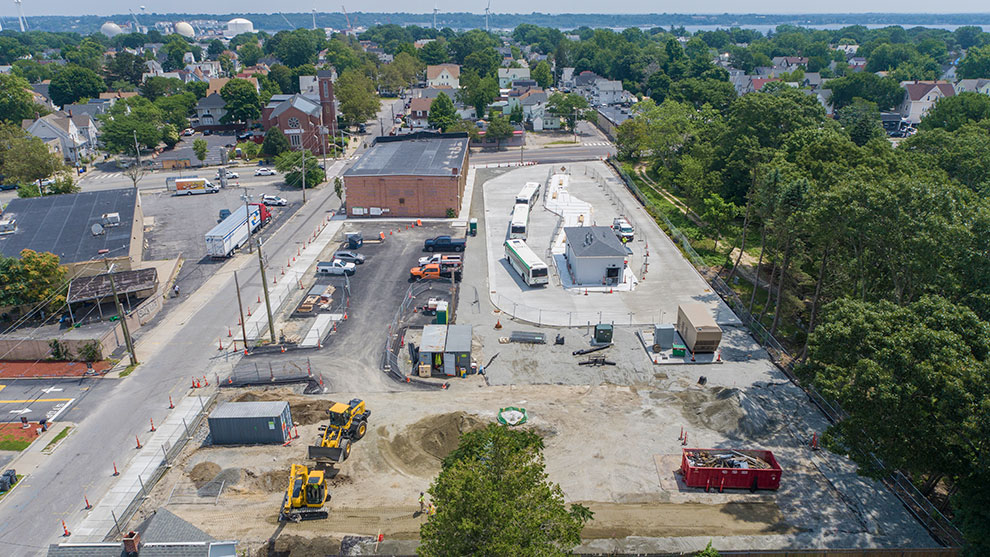
Aerial view of bus charging station during construction

Energy Management

Initially, three 40-foot Proterra Catalyst E2 pilot buses were leased by RIPTA and set up for charging at RIPTA’s existing maintenance facility in Providence. Each bus required a 60kW charging unit, for total of 180kW, which was a significant load on existing buildings. Once the facility was determined, Fuss & O’Neill designed the necessary electrical distribution system modifications to incorporate the Power Control Systems (PCS) and dispensers. We are currently working with RIPTA and Rhode Island Energy to address additional buses and subsequent electrical load, including potentially incorporating solar PV at these facilities to offset the electrical load.

Additionally, RIPTA used lessons learned from the leased electric buses for the purchase of New Flyer Xcelsior CHARGE NG™ 40-foot battery-electric transit buses. When added to RIPTA’s existing hybrid diesel electric buses (that combine diesel with battery power), these all electric buses give RIPTA a fleet that consists of approximately 36% low- and zero-emission vehicles.

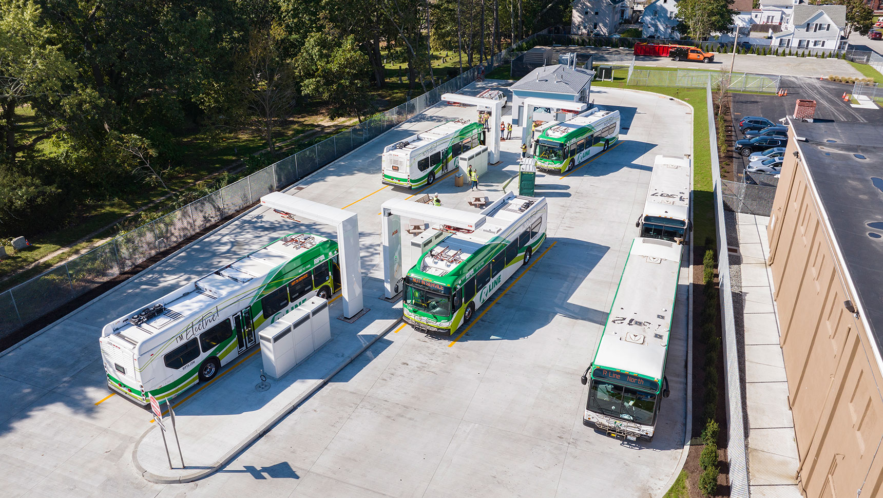
four buses charging

In-Line Charging Station

The New Flyer buses replace an equivalent number of diesel buses, which provides RIPTA with its first fully electric bus fleet. This fleet will serve the R-Line, which is RIPTA’s most frequently used and highest-ridership route, with rapid bus service that connects Cranston, Providence, and Pawtucket. A 1.5-acre RIPTA-owned property in Cranston at the southern end of the R-Line was selected as the location to develop the Northeast’s first in-line charging station.

This station location was selected to help revitalize the Washington Park neighborhood, lower emissions in an area that has been adversely affected by air pollution, and affirms RIPTA’s commitment towards achieving net-zero emissions.

Fuss & O’Neill worked with RIPTA from initial site selection and feasibility studies through construction oversight. We provided a comprehensive range of services included environmental due diligence, site assessment, remedial planning, civil design, geotechnical engineering, electrical engineering, and construction oversight.

Close up of RIPTA bus

$7.6 Million In-Line Charging Facility Highlights

  • Four 450kW ABB Heavy Vehicle Chargers with overhead pantographs.
  • 600kW standby natural gas generator to support the charging system during a power outage.
  • Lochinvar high-efficiency boilers to support a Viega snow melt system on the bus aisleway and driver plaza. Almost 25 miles of tubing was embedded in the site concrete to support the snow melt system, which is operated via sensors that monitor temperature and precipitation.
  • A 51-space parking lot to support parking for an adjacent business.
  • Technology and software supported by The Mobility House to allow RIPTA to remotely monitor and operate the charging units, including Automated Load Management to ensure that the total load from all chargers remains constant.
  • An 800 ft2 building to provide a modern comfort station for bus drivers, as well as to house mechanical, electrical, and IT infrastructure.
  • Landscaping and site furnishings.

Design-Build

A close up view of the bus charging

After initial due diligence, feasibility studies, and preparation of concept designs, Fuss & O’Neill worked with RIPTA to bid out the construction as a design-build project, which allowed RIPTA to proceed on an expedited schedule.

We assisted RIPTA in reviewing bids and selecting a design-build team. We then worked with RIPTA and the design-build team through the remainder of the design, permitting, and construction process, working as a cohesive team to complete the project.

Throughout the project, Fuss & O’Neill served as RIPTA’s engineer overseeing the completion of the project.

The Nightingale Redevelopment

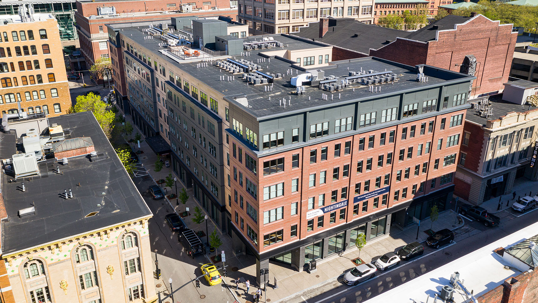
Aerial image of front of Nightingale building

Fuss & O’Neill provided a range of multidisciplinary services to support the $55 million redevelopment of an urban brownfield and parking lot into a new mixed-use, six-story building. The construction of this mixed-use building provides much needed commercial and residential space in the heart of downtown Providence and was the first new mixed-use apartment building constructed in downtown Providence in more than a generation.

The 0.83-acre parcel comprises an entire city block and, since the 1970s, served as an underutilized surface parking lot. The new development restored the urban fabric of this location and includes 11,000 ft2 of commercial space on the first floor and 150 luxury apartments on floors two through six.

To support this development, Fuss & O’Neill provided a comprehensive range of services from initial due diligence through construction. Our services included environmental due diligence; site assessment; remedial planning; hazardous building materials abatement; civil design and permitting; geotechnical engineering; landscape architecture; design of a green roof and elevated courtyard amenity space for building tenants; and construction oversight.

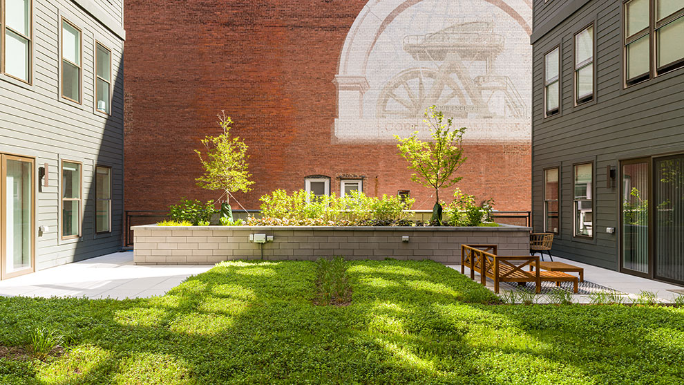
Nightingale courtyard view

Environmental Support

Environmental investigations indicated that the entire site was contaminated due to a long history of prior commercial and industrial uses. Urban fill materials were identified throughout the site, which contained concentrations of polycyclic aromatic hydrocarbons, arsenic, and lead at levels exceeding criteria established by the Rhode Island Department of Environmental Management (RIDEM). Soil containing petroleum was identified from leaks from former underground storage tanks (USTs). Soil vapor contained concentrations of trichloroethylene, which required additional response actions.

Remedial actions were designed to accommodate the site development and were conducted in conjunction with construction. Site cleanup included a site-wide soil cap, installation of a vapor barrier on the entire building foundation, and the permanent closure of three USTs.

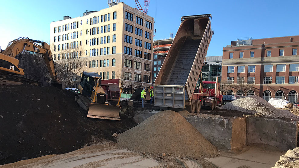
Dump truck dumping soil at the construction site

To assist with the costs of the cleanup, Fuss & O’Neill helped the development team secure and implement a $250,000 cleanup grant from RIDEM under the Brownfield Remediation and Economic Development 2016 Green Economy Bond.

Excavators at the construction site

Geotechnical Engineering and Soil Management

Fuss & O’Neill provided geotechnical engineering services to investigate pre-development subsurface conditions and to design and oversee a ground improvement program to support construction of the new building. The subsurface consisted primarily of demolition debris, foundations, and a concrete slab at approximately 12 feet below grade. These were remnants of the buildings that occupied the site prior to it becoming a parking lot.

Our engineers worked with the development and construction team to develop a site work program to excavate the debris and former foundations, screen contaminated soil from clean rubble, and backfill the excavation with imported structural fill that was suitable for the new building construction.

Fuss & O’Neill also provided turnkey soil disposal services to secure cost-effective trucking and disposal fees, and managed this process from initiation to closure.

In total, 7,202 tons of segregated concrete, rubble, and building debris and 15,616 tons of unsuitable soil were excavated and properly disposed off-site.

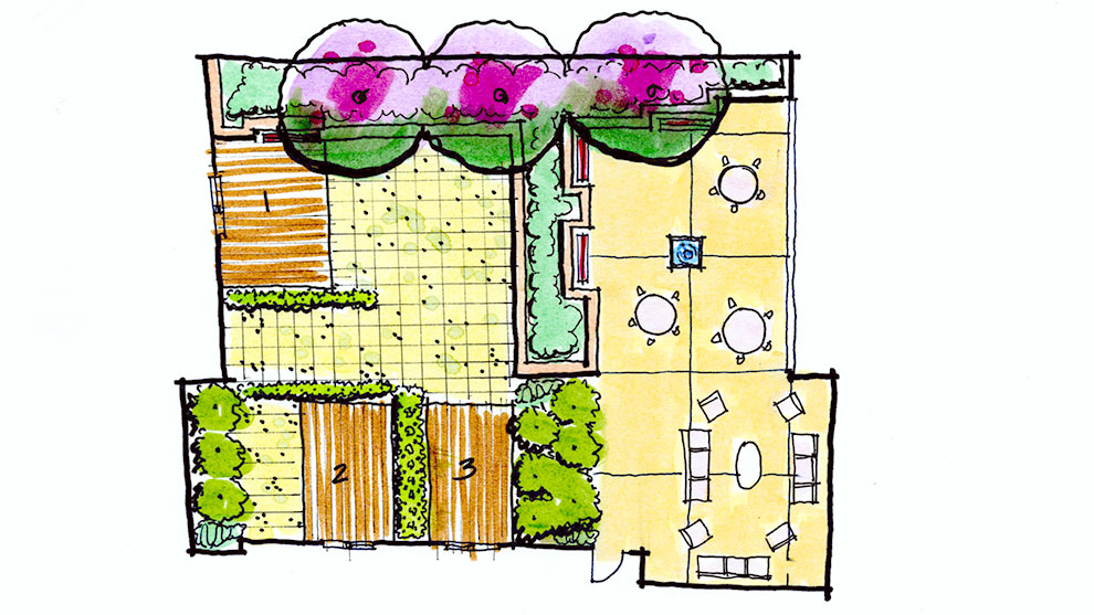
Nightingale concept drawing
Nightinggale outdoor area with grass and bench and mural view

Stormwater Management and Resilience through Innovative Design

To maximize the amount of buildable area in this urban environment, the majority of stormwater at the site is managed through an innovative green roof design at two elevated courtyards and the use of street tree filters that significantly reduce the amount of stormwater runoff from the site.

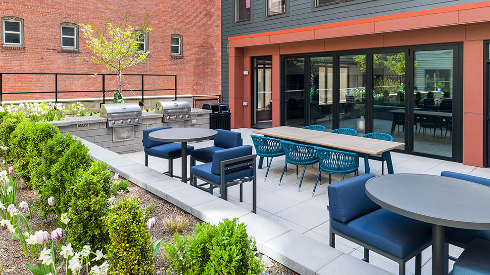
The design of the outdoor space was part of our landscape architecture services for this project and provides an outdoor amenity space for building tenants, including an outdoor lounge area with grilling stations. Other sections of the elevated courtyard and green roof were designated for private patios for select residential units.

As part of the green roof design, our landscape architects developed a planting plan, selected site materials (pavers, lighting, decking, countertops, fire pit, and fencing), and collaborated with our Mechanical, Electrical, and Plumbing Group regarding layout of lights, fixtures, and utilities.

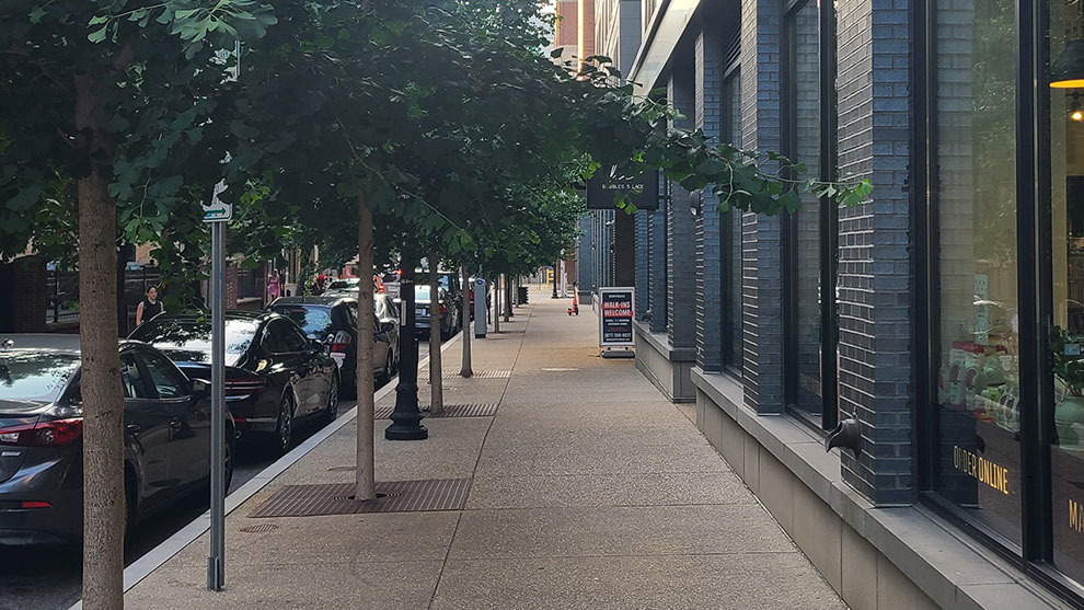
The street tree filters consist of a modular underground bioretention system that accepts the majority of stormwater runoff from the site and provides high-quality uncompacted soil to support the growth of trees in an urban environment. These systems support 10 street trees on Mathewson Street, which also contributes to reducing heat island effects and improving the streetscape and aesthetics of the new development.

Outcome

The new development restored the urban fabric of this location and includes 11,000 ft2 of commercial space on the first floor and 150 luxury apartments on floors two through six.

Resident amenities include 30 interior parking spaces (with car stacker lifts for additional car storage), an indoor lounge and fireplace, office space for remote working, a fitness room, interior bike storage, an elevated courtyard with an outdoor fireplace and grilling stations, and a rooftop deck and lounge area.

Apartments floor plans include studio, one-bedroom, and two-bedroom options. Some apartments feature private patios, and all apartments contain contemporary finishes, high-tech appliances, and ample storage.

Nightingale outdoor area
Nightingale outdoor seating area with gas fireplace
Garage car stacker at Nightingale redevelopment
Outdoor view of a finished Nightingale redevelopment rooftop
Aerial view of Nightingale building

Welcome Center Commissioning

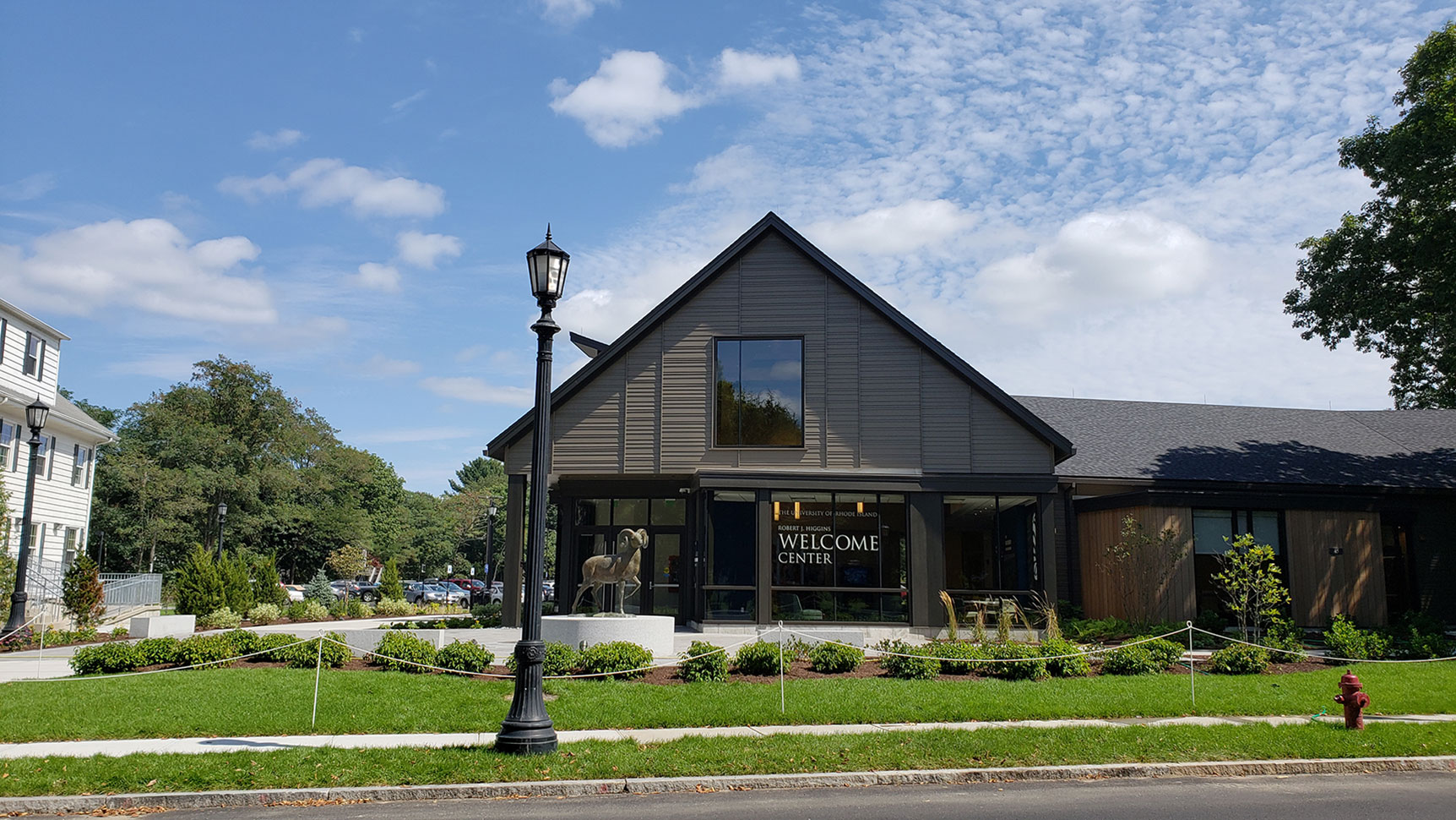
University of Rhode Island welcome center

The Robert J. Higgins Welcome Center is located on the University of Rhode Island’s South Kingstown campus. The Welcome Center is an interactive, one-story building that serves prospective students and families, visiting scholars, guest lecturers, as well as community and business leaders.

The University of Rhode Island (URI) was seeking LEED (Leadership in Energy and Environmental Design) Silver Certification for the Robert J. Higgins Welcome Center. A program of the U.S. Green Building Council, LEED Certification is a globally-recognized symbol of excellence in sustainable construction. To achieve LEED Silver status, the university elected to pursue EA Prerequisite 1: Fundamental Commissioning of the Building Energy Systems.


University of Rhode Island welcome center parking lot

Commissioning and MEP Support

Fuss & O’Neill was contracted to serve as the Commissioning Agent (CxA). We led, reviewed, and oversaw the commissioning process in accordance with the applicable sections of U.S. Green Building Council LEED BD+C: New Construction and provided commissioning services for mechanical, electrical, and plumbing (MEP) systems.

Mechanical systems included heating, ventilating, air conditioning, and refrigeration, as well as associated controls. Electrical systems included service, distribution, lighting, and associated controls. Plumbing systems included domestic hot water systems, pumps, and associated controls.

Design

During the design phase, our team reviewed Owner’s Project Requirements (OPR), the Basis of Design (BOD), and verified the BOD against URI’s OPR. We reviewed contract documents and developed a commissioning plan, which included the commissioning requirements and specifications to be included in the construction documents.
Construction

During the construction phase, we developed functional performance tests, as well as coordinated, witnessed, and documented functional performance tests performed by the contractor. We compiled a summary Commissioning Report and completed the online LEED forms and attachments.

Franz to view of the University of Rhode Island welcome center

The building achieved the LEED Silver Certification and the Welcome Center is the gateway to the University.

Transmission Line Surveys

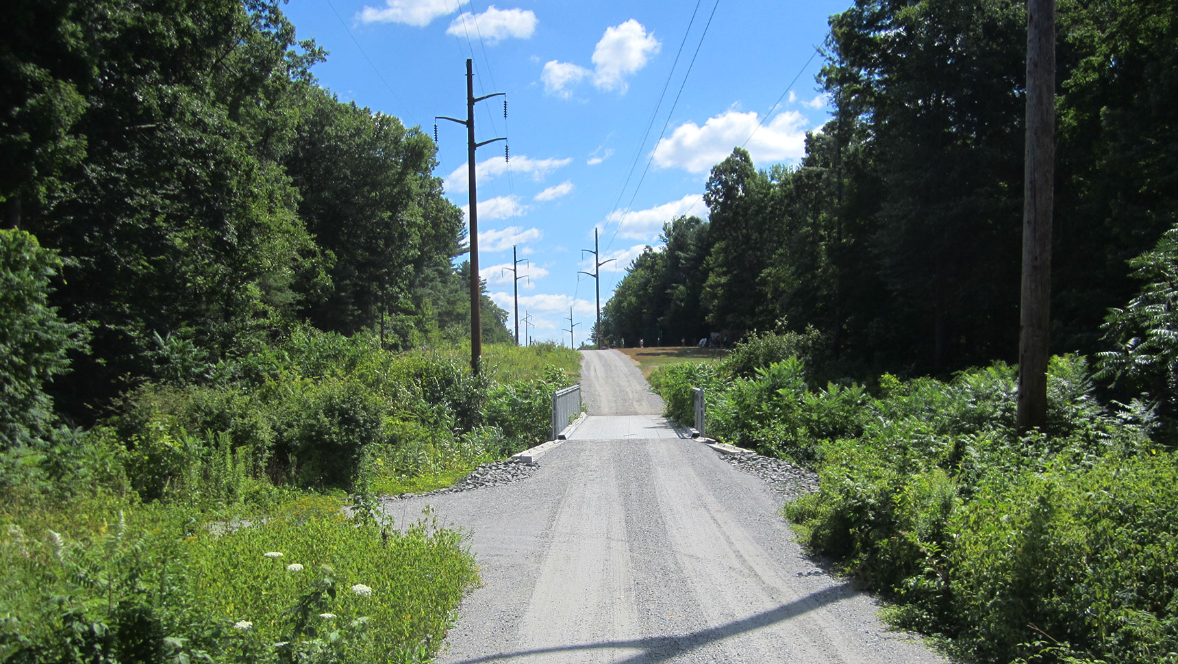
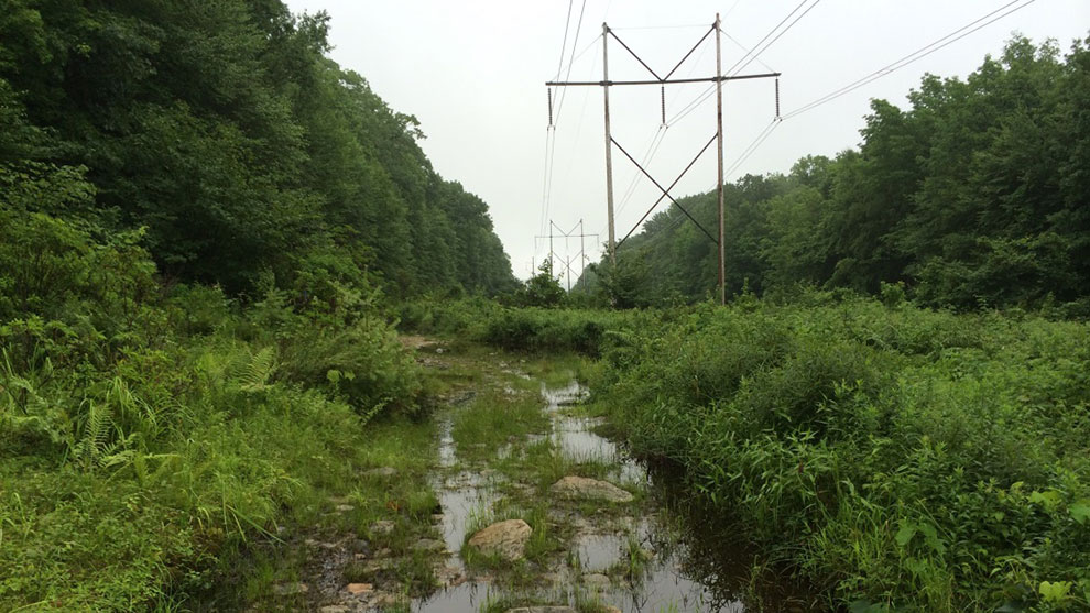
Completed pass to utility lines

Fuss & O’Neill has been providing transmission line surveys to Eversource for years. These projects are important to Eversource to ensure that they have clear documentation and monumenting of their acquired rights.

Through the research process, any deficiencies in rights or gaps in the corridor were presented to Eversource so that they could initiate the process of securing their contiguous rights in their transmission corridors as well as to identify or acquire access rights for construction and maintenance. The monumented line of location surveys provided record drawings that documented the rights throughout the transmission line corridors. The monuments provide a physical reference to the line of location. The placed monuments indicate where the line of location is on the ground.

These survey services are part of a larger multidisciplinary effort to improve and storm-harden the transmission lines to continue to provide reliable electricity to the communities that they serve. The following projects present examples of our work.


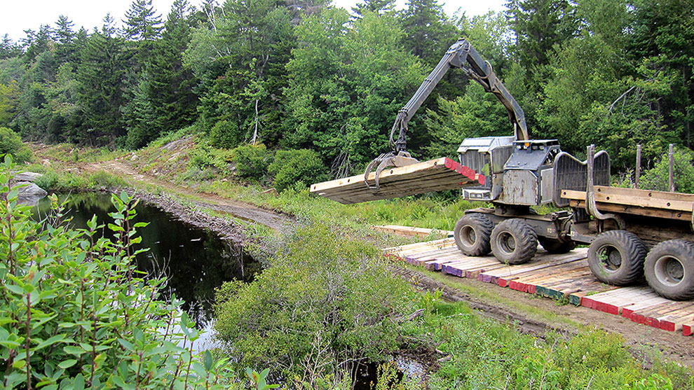
Excavator lifting wood

H123 Monumented Line of Location (MLOL) Survey

This project included review of easement documents, a right-of-way corridor survey, flagging of clearing limits, as well as structure and line sag as-builts for a three-mile transmission line segment that starts from the Bud Tap in Litchfield, NH, progresses northerly and easterly through Litchfield, and crosses the Merrimack River to the Reeds Ferry substation in Merrimack, NH.

Fuss & O’Neill’s survey team conducted extensive background research in the Brickyard Drive neighborhood to further document Eversource’s rights and easement location to ease the abutters’ concerns over the staked easement location that runs through their properties.

Additionally, we provided construction support with staking of new structures and flagging the easement limits of the transmission corridor. Upon completion of construction, we performed as-built surveys on the newly constructed structures and the line sags.

381 Line Monumented Line of Location (MLOL) Survey

This project included a 10-mile transmission line corridor survey from the Connecticut River in Hinsdale, NH, through Winchester, NH to the Massachusetts state line. Work included review of easement documents, a right-of-way corridor survey, and flagging of clearing limits through extremely rugged terrain. The baseline was monumented at approximate 600-foot intervals and record plans were generated that documented the survey and the monumented line of location.

Because of the short timeline for completion, Fuss & O’Neill orchestrated as many as four different crews to supply the necessary manpower to complete the project on time.

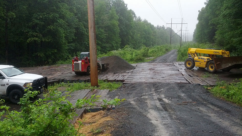
Excavators working on utility line area
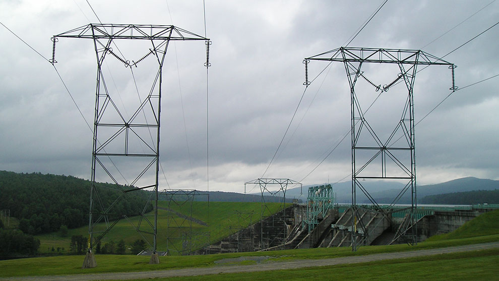
Utility lines

L175 Monumented Line of Location (MLOL) Survey

Fuss & O’Neill completed a survey of a 13-mile transmission line corridor for easement baseline monumentation between the Deerfield substation in Deerfield, NH and the Madbury substation in Madbury, NH. Eversource requested that their easement limits be reestablished and that a corridor baseline be monumented for permanent control.

A control network for the project was established on the SPC83 NH grid projection using GNSS. Research documents along the corridor were gathered and the corridor was surveyed for evidence of property lines and easement limits. Record and field evidence were reconciled to reestablish the L175 corridor easement. A baseline for the corridor was monumented at angle points and approximate 2,000-foot intervals. Record plans were generated that documented the survey and baseline monuments.

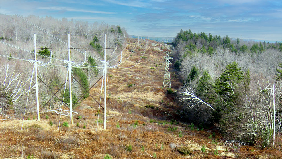
Utility lines on a hill

I158/W144 Monumented Line of Location (MLOL) Survey and As-builts

This project was a six-mile transmission line corridor for right-of-way baseline monumentation between the Huse Road substation in Manchester, NH and the Scobie Pond substation in Londonderry, NH. Eversource requested that their right-of-way limits be reviewed and reestablished for installation of permanent control monuments along the corridor baseline.

An isolated right-of-way discrepancy was discovered and reported to Eversource for resolution. A baseline for the corridor was monumented with granite bounds at approximate 1,000-foot intervals and record plans were generated documenting the survey and baseline monuments.

Services for stakeout of structures and clearing limits were also provided. Structure and line sag as-builts of the newly constructed transmission line were surveyed and the resulting data was transmitted to Eversource.

Utility lines on mountain

379 Line Monumented Line of Location (MLOL) Survey

This project included a 23-mile transmission line corridor survey that shared a 3-mile portion of the 381 Line corridor from the Connecticut River in Hinsdale, NH to where the 381 line branched off in Winchester, NH towards the Massachusetts state line. The 379 line then continued easterly to the Fitzwilliam substation in Fitzwilliam, NH.

Work included review of easement documents, a right-of-way corridor survey, and flagging of clearing limits through extremely rugged terrain. The baseline was monumented at approximate 600-foot intervals and record plans were generated documenting the survey and the monumented line of location.

Because of the short timeline for completion, Fuss & O’Neill coordinated as many as four different crews to supply the necessary manpower to complete the project on time.

J114 Monumented Line of Location (MLOL) Survey

This project is a three-mile transmission line MLOL survey. Eversource requested that their easement limits be reestablished and that a corridor baseline be monumented for permanent control. A control network for the project was established on the SPC83 NH grid projection with GNSS. Research documents along the corridor were gathered and the corridor was then surveyed for evidence of property lines and easement limits.

Record and field evidence were reconciled to reestablish the J114 easement corridor. A baseline for the corridor was monumented at angle points and approximate 600-foot intervals. Record plans were generated documenting the survey and baseline monuments.

Additionally, the Fuss & O’Neill survey team provided construction support with the staking of the location of new structures. Upon completion of construction, we performed as-built surveys on the newly constructed structures and the line sags